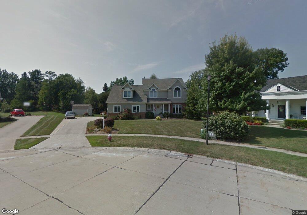
207 Kendal Ct W Amherst, OH 44001
Estimated Value: $369,000 - $434,000
4
Beds
4
Baths
2,242
Sq Ft
$177/Sq Ft
Est. Value
About This Home
This home is located at 207 Kendal Ct W, Amherst, OH 44001 and is currently estimated at $396,765, approximately $176 per square foot. 207 Kendal Ct W is a home located in Lorain County with nearby schools including Powers Elementary School, Walter G. Nord Middle School, and Amherst Junior High School.
Ownership History
Date
Name
Owned For
Owner Type
Purchase Details
Closed on
Aug 15, 2002
Sold by
Myers David G and Myers Anne E
Bought by
Seng Cynthia D
Current Estimated Value
Home Financials for this Owner
Home Financials are based on the most recent Mortgage that was taken out on this home.
Original Mortgage
$185,600
Interest Rate
6.56%
Purchase Details
Closed on
Jun 6, 2000
Sold by
Frey Martin F and Frey Ruth W
Bought by
Myers David G
Home Financials for this Owner
Home Financials are based on the most recent Mortgage that was taken out on this home.
Original Mortgage
$211,678
Interest Rate
7.43%
Mortgage Type
FHA
Purchase Details
Closed on
Dec 9, 1997
Sold by
R L R Const Inc
Bought by
Frey Martin F and Frey Ruth W
Home Financials for this Owner
Home Financials are based on the most recent Mortgage that was taken out on this home.
Original Mortgage
$173,900
Interest Rate
7.46%
Mortgage Type
New Conventional
Create a Home Valuation Report for This Property
The Home Valuation Report is an in-depth analysis detailing your home's value as well as a comparison with similar homes in the area
Home Values in the Area
Average Home Value in this Area
Purchase History
| Date | Buyer | Sale Price | Title Company |
|---|---|---|---|
| Seng Cynthia D | $232,000 | Real Estate Title | |
| Myers David G | $215,000 | Real Estate Title Service Co | |
| Frey Martin F | $202,500 | -- |
Source: Public Records
Mortgage History
| Date | Status | Borrower | Loan Amount |
|---|---|---|---|
| Previous Owner | Seng Cynthia D | $185,600 | |
| Previous Owner | Myers David G | $211,678 | |
| Previous Owner | Frey Martin F | $173,900 |
Source: Public Records
Tax History Compared to Growth
Tax History
| Year | Tax Paid | Tax Assessment Tax Assessment Total Assessment is a certain percentage of the fair market value that is determined by local assessors to be the total taxable value of land and additions on the property. | Land | Improvement |
|---|---|---|---|---|
| 2024 | $4,722 | $116,935 | $27,335 | $89,600 |
| 2023 | $4,088 | $85,313 | $23,667 | $61,646 |
| 2022 | $3,919 | $85,313 | $23,667 | $61,646 |
| 2021 | $3,929 | $85,313 | $23,667 | $61,646 |
| 2020 | $3,852 | $74,250 | $20,600 | $53,650 |
| 2019 | $3,775 | $74,250 | $20,600 | $53,650 |
| 2018 | $3,794 | $74,250 | $20,600 | $53,650 |
| 2017 | $3,564 | $65,460 | $16,770 | $48,690 |
| 2016 | $3,593 | $65,460 | $16,770 | $48,690 |
| 2015 | $3,572 | $65,460 | $16,770 | $48,690 |
| 2014 | $3,746 | $68,330 | $17,500 | $50,830 |
| 2013 | $3,759 | $68,330 | $17,500 | $50,830 |
Source: Public Records
Map
Nearby Homes
- 133 Ambleside Way
- 281 English Lakes Blvd Unit 67281
- 328 Buttermere Ln Unit 328
- V/L Middle Ridge Rd
- 653 Brennan Dr
- 335 Copper Creek
- 621 Van Oaks Dr
- 2176 Myla Way
- 2180 Myla Way
- 923 Longitude Ln
- 650 Eastpointe Ct
- 812 Bearing Ct
- 0 Middle Ridge Rd Unit 5160578
- 0 Middle Ridge Rd Unit 5102632
- 891 Park Ave
- 275 Cornell Ave
- 748 Tarry Ln
- 8030 Pyle South Amherst Rd
- 0 Stonebridge Dr
- 658 Nicole Dr
- 203 Kendal Ct W
- 129 Foresthill Dr
- 125 Foresthill Dr
- 206 Kendal Ct W
- 131 Foresthill Dr
- 204 Kendal Ct W
- 170 Ravenglass Blvd
- 133 Foresthill Dr
- 123 Foresthill Dr
- 180 Ravenglass Blvd
- 160 Ravenglass Blvd
- 135 Foresthill Dr
- 121 Foresthill Dr
- V/L Foresthill Dr
- 103 Keswick Ct
- 130 Idlewood Dr
- 126 Foresthill Dr
- 128 Foresthill Dr
- 162 Westchester Dr
- 150 Ravenglass Blvd