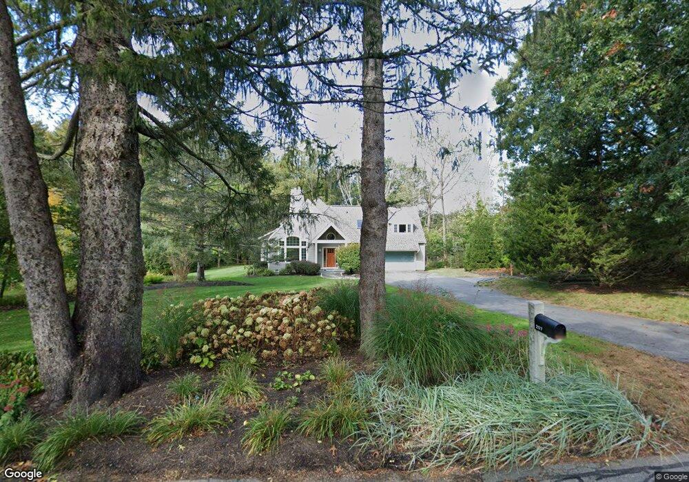
207 Lincoln Rd Lincoln, MA 01773
Estimated Value: $2,066,000 - $2,454,000
4
Beds
4
Baths
3,500
Sq Ft
$635/Sq Ft
Est. Value
About This Home
This home is located at 207 Lincoln Rd, Lincoln, MA 01773 and is currently estimated at $2,222,765, approximately $635 per square foot. 207 Lincoln Rd is a home located in Middlesex County with nearby schools including Lincoln-Sudbury Regional High School, Corwin-Russell School at Broccoli Hall, and Willow Hill School.
Ownership History
Date
Name
Owned For
Owner Type
Purchase Details
Closed on
Dec 21, 2011
Sold by
Desantis Joseph M and Solomon Sheryl R
Bought by
207 Lincoln Road Nt and Desantis Joseph M
Current Estimated Value
Purchase Details
Closed on
Mar 23, 1998
Sold by
Countrywide Bldg & Dev
Bought by
Butler Stephen B
Home Financials for this Owner
Home Financials are based on the most recent Mortgage that was taken out on this home.
Original Mortgage
$598,000
Interest Rate
6.92%
Mortgage Type
Purchase Money Mortgage
Purchase Details
Closed on
Apr 4, 1997
Sold by
Est Snelling Charles A and Snelling John R
Bought by
Countryside Bldg & Dev
Home Financials for this Owner
Home Financials are based on the most recent Mortgage that was taken out on this home.
Original Mortgage
$500,000
Interest Rate
7.5%
Mortgage Type
Purchase Money Mortgage
Create a Home Valuation Report for This Property
The Home Valuation Report is an in-depth analysis detailing your home's value as well as a comparison with similar homes in the area
Home Values in the Area
Average Home Value in this Area
Purchase History
| Date | Buyer | Sale Price | Title Company |
|---|---|---|---|
| 207 Lincoln Road Nt | -- | -- | |
| Butler Stephen B | $747,500 | -- | |
| Countryside Bldg & Dev | $275,000 | -- |
Source: Public Records
Mortgage History
| Date | Status | Borrower | Loan Amount |
|---|---|---|---|
| Previous Owner | Countryside Bldg & Dev | $417,000 | |
| Previous Owner | Countryside Bldg & Dev | $598,000 | |
| Previous Owner | Countryside Bldg & Dev | $500,000 |
Source: Public Records
Tax History Compared to Growth
Tax History
| Year | Tax Paid | Tax Assessment Tax Assessment Total Assessment is a certain percentage of the fair market value that is determined by local assessors to be the total taxable value of land and additions on the property. | Land | Improvement |
|---|---|---|---|---|
| 2025 | $245 | $1,908,700 | $719,700 | $1,189,000 |
| 2024 | $23,881 | $1,852,700 | $705,600 | $1,147,100 |
| 2023 | $22,854 | $1,641,800 | $649,900 | $991,900 |
| 2022 | $21,457 | $1,437,200 | $587,500 | $849,700 |
| 2021 | $20,862 | $1,344,200 | $519,900 | $824,300 |
| 2020 | $21,031 | $1,369,200 | $519,900 | $849,300 |
| 2019 | $19,730 | $1,364,900 | $503,600 | $861,300 |
| 2018 | $18,563 | $1,364,900 | $503,600 | $861,300 |
| 2017 | $18,166 | $1,326,000 | $475,300 | $850,700 |
| 2016 | $17,857 | $1,276,400 | $461,200 | $815,200 |
| 2015 | $17,262 | $1,219,900 | $427,100 | $792,800 |
| 2014 | $16,076 | $1,115,600 | $382,500 | $733,100 |
Source: Public Records
Map
Nearby Homes
- 152 S Great Rd
- 244 Lincoln Rd
- 93 Old Sudbury Rd
- 44 Baker Bridge Rd
- 33 Old Concord Rd
- 134 Chestnut Cir
- 130 Tower Rd
- 50 Windingwood Ln
- 3 Clifford Ln
- 49 Birchwood Ln Unit 49
- 6 Clifford Ln
- 22 Lincoln Rd
- 121 Cherry Brook Rd
- 75 Westland Rd
- 19 Conant Rd
- 15 Lewis Path
- 12 Laurel Dr
- 5 Peakes Ln
- 1 Aberdeen Rd
- 51 Willard Rd
- 209 Lincoln Rd
- 203 Lincoln Rd
- 211 Lincoln Rd
- 181 S Great Rd
- 215 Lincoln Rd
- 179 S Great Rd
- 175 S Great Rd
- 8 Meadowbrook Rd
- 4 Meadowbrook Rd
- 198 Lincon Rd
- 195 Lincoln Rd
- 178 S Great Rd
- 221 Lincoln Rd
- 12 Meadowbrook Rd
- 1 Meadowbrook Rd
- 170 S Great Rd
- 9 Meadowbrook Rd
- 189 Lincoln Rd
- LOT 2 S Great Rd
- 190 Lincoln Rd