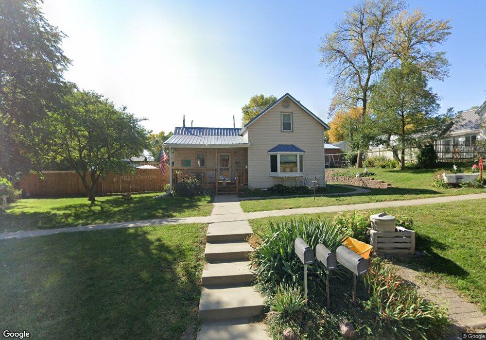
207 Market St Harlan, IA 51537
Estimated Value: $110,000 - $151,005
2
Beds
2
Baths
1,021
Sq Ft
$129/Sq Ft
Est. Value
About This Home
This home is located at 207 Market St, Harlan, IA 51537 and is currently estimated at $132,001, approximately $129 per square foot. 207 Market St is a home located in Shelby County with nearby schools including Harlan Primary School, Harlan Intermediate School, and Harlan Community Middle School.
Ownership History
Date
Name
Owned For
Owner Type
Purchase Details
Closed on
Mar 21, 2014
Sold by
Koppold Michelle and Koppold Scott
Bought by
Koppold Scott and Koppold Michelle
Current Estimated Value
Home Financials for this Owner
Home Financials are based on the most recent Mortgage that was taken out on this home.
Original Mortgage
$55,250
Interest Rate
4.29%
Mortgage Type
New Conventional
Purchase Details
Closed on
Jun 9, 2011
Sold by
Koppold Michelle and Koppold Scott
Bought by
Koppold Scott and Koppold Michelle
Home Financials for this Owner
Home Financials are based on the most recent Mortgage that was taken out on this home.
Original Mortgage
$50,400
Interest Rate
4.67%
Mortgage Type
Credit Line Revolving
Create a Home Valuation Report for This Property
The Home Valuation Report is an in-depth analysis detailing your home's value as well as a comparison with similar homes in the area
Home Values in the Area
Average Home Value in this Area
Purchase History
| Date | Buyer | Sale Price | Title Company |
|---|---|---|---|
| Koppold Scott | -- | None Available | |
| Koppold Scott | -- | -- |
Source: Public Records
Mortgage History
| Date | Status | Borrower | Loan Amount |
|---|---|---|---|
| Closed | Koppold Scott | $55,250 | |
| Closed | Koppold Scott | $50,400 |
Source: Public Records
Tax History Compared to Growth
Tax History
| Year | Tax Paid | Tax Assessment Tax Assessment Total Assessment is a certain percentage of the fair market value that is determined by local assessors to be the total taxable value of land and additions on the property. | Land | Improvement |
|---|---|---|---|---|
| 2025 | $1,856 | $123,964 | $17,325 | $106,639 |
| 2024 | $1,856 | $109,451 | $17,325 | $92,126 |
| 2023 | $1,654 | $109,451 | $17,325 | $92,126 |
| 2022 | $1,654 | $88,339 | $17,325 | $71,014 |
| 2021 | $1,546 | $88,339 | $17,325 | $71,014 |
| 2020 | $1,406 | $77,282 | $17,325 | $59,957 |
| 2019 | $1,326 | $71,572 | $0 | $0 |
| 2018 | $1,290 | $71,572 | $0 | $0 |
| 2017 | $1,290 | $71,572 | $0 | $0 |
| 2016 | $1,276 | $69,780 | $0 | $0 |
| 2015 | $1,276 | $67,963 | $0 | $0 |
| 2014 | $1,236 | $67,963 | $0 | $0 |
Source: Public Records
Map
Nearby Homes