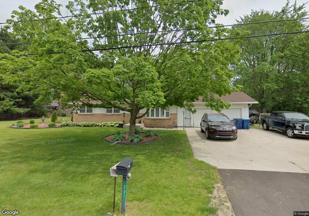
207 Morrow St Kalamazoo, MI 49048
Estimated Value: $189,000 - $228,000
3
Beds
2
Baths
1,100
Sq Ft
$190/Sq Ft
Est. Value
About This Home
This home is located at 207 Morrow St, Kalamazoo, MI 49048 and is currently estimated at $209,161, approximately $190 per square foot. 207 Morrow St is a home located in Kalamazoo County with nearby schools including Comstock Middle School and Comstock High School.
Ownership History
Date
Name
Owned For
Owner Type
Purchase Details
Closed on
Jul 26, 2023
Sold by
Mcelrath Billy J and Mcelrath Hazel
Bought by
Mcelrath Billy J
Current Estimated Value
Home Financials for this Owner
Home Financials are based on the most recent Mortgage that was taken out on this home.
Original Mortgage
$231,800
Interest Rate
6.9%
Mortgage Type
VA
Purchase Details
Closed on
Dec 3, 2002
Sold by
Stickney Robert A
Bought by
Mcelrath Billy J
Home Financials for this Owner
Home Financials are based on the most recent Mortgage that was taken out on this home.
Original Mortgage
$105,900
Interest Rate
6.38%
Mortgage Type
VA
Create a Home Valuation Report for This Property
The Home Valuation Report is an in-depth analysis detailing your home's value as well as a comparison with similar homes in the area
Home Values in the Area
Average Home Value in this Area
Purchase History
| Date | Buyer | Sale Price | Title Company |
|---|---|---|---|
| Mcelrath Billy J | -- | None Listed On Document | |
| Mcelrath Billy J | -- | Chicago Title |
Source: Public Records
Mortgage History
| Date | Status | Borrower | Loan Amount |
|---|---|---|---|
| Previous Owner | Mcelrath Billy J | $231,800 | |
| Previous Owner | Mcelrath Billy J | $105,900 |
Source: Public Records
Tax History Compared to Growth
Tax History
| Year | Tax Paid | Tax Assessment Tax Assessment Total Assessment is a certain percentage of the fair market value that is determined by local assessors to be the total taxable value of land and additions on the property. | Land | Improvement |
|---|---|---|---|---|
| 2025 | -- | $97,800 | $0 | $0 |
| 2024 | -- | $93,500 | $0 | $0 |
| 2023 | -- | $0 | $0 | $0 |
| 2022 | $962 | $68,000 | $0 | $0 |
| 2021 | $1,924 | $0 | $0 | $0 |
| 2020 | $0 | $0 | $0 | $0 |
| 2019 | $0 | $0 | $0 | $0 |
| 2018 | $0 | $41,600 | $2,500 | $39,100 |
| 2017 | $0 | $0 | $0 | $0 |
| 2016 | -- | $0 | $0 | $0 |
| 2015 | -- | $38,500 | $5,000 | $33,500 |
| 2014 | -- | $0 | $0 | $0 |
Source: Public Records
Map
Nearby Homes
- 359 Elliot Rd
- 7222 Gleason St
- 7138 Gleason St
- 8181 Fawn Meadow Trail
- 8464 E Michigan Ave
- 1353 N 30th St
- 1049 Antler
- 7862 E Main St
- 6390 Celery St
- 7702 N Gleneagle Dr
- 7683 Kilowatt Dr
- 221 Sparks St
- 147 Station Hill St
- 134 Grandview Unit 47
- 218 N 26th St
- 1187 Merry Brook Dr
- 1226 Merry Brook St
- 207 Station Hill St
- 222 Station Hill St
- 233 Depot Cir