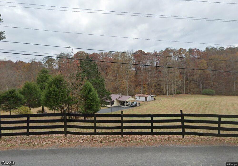
207 Mountain Laurel Dr Mc Donald, TN 37353
Estimated Value: $373,000 - $456,859
4
Beds
3
Baths
1,957
Sq Ft
$217/Sq Ft
Est. Value
About This Home
This home is located at 207 Mountain Laurel Dr, Mc Donald, TN 37353 and is currently estimated at $424,215, approximately $216 per square foot. 207 Mountain Laurel Dr is a home located in Bradley County with nearby schools including Prospect Elementary School, Ocoee Middle School, and Walker Valley High School.
Ownership History
Date
Name
Owned For
Owner Type
Purchase Details
Closed on
Oct 6, 2006
Sold by
Steele Jeffrey T
Bought by
Lovell Daryl Etvir
Current Estimated Value
Home Financials for this Owner
Home Financials are based on the most recent Mortgage that was taken out on this home.
Original Mortgage
$172,000
Outstanding Balance
$107,185
Interest Rate
6.45%
Estimated Equity
$317,030
Purchase Details
Closed on
Oct 5, 2006
Sold by
Steele Jeffrey T
Bought by
Lovell Daryl Etvir
Home Financials for this Owner
Home Financials are based on the most recent Mortgage that was taken out on this home.
Original Mortgage
$172,000
Outstanding Balance
$107,185
Interest Rate
6.45%
Estimated Equity
$317,030
Purchase Details
Closed on
Dec 11, 2000
Sold by
Barber Thomas W
Bought by
Steele Jeffrey T
Purchase Details
Closed on
Aug 19, 1996
Sold by
Richardson Steven L
Bought by
Barber Thomas
Create a Home Valuation Report for This Property
The Home Valuation Report is an in-depth analysis detailing your home's value as well as a comparison with similar homes in the area
Home Values in the Area
Average Home Value in this Area
Purchase History
| Date | Buyer | Sale Price | Title Company |
|---|---|---|---|
| Lovell Daryl Etvir | $215,000 | -- | |
| Lovell Daryl Etvir | $215,000 | -- | |
| Steele Jeffrey T | $138,000 | -- | |
| Barber Thomas | $131,900 | -- |
Source: Public Records
Mortgage History
| Date | Status | Borrower | Loan Amount |
|---|---|---|---|
| Open | Barber Thomas | $172,000 | |
| Closed | Lovell Daryl Etvir | $172,000 |
Source: Public Records
Tax History Compared to Growth
Tax History
| Year | Tax Paid | Tax Assessment Tax Assessment Total Assessment is a certain percentage of the fair market value that is determined by local assessors to be the total taxable value of land and additions on the property. | Land | Improvement |
|---|---|---|---|---|
| 2024 | $1,209 | $67,400 | $12,975 | $54,425 |
| 2023 | $1,209 | $67,400 | $12,975 | $54,425 |
| 2022 | $1,209 | $67,400 | $12,975 | $54,425 |
| 2021 | $1,209 | $67,400 | $0 | $0 |
| 2020 | $1,106 | $67,400 | $0 | $0 |
| 2019 | $1,106 | $49,775 | $0 | $0 |
| 2018 | $1,045 | $0 | $0 | $0 |
| 2017 | $1,094 | $0 | $0 | $0 |
| 2016 | $1,094 | $0 | $0 | $0 |
| 2015 | $1,057 | $0 | $0 | $0 |
| 2014 | $888 | $0 | $0 | $0 |
Source: Public Records
Map
Nearby Homes
- 122 Whitney Dr
- 9805 Ooltewah Georgetown Rd
- 0 Old Harrison Rd SW Unit 1295910
- 486 Clay Baker Rd NW
- 1636 White Oak Rd NW
- Tract 6 SW Owl Hollow Rd
- 9733 Snow Hill Rd
- Tract 2 SW Owl Hollow Rd
- Lot 3 Creekwood
- Lot 2 Creekwood
- 357 Rabbit Valley Rd NW
- 7332 Tiercel Dr
- 9802 Falcon Crest Dr
- 7759 Sir Anderson Ct
- 9739 Falcon Crest Dr
- 197 Julius St
- 160 Crane St
- 150 Crane St
- 126 Crane St
- 151 Crane St
- 237 Mountain Laurel Dr
- 236 Mountain Laurel Dr
- 130 Mountain Laurel Dr
- 133 Mountain Laurel Dr
- 182 Mountain Cir
- 258 Mountain Laurel Dr
- 258 Mountain Cir
- 1130 Mountain Rd
- 1130 Mountain Rd Unit 1
- 1096 Mountain Rd
- 1158 Mountain Rd
- 268 Mountain Cir
- 1084 Mountain Rd
- 131 Mountain Cir
- 131 Mountain Cir
- 1224 Mountain Rd
- 267 Mountain Cir
- 1131 Mountain Rd
- 324 Mountain Cir
- 1060 Mountain Rd