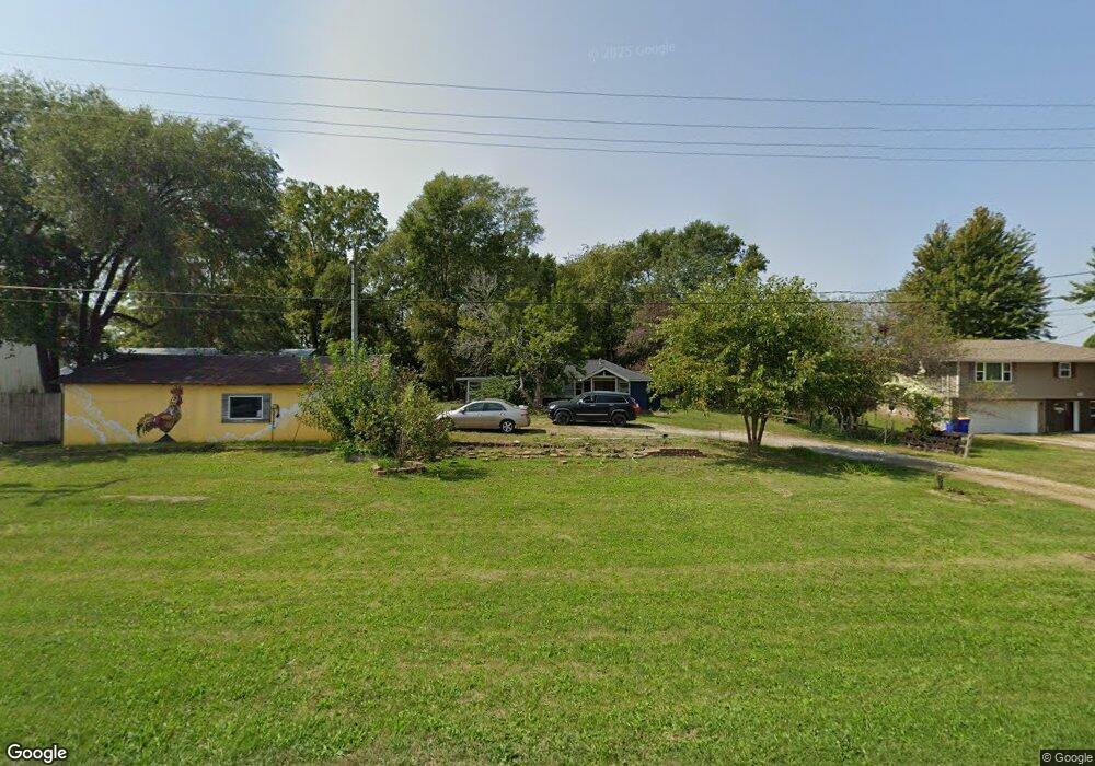
207 N Devoe St Lone Tree, IA 52755
Estimated Value: $163,000 - $195,000
2
Beds
2
Baths
808
Sq Ft
$218/Sq Ft
Est. Value
About This Home
This home is located at 207 N Devoe St, Lone Tree, IA 52755 and is currently estimated at $176,454, approximately $218 per square foot. 207 N Devoe St is a home located in Johnson County with nearby schools including Lone Tree Elementary School and Lone Tree Junior/Senior High School.
Ownership History
Date
Name
Owned For
Owner Type
Purchase Details
Closed on
Jul 20, 2017
Sold by
Hedlund Sarah G
Bought by
Green Jonathan E
Current Estimated Value
Purchase Details
Closed on
Nov 17, 2016
Sold by
Green Donald J and Jeanette Green M
Bought by
Hedlund Sarah G and Green Jonathan E
Purchase Details
Closed on
Nov 17, 2014
Sold by
Green Donald J and Jeanette Green M
Bought by
Green Jonathan E and Hedlund Sarah G
Home Financials for this Owner
Home Financials are based on the most recent Mortgage that was taken out on this home.
Original Mortgage
$45,000
Interest Rate
4.1%
Mortgage Type
New Conventional
Create a Home Valuation Report for This Property
The Home Valuation Report is an in-depth analysis detailing your home's value as well as a comparison with similar homes in the area
Purchase History
| Date | Buyer | Sale Price | Title Company |
|---|---|---|---|
| Green Jonathan E | -- | None Available | |
| Hedlund Sarah G | -- | None Available | |
| Green Jonathan E | $45,000 | None Available |
Source: Public Records
Mortgage History
| Date | Status | Borrower | Loan Amount |
|---|---|---|---|
| Previous Owner | Green Jonathan E | $45,000 |
Source: Public Records
Tax History
| Year | Tax Paid | Tax Assessment Tax Assessment Total Assessment is a certain percentage of the fair market value that is determined by local assessors to be the total taxable value of land and additions on the property. | Land | Improvement |
|---|---|---|---|---|
| 2025 | $2,176 | $157,400 | $72,500 | $84,900 |
| 2024 | $21 | $157,500 | $72,500 | $85,000 |
| 2023 | $1,796 | $157,500 | $72,500 | $85,000 |
| 2022 | $1,774 | $122,800 | $57,300 | $65,500 |
| 2021 | $1,862 | $122,800 | $57,300 | $65,500 |
| 2020 | $1,862 | $122,800 | $57,300 | $65,500 |
| 2019 | $1,660 | $122,800 | $57,300 | $65,500 |
| 2018 | $1,628 | $108,500 | $57,300 | $51,200 |
| 2017 | $1,742 | $108,500 | $57,300 | $51,200 |
| 2016 | $1,664 | $108,700 | $56,800 | $51,900 |
| 2015 | $1,664 | $108,700 | $56,800 | $51,900 |
| 2014 | $1,890 | $113,100 | $49,700 | $63,400 |
Source: Public Records
Map
Nearby Homes
- 221 W Commercial St
- 305 S Riggs St
- 407 E Elm St
- 500 S Center St
- 763 N Perkins St
- 210 W Mapel Dr
- 25840 Golden Oak Ln Lot 1
- 25838 Golden Oak Ln Lot 7
- 25836 Golden Oak Ln Lot 8
- 25832 Golden Oak Ln Lot 12
- 25736 Golden Pond Ln Se Lot 17
- 25738 Golden Pond Ln Se Lot 16
- 25824 Golden Oak Ln Lot 9
- 1092 Walnut Ave Unit 209
- 1092 Walnut Ave Unit 301
- 1092 Walnut Ave Unit 117 Bld E
- 1092 Walnut Ave Unit 114 Bld D
- Lot 2 116th Cir
- 207 Short St
- Lot 39 Walter Mapp Dr
- 205 N Devoe St
- 211 N Devoe St
- 105 W Kirkpatrick St
- 107 W Kirkpatrick St
- 109 W Kirkpatrick St
- 208 N Huskins St
- 301 N Devoe St
- 201 N Devoe St
- 113 W Kirkpatrick St
- 118 W Kirkpatrick St
- 215 N Huskins St
- 217 N Huskins St
- 113 W Commercial St
- 331 N Devoe St
- 321 N Devoe St
- 119 W Commercial St
- 201 W Kirkpatrick St
- 115 W Commercial St
- 200 E Commercial St
- 200 W Commercial St
Your Personal Tour Guide
Ask me questions while you tour the home.