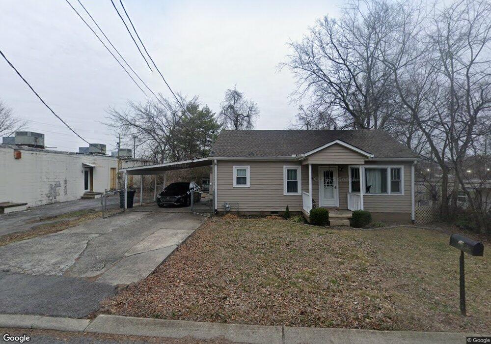
207 N Locust Ave Gallatin, TN 37066
Estimated Value: $194,638 - $244,000
--
Bed
1
Bath
884
Sq Ft
$248/Sq Ft
Est. Value
About This Home
This home is located at 207 N Locust Ave, Gallatin, TN 37066 and is currently estimated at $219,660, approximately $248 per square foot. 207 N Locust Ave is a home located in Sumner County with nearby schools including Guild Elementary School, Rucker Stewart Middle School, and Gallatin Senior High School.
Ownership History
Date
Name
Owned For
Owner Type
Purchase Details
Closed on
Dec 28, 2018
Sold by
Helson Robert C and Adcock Jacob B
Bought by
Major Caleb E
Current Estimated Value
Home Financials for this Owner
Home Financials are based on the most recent Mortgage that was taken out on this home.
Original Mortgage
$127,546
Outstanding Balance
$112,745
Interest Rate
4.87%
Mortgage Type
FHA
Estimated Equity
$106,915
Purchase Details
Closed on
May 1, 2013
Sold by
Hurst Daniel
Bought by
Helson Robert C and Helson Jacob B
Purchase Details
Closed on
Mar 18, 2005
Sold by
Mcbride Johnny and Mcbride Elizabeth
Bought by
Hurst Daniel
Purchase Details
Closed on
Mar 23, 1994
Sold by
Etal Mcbride Mattie E
Bought by
Johnny Mcbride
Create a Home Valuation Report for This Property
The Home Valuation Report is an in-depth analysis detailing your home's value as well as a comparison with similar homes in the area
Home Values in the Area
Average Home Value in this Area
Purchase History
| Date | Buyer | Sale Price | Title Company |
|---|---|---|---|
| Major Caleb E | $129,900 | Highland Title Llc | |
| Helson Robert C | $29,000 | None Available | |
| Hurst Daniel | $38,000 | -- | |
| Johnny Mcbride | $8,877 | -- |
Source: Public Records
Mortgage History
| Date | Status | Borrower | Loan Amount |
|---|---|---|---|
| Open | Major Caleb E | $127,546 |
Source: Public Records
Tax History Compared to Growth
Tax History
| Year | Tax Paid | Tax Assessment Tax Assessment Total Assessment is a certain percentage of the fair market value that is determined by local assessors to be the total taxable value of land and additions on the property. | Land | Improvement |
|---|---|---|---|---|
| 2024 | $545 | $38,350 | $15,000 | $23,350 |
| 2023 | $1,027 | $33,650 | $20,000 | $13,650 |
| 2022 | $1,030 | $33,650 | $20,000 | $13,650 |
| 2021 | $1,030 | $33,650 | $20,000 | $13,650 |
| 2020 | $1,030 | $33,650 | $20,000 | $13,650 |
| 2019 | $1,030 | $0 | $0 | $0 |
| 2018 | $462 | $0 | $0 | $0 |
| 2017 | $462 | $0 | $0 | $0 |
| 2016 | $331 | $0 | $0 | $0 |
| 2015 | -- | $0 | $0 | $0 |
| 2014 | -- | $0 | $0 | $0 |
Source: Public Records
Map
Nearby Homes
- 0 Collier Ln Unit RTC2905448
- 212 S Boyers Ave
- 209 E Winchester St
- 542 Spencer Ave
- 211 W Lyons St
- 200 College St
- 131 Mcdavid St
- 216 Daleview Ave
- 128 Morningside Dr
- 190 W Hite St
- 416 E Bledsoe St
- 138 Barbara Ave
- 1709 Elliott Williams Pvt Way
- 1720 Elliott Williams Pvt Way
- 1721 Elliott Williams Pvt Way
- 1724 Elliott Williams Pvt Way
- 1716 Elliott Williams Pvt Way
- 1725 Elliott Williams Pvt Way
- 1729 Elliott Williams Pvt Way
- 1733 Elliott Williams Pvt Way
- 207 S Locust Ave
- 210 S Foster Ave
- 175 W Smith St
- 174 W Bledsoe St
- 206 W Bledsoe St
- 211 W Smith St
- 210 W Bledsoe St
- 54 Bellingdon Drive Lot Unit 54
- 0 Commons Drive 1-G Unit 1843019
- 0 Commons Drive 1-F Unit 1843017
- 0 Commons Drive 1-E Unit 1843016
- 0 Collier Ln Unit 1813737
- 0 Collier Ln Unit 1813726
- 0 Collier Ln Unit RTC2944635
- 0 Commons Drive 1-G Unit RTC1310046
- 0 Commons Drive 1-F Unit RTC1310044
- 0 Commons Drive 1-E Unit RTC1310041
- 1992 Bellingdon Dr
- 1523 Sullivan St
- 1505 Sullivan St