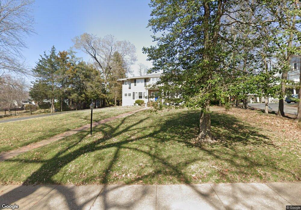
207 Oakwood Ave Saint Louis, MO 63119
Estimated Value: $759,000 - $1,122,000
4
Beds
2
Baths
2,560
Sq Ft
$370/Sq Ft
Est. Value
About This Home
This home is located at 207 Oakwood Ave, Saint Louis, MO 63119 and is currently estimated at $947,862, approximately $370 per square foot. 207 Oakwood Ave is a home located in St. Louis County with nearby schools including Avery Elementary School, Hixson Middle School, and Webster Groves High School.
Ownership History
Date
Name
Owned For
Owner Type
Purchase Details
Closed on
May 21, 2010
Sold by
Macdonald Edward K and Macdonald Ellen K
Bought by
Pino Octavio A and Pino Nancy C
Current Estimated Value
Home Financials for this Owner
Home Financials are based on the most recent Mortgage that was taken out on this home.
Original Mortgage
$402,000
Outstanding Balance
$268,784
Interest Rate
5%
Mortgage Type
New Conventional
Estimated Equity
$679,078
Purchase Details
Closed on
Nov 10, 1999
Sold by
Robichaux Lynn M and Robichaux Raoul M
Bought by
Macdonald Edward K and Macdonald Ellen K
Home Financials for this Owner
Home Financials are based on the most recent Mortgage that was taken out on this home.
Original Mortgage
$345,000
Interest Rate
7.75%
Create a Home Valuation Report for This Property
The Home Valuation Report is an in-depth analysis detailing your home's value as well as a comparison with similar homes in the area
Home Values in the Area
Average Home Value in this Area
Purchase History
| Date | Buyer | Sale Price | Title Company |
|---|---|---|---|
| Pino Octavio A | $502,500 | Integrity Land Title Co Inc | |
| Macdonald Edward K | $425,000 | -- |
Source: Public Records
Mortgage History
| Date | Status | Borrower | Loan Amount |
|---|---|---|---|
| Open | Pino Octavio A | $402,000 | |
| Previous Owner | Macdonald Edward K | $345,000 |
Source: Public Records
Tax History Compared to Growth
Tax History
| Year | Tax Paid | Tax Assessment Tax Assessment Total Assessment is a certain percentage of the fair market value that is determined by local assessors to be the total taxable value of land and additions on the property. | Land | Improvement |
|---|---|---|---|---|
| 2025 | $9,154 | $157,060 | $106,120 | $50,940 |
| 2024 | $9,154 | $132,070 | $82,460 | $49,610 |
| 2023 | $9,109 | $132,070 | $82,460 | $49,610 |
| 2022 | $8,547 | $115,060 | $82,460 | $32,600 |
| 2021 | $8,518 | $115,060 | $82,460 | $32,600 |
| 2020 | $8,556 | $107,670 | $73,280 | $34,390 |
| 2019 | $8,494 | $107,670 | $73,280 | $34,390 |
| 2018 | $8,412 | $94,700 | $49,100 | $45,600 |
| 2017 | $8,355 | $94,700 | $49,100 | $45,600 |
| 2016 | $8,194 | $88,840 | $41,230 | $47,610 |
| 2015 | $8,241 | $88,840 | $41,230 | $47,610 |
| 2014 | $8,052 | $84,450 | $39,440 | $45,010 |
Source: Public Records
Map
Nearby Homes
- 112 Oakwood Ave
- 441 Park Rd
- 546 Holland Ave
- 450 E Lockwood Ave Unit 303
- 610 Cornelia Ave
- 136 N Gore Ave
- 617 N Elm Ave
- 814 Holland Ave
- 619 N Bompart Ave
- 218 Euclid Ave
- 400 Marion Ave
- 8361 Big Bend Blvd
- 234 Plant Ave
- 827 Cornell Ave
- 156 Gray Ave
- 404 W Kirkham Ave
- 336 Madison Ave
- 716 Clark Ave
- 544 Summit Ave
- 426 W Kirkham Ave