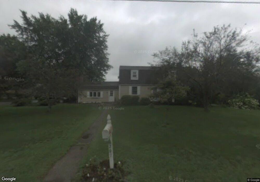
207 Olney St Seekonk, MA 02771
Estimated Value: $525,605 - $665,000
3
Beds
2
Baths
1,808
Sq Ft
$326/Sq Ft
Est. Value
About This Home
This home is located at 207 Olney St, Seekonk, MA 02771 and is currently estimated at $589,901, approximately $326 per square foot. 207 Olney St is a home located in Bristol County with nearby schools including Seekonk High School, Ocean State Montessori School, and Providence Country Day School.
Ownership History
Date
Name
Owned For
Owner Type
Purchase Details
Closed on
Mar 28, 1997
Sold by
Treanor Michael J and Treanor Stephanie C
Bought by
Mirka Mary R and Mirka Edmund
Current Estimated Value
Purchase Details
Closed on
Apr 16, 1991
Sold by
Emond Rachelle I
Bought by
Treanor Michael J
Home Financials for this Owner
Home Financials are based on the most recent Mortgage that was taken out on this home.
Original Mortgage
$146,200
Interest Rate
9.32%
Mortgage Type
Purchase Money Mortgage
Create a Home Valuation Report for This Property
The Home Valuation Report is an in-depth analysis detailing your home's value as well as a comparison with similar homes in the area
Home Values in the Area
Average Home Value in this Area
Purchase History
| Date | Buyer | Sale Price | Title Company |
|---|---|---|---|
| Mirka Mary R | $150,500 | -- | |
| Treanor Michael J | $162,500 | -- |
Source: Public Records
Mortgage History
| Date | Status | Borrower | Loan Amount |
|---|---|---|---|
| Open | Treanor Michael J | $135,000 | |
| Closed | Treanor Michael J | $75,000 | |
| Previous Owner | Treanor Michael J | $146,200 |
Source: Public Records
Tax History Compared to Growth
Tax History
| Year | Tax Paid | Tax Assessment Tax Assessment Total Assessment is a certain percentage of the fair market value that is determined by local assessors to be the total taxable value of land and additions on the property. | Land | Improvement |
|---|---|---|---|---|
| 2025 | $5,497 | $445,100 | $156,900 | $288,200 |
| 2024 | $5,270 | $426,700 | $156,900 | $269,800 |
| 2023 | $5,157 | $393,400 | $140,300 | $253,100 |
| 2022 | $4,201 | $314,900 | $134,600 | $180,300 |
| 2021 | $4,017 | $296,000 | $119,400 | $176,600 |
| 2020 | $3,801 | $288,600 | $119,200 | $169,400 |
| 2019 | $3,695 | $282,900 | $119,200 | $163,700 |
| 2018 | $3,699 | $277,100 | $119,200 | $157,900 |
| 2017 | $3,601 | $267,500 | $114,100 | $153,400 |
| 2016 | $3,570 | $266,200 | $114,100 | $152,100 |
| 2015 | $3,366 | $254,400 | $114,100 | $140,300 |
Source: Public Records
Map
Nearby Homes
- 147 Olney St
- 358 Olney St
- 30 Rosemarie Dr
- 42 Tee Jay Dr
- 349 County St
- 524 County St
- 199 Cole St
- 454 Fall River Ave
- 759 Fall River Ave
- 698 Fall River Ave
- 420 Chestnut St
- 39 John Alden Rd
- 296 Fall River Ave
- 62 Chestnut St
- 72 School St
- 44 Raymond Dr
- 442 Taunton Ave
- 0 Milton St Unit 72633661
- 206 Wheeler St
- 0 Pleasant St
- 15 Pocahontas Dr
- 5 Evergreen Dr
- 2 King Philip Rd
- 200 Olney St
- 27 Pocahontas Dr
- 223 Olney St
- 5 King Philip Rd
- 12 King Philip Rd
- 11 King Philip Rd
- 33 Pocahontas Dr
- 190 Olney St
- 17 Evergreen Dr
- 226 Olney St
- 10 Evergreen Dr
- 32 Pocahontas Dr
- 26 Airdrie Ct
- 12 Mohawk Dr
- 160 Olney St
- 21 King Philip Rd
- 22 King Philip Rd