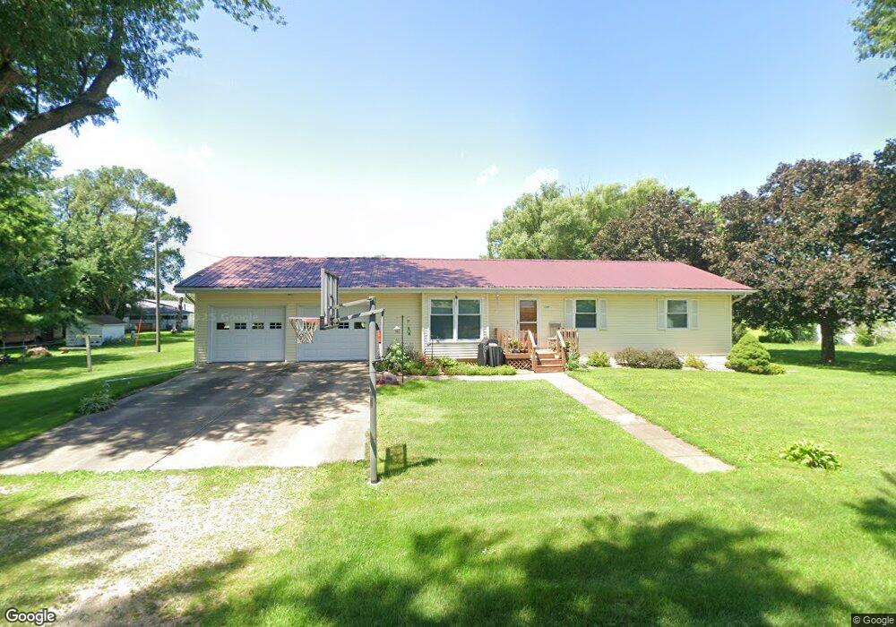
207 S Walnut St Stanwood, IA 52337
Estimated Value: $151,000 - $180,000
3
Beds
2
Baths
1,344
Sq Ft
$125/Sq Ft
Est. Value
About This Home
This home is located at 207 S Walnut St, Stanwood, IA 52337 and is currently estimated at $167,810, approximately $124 per square foot. 207 S Walnut St is a home located in Cedar County with nearby schools including North Cedar Junior/Senior High School.
Ownership History
Date
Name
Owned For
Owner Type
Purchase Details
Closed on
Mar 15, 2023
Sold by
John Pamela Jo St
Bought by
Tenley Land Ii Llc
Current Estimated Value
Purchase Details
Closed on
Feb 5, 2023
Sold by
St John Pamela Jo
Bought by
Tenley Tanner L and Tenley Lakaya L
Purchase Details
Closed on
Oct 5, 2022
Sold by
Richard L Tenley Living Trust
Bought by
Boesenberg Pamela Jo and Tenley Dennis L
Purchase Details
Closed on
Mar 7, 2021
Sold by
St John Pamela Jo
Bought by
Richard L Tenley Living Trust
Purchase Details
Closed on
Sep 23, 2008
Sold by
The City Of Stanwood
Bought by
St John Michael A and St John Pamela J
Create a Home Valuation Report for This Property
The Home Valuation Report is an in-depth analysis detailing your home's value as well as a comparison with similar homes in the area
Purchase History
| Date | Buyer | Sale Price | Title Company |
|---|---|---|---|
| Tenley Land Ii Llc | $1,000 | None Listed On Document | |
| Tenley Land Llc | $1,000 | None Listed On Document | |
| Tenley Tanner L | -- | None Listed On Document | |
| Boesenberg Pamela Jo | -- | -- | |
| Richard L Tenley Living Trust | $1,000 | None Listed On Document | |
| St John Michael A | -- | None Available |
Source: Public Records
Tax History
| Year | Tax Paid | Tax Assessment Tax Assessment Total Assessment is a certain percentage of the fair market value that is determined by local assessors to be the total taxable value of land and additions on the property. | Land | Improvement |
|---|---|---|---|---|
| 2025 | $2,330 | $154,760 | $29,280 | $125,480 |
| 2024 | $2,330 | $155,360 | $29,280 | $126,080 |
| 2023 | $2,294 | $159,000 | $29,280 | $129,720 |
| 2022 | $2,104 | $124,970 | $21,960 | $103,010 |
| 2021 | $2,050 | $124,970 | $21,960 | $103,010 |
| 2020 | $1,840 | $118,530 | $21,960 | $96,570 |
| 2019 | $1,888 | $116,900 | $21,960 | $96,570 |
| 2018 | $1,812 | $116,900 | $0 | $0 |
| 2017 | $1,907 | $114,920 | $0 | $0 |
| 2016 | $1,842 | $114,920 | $0 | $0 |
| 2015 | $1,770 | $114,920 | $0 | $0 |
| 2014 | $1,702 | $114,920 | $0 | $0 |
Source: Public Records
Map
Nearby Homes
- 507 1st Ave
- 414 6th Ave
- 401 7th Ave
- 410 9th Ave
- 123 Cottage Dr
- 406 E South St
- 208 E South St
- 405 W 1st St
- 409 W 1st St
- 200 N Washington St
- 1748 190th St
- 302 Walnut St
- 1105 Iowa 38
- 1105 Highway 38
- 12802 County Road E45
- 1310 Plum St
- 0 200th St Unit NOC6335338
- 1210 North Ave
- 1200 North Ave
- 111 W 11th St
- 304 E Preston St
- 206 S Main St
- 302 E Preston St
- 305 E Center St
- 210 S Main St
- 204 S Walnut St
- 208 S Walnut St
- 401 E Center St
- 212 S Walnut St
- 403 E Center St
- 404 E Preston St
- 207 S Maple St
- 303 E Preston St
- 301 E Preston St
- 201 S Maple St
- 203 S Main St
- 401 E Preston St
- 302 S Main St
- 209 E Center St
- 405 E Center St
Your Personal Tour Guide
Ask me questions while you tour the home.