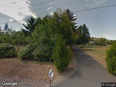
207 State Route 122 Mossyrock, WA 98564
Estimated Value: $495,000 - $733,000
3
Beds
2
Baths
2,152
Sq Ft
$305/Sq Ft
Est. Value
About This Home
This home is located at 207 State Route 122, Mossyrock, WA 98564 and is currently estimated at $656,651, approximately $305 per square foot. 207 State Route 122 is a home located in Lewis County with nearby schools including Mossyrock Elementary School and Mossyrock Middle/High School.
Ownership History
Date
Name
Owned For
Owner Type
Purchase Details
Closed on
Jun 14, 2006
Sold by
Beebe Jeremy L and Beebe Jennifer A
Bought by
Hood David G and Hood Debra J
Current Estimated Value
Home Financials for this Owner
Home Financials are based on the most recent Mortgage that was taken out on this home.
Original Mortgage
$52,158
Interest Rate
6.55%
Mortgage Type
Credit Line Revolving
Purchase Details
Closed on
Oct 7, 2005
Sold by
Beebe Jeremy
Bought by
Beebe Jeremy L and Beebe Jennifer A
Create a Home Valuation Report for This Property
The Home Valuation Report is an in-depth analysis detailing your home's value as well as a comparison with similar homes in the area
Home Values in the Area
Average Home Value in this Area
Purchase History
| Date | Buyer | Sale Price | Title Company |
|---|---|---|---|
| Hood David G | $25,016,825 | Title Guaranty | |
| Beebe Jeremy L | -- | None Available |
Source: Public Records
Mortgage History
| Date | Status | Borrower | Loan Amount |
|---|---|---|---|
| Open | Hood David G | $181,000 | |
| Closed | Hood Debra J | $202,250 | |
| Closed | Hood David G | $52,158 |
Source: Public Records
Tax History Compared to Growth
Tax History
| Year | Tax Paid | Tax Assessment Tax Assessment Total Assessment is a certain percentage of the fair market value that is determined by local assessors to be the total taxable value of land and additions on the property. | Land | Improvement |
|---|---|---|---|---|
| 2024 | $4,458 | $645,300 | $112,900 | $532,400 |
| 2023 | $4,435 | $615,600 | $83,200 | $532,400 |
| 2022 | $4,452 | $471,800 | $65,900 | $405,900 |
| 2021 | $4,172 | $471,800 | $65,900 | $405,900 |
| 2020 | $3,651 | $387,200 | $54,900 | $332,300 |
| 2019 | $3,698 | $324,200 | $45,600 | $278,600 |
| 2018 | $3,793 | $311,600 | $40,700 | $270,900 |
| 2017 | $3,416 | $291,200 | $39,300 | $251,900 |
| 2016 | $3,225 | $261,500 | $40,500 | $221,000 |
| 2015 | $2,968 | $266,000 | $45,000 | $221,000 |
| 2013 | $2,968 | $266,000 | $45,000 | $221,000 |
Source: Public Records
Map
Nearby Homes
- 166 Washington 122
- 0 Valley View Dr
- 128 Valley View Dr
- 0 Del Ray Rd
- 179 Valley View Dr
- 154 Valley View Dr
- 486 Washington 122
- 143 Damron Rd
- 0 XXXX Coleman Rd
- 4057 - 51 U S 12
- 277 Skyview Dr
- 154 Mossyrock Rd W Unit 5
- 220 W Mossyrock
- 130 W State St
- 100 E State St
- 231 E Main
- 137 Lake Rd
- 137 Lake Dr
- 222 W Mossyrock
- 238 Sunset Ave
- 207 State Route 122
- 127 Del Ray Rd
- 225 Washington 122
- 199 State Route 122
- 199 Washington 122
- 225 State Route 122
- 121 Del Ray Rd
- 116 Valley View Dr
- 187 State Route 122
- 0 XXX Del Ray Rd
- 159 Del Ray Rd
- 124 Del Ray Rd
- 106 Del Ray Rd
- 106 Del Ray Rd
- 106 Valley View Dr
- 139 Del Ray Rd
- 136 Del Ray Rd
- 143 Del Ray Rd
- 176 State Route 122
- 176 State Route 122
