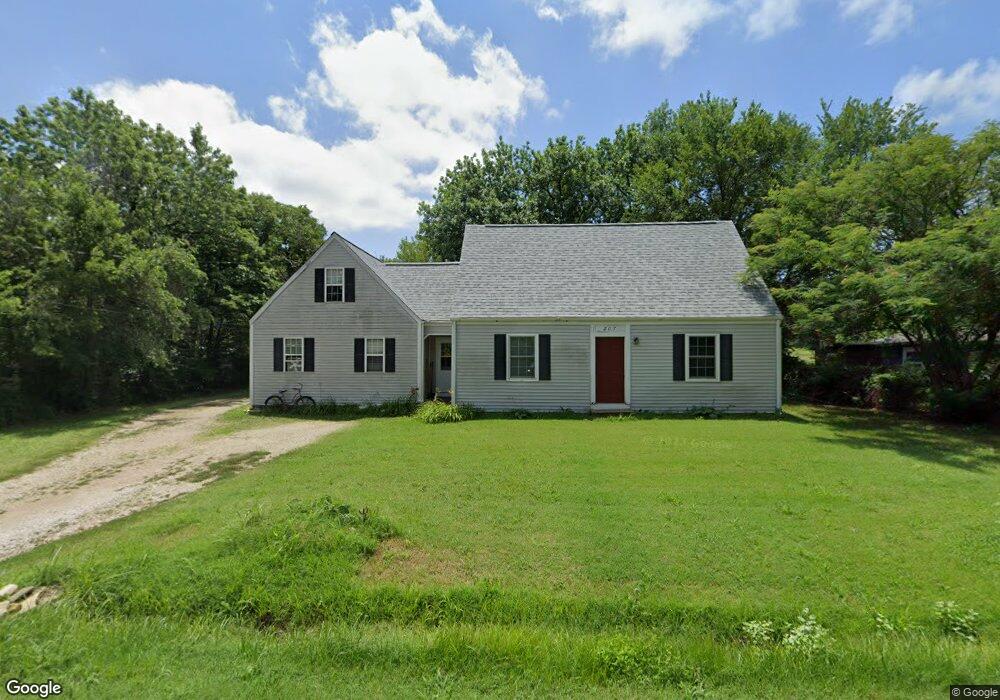
207 W 10th St Andover, KS 67002
Estimated Value: $213,000 - $233,000
3
Beds
2
Baths
1,766
Sq Ft
$128/Sq Ft
Est. Value
About This Home
This home is located at 207 W 10th St, Andover, KS 67002 and is currently estimated at $225,519, approximately $127 per square foot. 207 W 10th St is a home located in Butler County with nearby schools including Cottonwood Elementary School, Andover Middle School, and Andover High School.
Ownership History
Date
Name
Owned For
Owner Type
Purchase Details
Closed on
Mar 29, 2025
Sold by
Malcom Ronald L and Malcom Luellen
Bought by
Ronald And Luellen Malcom Family Trust
Current Estimated Value
Purchase Details
Closed on
Dec 30, 2024
Sold by
Malcom Ronald L and Malcom Luellen
Bought by
Ronald And Luellen Malcom Family Trust
Create a Home Valuation Report for This Property
The Home Valuation Report is an in-depth analysis detailing your home's value as well as a comparison with similar homes in the area
Home Values in the Area
Average Home Value in this Area
Purchase History
| Date | Buyer | Sale Price | Title Company |
|---|---|---|---|
| Ronald And Luellen Malcom Family Trust | -- | None Listed On Document | |
| Ronald And Luellen Malcom Family Trust | -- | None Listed On Document | |
| Ronald And Luellen Malcom Family Trust | -- | None Listed On Document | |
| Ronald And Luellen Malcom Family Trust | -- | None Listed On Document |
Source: Public Records
Tax History Compared to Growth
Tax History
| Year | Tax Paid | Tax Assessment Tax Assessment Total Assessment is a certain percentage of the fair market value that is determined by local assessors to be the total taxable value of land and additions on the property. | Land | Improvement |
|---|---|---|---|---|
| 2025 | $29 | $20,396 | $4,037 | $16,359 |
| 2024 | $29 | $20,193 | $3,347 | $16,846 |
| 2023 | $3,082 | $20,793 | $3,347 | $17,446 |
| 2022 | $3,067 | $17,860 | $3,347 | $14,513 |
| 2021 | $2,448 | $15,514 | $3,347 | $12,167 |
| 2020 | $2,508 | $15,606 | $3,347 | $12,259 |
| 2019 | $2,448 | $15,100 | $3,347 | $11,753 |
| 2018 | $2,381 | $14,755 | $3,347 | $11,408 |
| 2017 | $2,276 | $14,119 | $3,347 | $10,772 |
| 2014 | -- | $109,010 | $29,100 | $79,910 |
Source: Public Records
Map
Nearby Homes
- 545 N Andover Rd
- 2800 N Andover Rd
- 606 N Lakeside Dr
- 1317 N Shadow Rock Dr
- 601 Brentwood Place
- 620 N Somerset Ct
- 602 Brentwood Place
- 821 N Fairoaks Ct
- 1413 N Shadow Rock Dr
- 1447 N Lakeside Dr
- 918 E Lakecrest Dr
- Bedford Plan at The Courtyards at Cornerstone
- Portico Tandem Plan at The Courtyards at Cornerstone
- Portico Plus Plan at The Courtyards at Cornerstone
- Ashford Plan at The Courtyards at Cornerstone
- Salerno Plan at The Courtyards at Cornerstone
- 300 W Pepper Tree Rd
- Promenade III Plan at The Courtyards at Cornerstone
- Haven Plan at The Courtyards at Cornerstone
- Acadia Plan at The Courtyards at Cornerstone