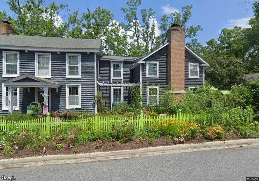
207 W Chew Ave Saint Michaels, MD 21663
Estimated Value: $967,000 - $1,184,000
--
Bed
1
Bath
2,953
Sq Ft
$365/Sq Ft
Est. Value
About This Home
This home is located at 207 W Chew Ave, Saint Michaels, MD 21663 and is currently estimated at $1,078,205, approximately $365 per square foot. 207 W Chew Ave is a home located in Talbot County with nearby schools including St. Michaels Elementary School, St. Michaels Middle/High School, and Easton High School.
Ownership History
Date
Name
Owned For
Owner Type
Purchase Details
Closed on
Aug 5, 2005
Sold by
Hartjens Peter G
Bought by
Morris Hartjens Peter G and Morris Hope, Constance
Current Estimated Value
Purchase Details
Closed on
Aug 3, 1999
Sold by
Harrison Drayton C
Bought by
Hartjens Peter G
Create a Home Valuation Report for This Property
The Home Valuation Report is an in-depth analysis detailing your home's value as well as a comparison with similar homes in the area
Home Values in the Area
Average Home Value in this Area
Purchase History
| Date | Buyer | Sale Price | Title Company |
|---|---|---|---|
| Morris Hartjens Peter G | -- | -- | |
| Hartjens Peter G | $285,000 | -- |
Source: Public Records
Tax History Compared to Growth
Tax History
| Year | Tax Paid | Tax Assessment Tax Assessment Total Assessment is a certain percentage of the fair market value that is determined by local assessors to be the total taxable value of land and additions on the property. | Land | Improvement |
|---|---|---|---|---|
| 2025 | $7,908 | $684,900 | $289,600 | $395,300 |
| 2024 | $7,908 | $640,467 | $0 | $0 |
| 2023 | $7,079 | $596,033 | $0 | $0 |
| 2022 | $6,324 | $551,600 | $246,100 | $305,500 |
| 2021 | $6,100 | $544,333 | $0 | $0 |
| 2020 | $6,100 | $537,067 | $0 | $0 |
| 2019 | $6,018 | $529,800 | $218,700 | $311,100 |
| 2018 | $5,569 | $499,400 | $0 | $0 |
| 2017 | $5,064 | $469,000 | $0 | $0 |
| 2016 | $4,221 | $438,600 | $0 | $0 |
| 2015 | $2,387 | $438,600 | $0 | $0 |
| 2014 | $2,387 | $438,600 | $0 | $0 |
Source: Public Records
Map
Nearby Homes
- 0 Grace St Unit MDTA2012346
- 100 Grace St
- 107 E Chestnut St
- 105 Seymour Ave
- 102 Gloria Ave
- 222 E Chestnut St
- 704 Meadow St
- Lot 16A Meadow St
- 216 E Chew Ave
- 807 Radcliff Ave
- 207 Dodson Ave
- 408 Spinnaker Ln
- 209 Webb Ln
- 300 Perry St
- 25500 Chance Farm Rd
- 216 Brooks Ln
- 912 Calvert Ave
- 24390 Oakwood Park Rd
- 24318 Oakwood Park Rd
- 228 Tyler Ave
- 503 Tilden St
- 208 W Chew Ave
- 205 W Chew Ave
- 122 W Chestnut St
- 120 W Chestnut St
- 203 W Chew Ave
- 301 W Chew Ave
- 500 Tilden St
- 118 W Chestnut St
- 200 W Chew Ave
- 0 W Chestnut St
- 201 W Chew Ave
- 116 W Chestnut St
- 114 W Chestnut St
- 117 W Chew Ave
- 115 W Chew Ave
- 114 W Chew Ave
- 125 W Chestnut St
- 112 W Chestnut St
- 602 Division St