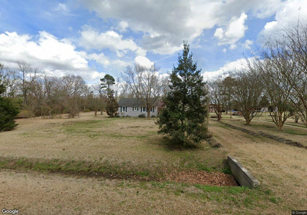
2070 Lamb Rd Willard, NC 28478
Willard NeighborhoodEstimated Value: $152,000 - $175,000
3
Beds
2
Baths
946
Sq Ft
$173/Sq Ft
Est. Value
About This Home
This home is located at 2070 Lamb Rd, Willard, NC 28478 and is currently estimated at $164,059, approximately $173 per square foot. 2070 Lamb Rd is a home located in Pender County with nearby schools including Penderlea Elementary School and Pender High School.
Ownership History
Date
Name
Owned For
Owner Type
Purchase Details
Closed on
Apr 22, 2005
Sold by
Rivenbark Ricky Reagan and Rivenbark Beverly
Bought by
Moosman Lonnie
Current Estimated Value
Home Financials for this Owner
Home Financials are based on the most recent Mortgage that was taken out on this home.
Original Mortgage
$80,750
Outstanding Balance
$40,843
Interest Rate
5.88%
Mortgage Type
New Conventional
Estimated Equity
$123,216
Create a Home Valuation Report for This Property
The Home Valuation Report is an in-depth analysis detailing your home's value as well as a comparison with similar homes in the area
Home Values in the Area
Average Home Value in this Area
Purchase History
| Date | Buyer | Sale Price | Title Company |
|---|---|---|---|
| Moosman Lonnie | $85,000 | -- |
Source: Public Records
Mortgage History
| Date | Status | Borrower | Loan Amount |
|---|---|---|---|
| Open | Moosman Lonnie | $80,750 |
Source: Public Records
Tax History
| Year | Tax Paid | Tax Assessment Tax Assessment Total Assessment is a certain percentage of the fair market value that is determined by local assessors to be the total taxable value of land and additions on the property. | Land | Improvement |
|---|---|---|---|---|
| 2025 | $882 | $212,177 | $64,380 | $147,797 |
| 2024 | $882 | $73,349 | $38,960 | $34,389 |
| 2023 | $834 | $73,349 | $38,960 | $34,389 |
| 2022 | $834 | $73,349 | $38,960 | $34,389 |
| 2021 | $834 | $73,349 | $38,960 | $34,389 |
| 2020 | $834 | $73,349 | $38,960 | $34,389 |
| 2019 | $834 | $73,349 | $38,960 | $34,389 |
| 2018 | $957 | $86,911 | $16,546 | $70,365 |
| 2017 | $957 | $86,911 | $16,546 | $70,365 |
| 2016 | $948 | $86,911 | $16,546 | $70,365 |
| 2015 | $913 | $86,911 | $16,546 | $70,365 |
| 2014 | $742 | $86,911 | $16,546 | $70,365 |
| 2013 | -- | $86,911 | $16,546 | $70,365 |
| 2012 | -- | $86,911 | $16,546 | $70,365 |
Source: Public Records
Map
Nearby Homes
- 9701 Penderlea Hwy
- 4044 Nc Highway 11
- 10.6 Crooked Run Rd
- 11.98 Pelham Rd
- 8729 Mary Slocum Rd SW
- 1003 Old Mill Rd
- 994 Test Farm Rd
- 993 Old Mill Rd
- 510 Mary Slocum Rd NE
- 3515 Watha Rd
- 1856 Old Mill Rd
- 25511 Hwy 421
- 25625 US Hwy 421
- 3763 Piney Woods Rd
- 405 S Alligator Ln
- 3 U S 117
- 00 Cumberland Clement
- 2971 Penderlea Hwy
- 570 W Main St
- 4441 S Nc 11 Hwy
- 2111 Lamb Rd
- 1935 Lamb Rd
- 2244 Lamb Rd
- 1745 Lamb Rd
- 1734 Lamb Rd
- 1704 Lamb Rd
- 10.57 Sunset
- 42.95 Acres Sunset
- 9819 Penderlea Hwy
- 1580 Lamb Rd
- 6565 Pelham Rd
- 6391 Pelham Rd
- 100 Oak Landing
- 104 Oak Landing
- 102 Oak Landing
- 343 Jonestown Rd Off
- 17.61 Acres Sunset
- 9633 Penderlea Hwy
- 10.6 Crooked Run
- 2604 Lamb Rd
Your Personal Tour Guide
Ask me questions while you tour the home.