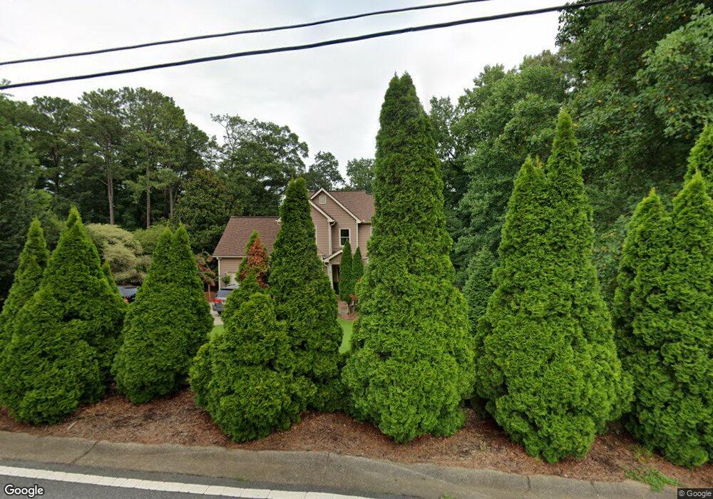
2070 Murdock Rd Marietta, GA 30062
East Cobb NeighborhoodEstimated Value: $524,000 - $649,000
4
Beds
3
Baths
2,062
Sq Ft
$287/Sq Ft
Est. Value
About This Home
This home is located at 2070 Murdock Rd, Marietta, GA 30062 and is currently estimated at $591,419, approximately $286 per square foot. 2070 Murdock Rd is a home located in Cobb County with nearby schools including Murdock Elementary School, Dodgen Middle School, and Pope High School.
Ownership History
Date
Name
Owned For
Owner Type
Purchase Details
Closed on
Apr 17, 2002
Sold by
Murdock Cobb 2070 Trust
Bought by
Lamei Cyrous
Current Estimated Value
Home Financials for this Owner
Home Financials are based on the most recent Mortgage that was taken out on this home.
Original Mortgage
$177,600
Interest Rate
6.53%
Mortgage Type
New Conventional
Purchase Details
Closed on
May 4, 2001
Sold by
Burdette Jonathan K and Burdette Shannon M
Bought by
Murdock Cobb 2070 Trust
Home Financials for this Owner
Home Financials are based on the most recent Mortgage that was taken out on this home.
Original Mortgage
$57,500
Interest Rate
6.95%
Mortgage Type
New Conventional
Create a Home Valuation Report for This Property
The Home Valuation Report is an in-depth analysis detailing your home's value as well as a comparison with similar homes in the area
Home Values in the Area
Average Home Value in this Area
Purchase History
| Date | Buyer | Sale Price | Title Company |
|---|---|---|---|
| Lamei Cyrous | $187,000 | -- | |
| Murdock Cobb 2070 Trust | $56,700 | -- |
Source: Public Records
Mortgage History
| Date | Status | Borrower | Loan Amount |
|---|---|---|---|
| Previous Owner | Lamei Cyrous | $177,600 | |
| Previous Owner | Murdock Cobb 2070 Trust | $57,500 |
Source: Public Records
Tax History Compared to Growth
Tax History
| Year | Tax Paid | Tax Assessment Tax Assessment Total Assessment is a certain percentage of the fair market value that is determined by local assessors to be the total taxable value of land and additions on the property. | Land | Improvement |
|---|---|---|---|---|
| 2025 | $863 | $200,932 | $51,000 | $149,932 |
| 2024 | $4,437 | $200,932 | $51,000 | $149,932 |
| 2023 | $3,778 | $195,568 | $40,800 | $154,768 |
| 2022 | $3,683 | $164,732 | $30,600 | $134,132 |
| 2021 | $3,079 | $137,144 | $30,600 | $106,544 |
| 2020 | $3,079 | $137,144 | $30,600 | $106,544 |
| 2019 | $2,718 | $120,660 | $25,500 | $95,160 |
| 2018 | $2,718 | $120,660 | $25,500 | $95,160 |
| 2017 | $2,403 | $108,192 | $25,500 | $82,692 |
| 2016 | $2,410 | $108,192 | $25,500 | $82,692 |
| 2015 | $2,452 | $108,192 | $25,500 | $82,692 |
| 2014 | $1,714 | $74,704 | $0 | $0 |
Source: Public Records
Map
Nearby Homes
- 3025 Bunker Hill Cir
- 2197 Cedar Forks Dr Unit 1
- 2186 Cedar Forks Dr
- 3292 Holly Mill Ct
- 3152 Normandy Cir NE
- 2138 Cedar Forks Dr Unit 2
- 1771 Canton Hills Cir
- 2041 Kramer Way
- 3402 Devoe Ct
- 2726 Whitehurst Dr NE
- 3218 Holly Mill Run
- 1900 Holly Springs Rd NE
- 2792 Craig Ct
- 3246 Able Ct
- 2726 Riderwood Ln NE
- 2260 Falkirk Pointe Dr
- 2268 Woodsfield Ln NE
- 2988 Nestle Creek Dr
- 2040 Murdock Rd
- 3057 Bunker Hill Cir
- 2100 Murdock Rd
- 2999 Bea Mar Dr
- 3061 Bunker Hill Cir
- 3037 Bunker Hill Cir
- 2010 Murdock Rd
- 2994 Bea Mar Dr
- 2994 Sutton Glen
- 3067 Bunker Hill Cir
- 2155 Sumter Lake Dr
- 1980 Murdock Rd
- 2087 Murdock Rd
- 2104 Murdock Rd
- 2989 Bea Mar Dr Unit 1
- 2161 Sumter Lake Dr
- 3046 Bunker Hill Cir
- 2992 Sutton Glen
- 2094 Melissa Ct
- 3009 Bunker Hill Rd