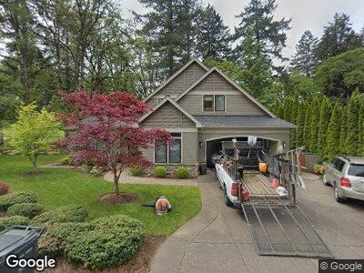
2070 SW Whiteside Dr Corvallis, OR 97333
Southwest Corvallis NeighborhoodEstimated Value: $816,000 - $1,007,000
3
Beds
4
Baths
2,539
Sq Ft
$370/Sq Ft
Est. Value
About This Home
This home is located at 2070 SW Whiteside Dr, Corvallis, OR 97333 and is currently estimated at $940,338, approximately $370 per square foot. 2070 SW Whiteside Dr is a home located in Benton County with nearby schools including Adams Elementary School, Linus Pauling Middle School, and Corvallis High School.
Ownership History
Date
Name
Owned For
Owner Type
Purchase Details
Closed on
Jan 5, 2021
Sold by
J Stephen Schaberg Trust and Stephen Schaberg J
Bought by
Linda L Schaberg Trust and Schaberg
Current Estimated Value
Purchase Details
Closed on
Dec 18, 2020
Sold by
Schaberg J Stephen and J Stephen Schaberg Trust
Bought by
Schaberg Linda L and Linda L Schaberg Trust
Purchase Details
Closed on
Jun 25, 2001
Sold by
Robinson Darvin and Robinson Diane M
Bought by
Schaberg J Stephen and The J Stephen Schaberg Trust
Create a Home Valuation Report for This Property
The Home Valuation Report is an in-depth analysis detailing your home's value as well as a comparison with similar homes in the area
Home Values in the Area
Average Home Value in this Area
Purchase History
| Date | Buyer | Sale Price | Title Company |
|---|---|---|---|
| Linda L Schaberg Trust | -- | None Listed On Document | |
| Schaberg Linda L | -- | None Available | |
| Schaberg J Stephen | $185,000 | Ticor Title Insurance |
Source: Public Records
Tax History Compared to Growth
Tax History
| Year | Tax Paid | Tax Assessment Tax Assessment Total Assessment is a certain percentage of the fair market value that is determined by local assessors to be the total taxable value of land and additions on the property. | Land | Improvement |
|---|---|---|---|---|
| 2024 | $12,120 | $630,952 | -- | -- |
| 2023 | $11,413 | $612,575 | $0 | $0 |
| 2022 | $11,079 | $594,733 | $0 | $0 |
| 2021 | $10,712 | $577,411 | $0 | $0 |
| 2020 | $10,654 | $560,593 | $0 | $0 |
| 2019 | $9,652 | $544,265 | $0 | $0 |
| 2018 | $9,866 | $528,413 | $0 | $0 |
| 2017 | $8,756 | $513,022 | $0 | $0 |
| 2016 | $8,602 | $498,080 | $0 | $0 |
| 2015 | $8,359 | $483,573 | $0 | $0 |
| 2014 | $8,260 | $469,488 | $0 | $0 |
| 2012 | -- | $227,917 | $0 | $0 |
Source: Public Records
Map
Nearby Homes
- 2520 SW Whiteside Dr
- 2604 SW Wolverine Dr
- 2713 SW Wolverine Dr
- 3475 SW Buckeye Place
- 2755 SW Fairmont Dr
- 3386 SW Badger Place
- 1907 SW Brooklane Dr
- 2788 SW Mulligan Place
- 2315 SW 45th St
- 4149 SW Research Way
- 4525 SW Nash Ave
- 0 SW Herbert (57 Acres) Ave
- 4862 SW Hollyhock Cir
- 4941 SW Hollyhock Cir
- 1125 SW Cole Place
- 4530 SW Nash (Next To) Ave
- 4968 SW Kara Ave
- 4970 SW Hudson Ave
- 2839 SW Western Blvd
- 380 SW Tunison Ave
- 2070 SW Whiteside Dr
- 2060 SW Whiteside Dr
- 2135 SW Whiteside Dr
- 2050 SW Whiteside Dr
- 3445 SW Cascade Ave
- 3440 SW Cascade Ave
- 2055 SW Whiteside Dr
- 3600 SW Chintimini Ave
- 2030 SW Whiteside Dr
- 3420 SW Cascade Ave
- 2015 SW Whiteside Dr
- 3630 SW Chintimini Ave
- 3435 SW Cascade Ave
- 10 SW Whiteside Dr
- 7 SW Whiteside Dr Unit 7
- #10 SW Whiteside Dr
- Lot #7 SW Whiteside Dr
- 0 SW Whiteside Dr Unit 620324
- 3410 SW Cascade Ave
- 3428 SW Chintimini Ave