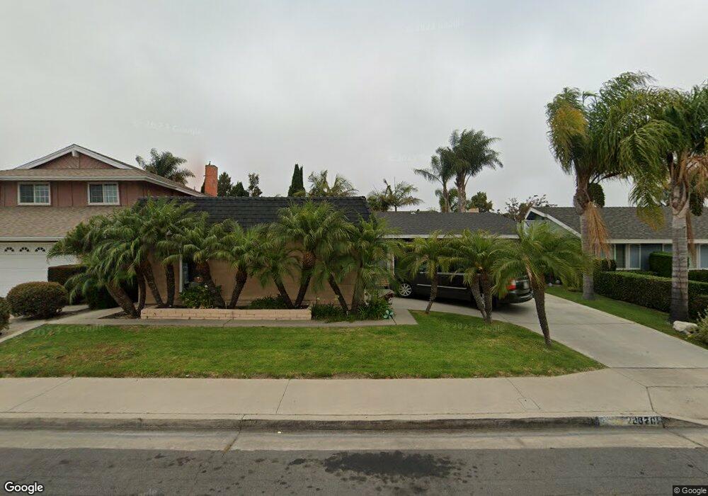
20701 Reef Ln Huntington Beach, CA 92646
Southeast NeighborhoodEstimated Value: $1,363,648 - $1,604,000
4
Beds
2
Baths
1,595
Sq Ft
$941/Sq Ft
Est. Value
About This Home
This home is located at 20701 Reef Ln, Huntington Beach, CA 92646 and is currently estimated at $1,501,162, approximately $941 per square foot. 20701 Reef Ln is a home located in Orange County with nearby schools including Ralph E. Hawes Elementary School, Isaac L. Sowers Middle School, and Edison High School.
Ownership History
Date
Name
Owned For
Owner Type
Purchase Details
Closed on
Mar 11, 2012
Sold by
Broder Edward and Broder Nancy K Luksa
Bought by
Rosie Mesa Properties Llc
Current Estimated Value
Purchase Details
Closed on
Oct 31, 2001
Sold by
Broder Edward and Luksa Nancy K
Bought by
Broder Edward and Broder Nancy K Luksa
Purchase Details
Closed on
Mar 28, 2001
Sold by
Founder Properties
Bought by
Broder Edward and Luksa Nancy K
Create a Home Valuation Report for This Property
The Home Valuation Report is an in-depth analysis detailing your home's value as well as a comparison with similar homes in the area
Home Values in the Area
Average Home Value in this Area
Purchase History
| Date | Buyer | Sale Price | Title Company |
|---|---|---|---|
| Rosie Mesa Properties Llc | -- | Fnt | |
| Broder Edward | -- | -- | |
| Broder Edward | -- | North American Title Co |
Source: Public Records
Tax History Compared to Growth
Tax History
| Year | Tax Paid | Tax Assessment Tax Assessment Total Assessment is a certain percentage of the fair market value that is determined by local assessors to be the total taxable value of land and additions on the property. | Land | Improvement |
|---|---|---|---|---|
| 2025 | $3,191 | $258,960 | $128,517 | $130,443 |
| 2024 | $3,191 | $253,883 | $125,997 | $127,886 |
| 2023 | $3,117 | $248,905 | $123,526 | $125,379 |
| 2022 | $3,034 | $244,025 | $121,104 | $122,921 |
| 2021 | $2,980 | $239,241 | $118,730 | $120,511 |
| 2020 | $2,959 | $236,788 | $117,512 | $119,276 |
| 2019 | $2,927 | $232,146 | $115,208 | $116,938 |
| 2018 | $2,883 | $227,595 | $112,949 | $114,646 |
| 2017 | $2,845 | $223,133 | $110,734 | $112,399 |
| 2016 | $2,726 | $218,758 | $108,562 | $110,196 |
| 2015 | $2,699 | $215,473 | $106,932 | $108,541 |
| 2014 | $2,643 | $211,253 | $104,838 | $106,415 |
Source: Public Records
Map
Nearby Homes
- 9812 La Cresta Cir
- 20862 Lancelot Ln
- 10101 Theseus Dr
- 20392 Redwood Ln
- 21022 Manessa Cir
- 9522 Yellowstone Dr
- 21072 Galbar Cir
- 9802 Effingham Dr
- 20442 Craimer Ln
- 10172 Stonybrook Dr
- 9581 Chevy Chase Dr
- 9221 Belcaro Dr
- 21361 Lemontree Ln
- 21382 Lemontree Ln
- 21221 Hillsdale Ln
- 9695 Adams Ave
- 20071 Moontide Cir
- 9001 Oceanwood Dr
- 20111 Marina Ln
- 9667 Durham Dr
- 20711 Reef Ln
- 20691 Reef Ln
- 20672 Queens Park Ln
- 20721 Reef Ln
- 20682 Queens Park Ln
- 20671 Reef Ln
- 20662 Queens Park Ln
- 20692 Queens Park Ln
- 20702 Reef Ln
- 20712 Reef Ln
- 20652 Queens Park Ln
- 20692 Reef Ln
- 20661 Reef Ln
- 20731 Reef Ln
- 20702 Queens Park Ln
- 20672 Reef Ln
- 20642 Queens Park Ln
- 20651 Reef Ln
- 9772 Silver Strand Dr
- 20662 Reef Ln