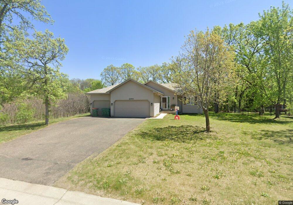
20703 Atlantic Blvd Big Lake, MN 55309
Estimated Value: $370,532 - $437,000
3
Beds
2
Baths
1,573
Sq Ft
$250/Sq Ft
Est. Value
About This Home
This home is located at 20703 Atlantic Blvd, Big Lake, MN 55309 and is currently estimated at $393,133, approximately $249 per square foot. 20703 Atlantic Blvd is a home located in Sherburne County with nearby schools including Liberty Elementary School, Independence Elementary School, and Big Lake Middle School.
Ownership History
Date
Name
Owned For
Owner Type
Purchase Details
Closed on
Aug 3, 2020
Sold by
Cotter Nathan D and Cotter Sarah J
Bought by
Trastenok Mikhail and Trastenok Ruth
Current Estimated Value
Home Financials for this Owner
Home Financials are based on the most recent Mortgage that was taken out on this home.
Original Mortgage
$282,292
Outstanding Balance
$250,413
Interest Rate
3%
Mortgage Type
New Conventional
Estimated Equity
$142,720
Purchase Details
Closed on
Apr 27, 2016
Bought by
Cotter Nathan D
Home Financials for this Owner
Home Financials are based on the most recent Mortgage that was taken out on this home.
Original Mortgage
$138,000
Interest Rate
3.59%
Purchase Details
Closed on
Feb 25, 2010
Sold by
Tri County Action Program Inc
Bought by
Schneider Sarah J
Create a Home Valuation Report for This Property
The Home Valuation Report is an in-depth analysis detailing your home's value as well as a comparison with similar homes in the area
Home Values in the Area
Average Home Value in this Area
Purchase History
| Date | Buyer | Sale Price | Title Company |
|---|---|---|---|
| Trastenok Mikhail | $287,500 | Ancona Title | |
| Cotter Nathan D | -- | -- | |
| Schneider Sarah J | $165,000 | -- |
Source: Public Records
Mortgage History
| Date | Status | Borrower | Loan Amount |
|---|---|---|---|
| Open | Trastenok Mikhail | $282,292 | |
| Previous Owner | Cotter Nathan D | $138,000 | |
| Previous Owner | Cotter Nathan D | -- |
Source: Public Records
Tax History Compared to Growth
Tax History
| Year | Tax Paid | Tax Assessment Tax Assessment Total Assessment is a certain percentage of the fair market value that is determined by local assessors to be the total taxable value of land and additions on the property. | Land | Improvement |
|---|---|---|---|---|
| 2025 | $4,312 | $357,400 | $85,000 | $272,400 |
| 2024 | $4,470 | $357,400 | $85,000 | $272,400 |
| 2023 | $4,404 | $370,100 | $96,700 | $273,400 |
| 2022 | $4,176 | $352,300 | $81,700 | $270,600 |
| 2020 | $3,804 | $268,000 | $50,100 | $217,900 |
| 2019 | $3,606 | $252,600 | $44,100 | $208,500 |
| 2018 | $3,124 | $237,600 | $40,400 | $197,200 |
| 2017 | $3,432 | $202,100 | $35,500 | $166,600 |
| 2016 | $3,476 | $211,800 | $32,000 | $179,800 |
| 2015 | $3,188 | $197,300 | $31,600 | $165,700 |
| 2014 | $2,916 | $190,500 | $31,400 | $159,100 |
| 2013 | -- | $165,400 | $30,400 | $135,000 |
Source: Public Records
Map
Nearby Homes
- 18585 Arctic Ave
- 18012 Walnut Cir
- 18050 Walnut Cir
- 18052 Walnut Cir
- 18041 Walnut Cir
- 18043 Walnut Cir
- 18059 Walnut Cir
- 585 Glenwood Ave
- 591 Glenwood Ave
- 1280 Hill St
- 20386 181st Cir NW
- 5017 Edinburgh Way
- 5385 Edinburgh Way
- 393 Phyllis St
- 23xxx 182nd St NW
- 4327 Sterling Dr
- 1641 Kenabec St
- 541 William St
- 21453 Lena Trail
- 1106 Kilbirnie Rd
- 20683 Atlantic Blvd
- XXXXX Atlantic Blvd
- 20663 Atlantic Blvd
- 1281 Vernon St
- 20724 Atlantic Blvd
- 20704 Atlantic Blvd
- 20744 Atlantic Blvd
- 18512 Arctic Cir
- 20684 Atlantic Blvd
- YYY Atlantic Blvd
- XXXXX Arctic Blvd
- 1291 Vernon St
- 20764 Atlantic Blvd
- 1251 Vernon St
- 1261 Vernon St
- 20664 Atlantic Blvd
- XXXX Atlantic Blvd
- 18502 Arctic Cir
- XXX Atlantic Blvd
- 23855 187th St NW