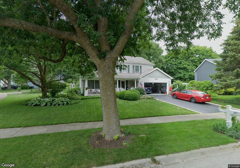
2071 Garth Ct Naperville, IL 60565
Old Farm NeighborhoodEstimated Value: $498,000 - $580,000
Studio
1
Bath
2,546
Sq Ft
$208/Sq Ft
Est. Value
About This Home
This home is located at 2071 Garth Ct, Naperville, IL 60565 and is currently estimated at $530,832, approximately $208 per square foot. 2071 Garth Ct is a home located in DuPage County with nearby schools including Kingsley Elementary School, Lincoln Jr. High School, and Naperville Central High School.
Ownership History
Date
Name
Owned For
Owner Type
Purchase Details
Closed on
Apr 28, 2025
Sold by
William E Starkweather Trust and Barbara A Starkweather Trust
Bought by
William E Starkweather Trust and Barbara A Starkweather Trust
Current Estimated Value
Purchase Details
Closed on
Apr 2, 2009
Sold by
Starkweather William E and Starkweather Barbara A
Bought by
Starkweather William E and William E Starkweather Trust
Create a Home Valuation Report for This Property
The Home Valuation Report is an in-depth analysis detailing your home's value as well as a comparison with similar homes in the area
Home Values in the Area
Average Home Value in this Area
Purchase History
| Date | Buyer | Sale Price | Title Company |
|---|---|---|---|
| William E Starkweather Trust | -- | None Listed On Document | |
| Starkweather William E | -- | None Available |
Source: Public Records
Tax History
| Year | Tax Paid | Tax Assessment Tax Assessment Total Assessment is a certain percentage of the fair market value that is determined by local assessors to be the total taxable value of land and additions on the property. | Land | Improvement |
|---|---|---|---|---|
| 2024 | $9,943 | $178,304 | $67,901 | $110,403 |
| 2023 | $9,534 | $162,730 | $61,970 | $100,760 |
| 2022 | $8,863 | $147,940 | $56,340 | $91,600 |
| 2021 | $8,526 | $142,350 | $54,210 | $88,140 |
| 2020 | $8,338 | $139,800 | $53,240 | $86,560 |
| 2019 | $8,080 | $133,760 | $50,940 | $82,820 |
| 2018 | $7,663 | $127,390 | $48,510 | $78,880 |
| 2017 | $7,496 | $123,090 | $46,870 | $76,220 |
| 2016 | $7,332 | $118,640 | $45,180 | $73,460 |
| 2015 | $7,622 | $111,730 | $42,550 | $69,180 |
| 2014 | $7,326 | $104,420 | $39,770 | $64,650 |
| 2013 | $7,216 | $104,680 | $39,870 | $64,810 |
Source: Public Records
Map
Nearby Homes
- 2023 Springside Dr
- 362 Ripley Ct
- 233 Briarheath Ln
- 2221 Woodland Cir
- 2049 Dorval Dr
- 270 Pebblestone Rd
- 2308 Modaff Rd
- 381 Prairie Knoll Dr
- 2245 Petworth Ct Unit 202C
- 352 Danbury Dr
- 96 Midhurst Ct Unit 201
- 332 Prairie Knoll Dr
- 47 Glencoe Ct Unit 102D
- 2206 Worthing Dr
- 18 Newgate Ave
- 34 Glencoe Ct Unit 202B
- 364 Avena Cir
- 48 Starling Ln
- 628 Flock Ave Unit 3
- 2438 Wendover Dr
- 305 Devlin Ct
- 2069 Garth Ct
- 2068 Garth Ct
- 2031 Bristol Ct
- 309 Devlin Ct
- 302 Devlin Ct
- 2063 Garth Ct
- 2027 Bristol Ct
- 2064 Garth Ct Unit 2
- 306 Devlin Ct
- 311 Devlin Ct
- 2065 Springside Dr
- 298 Devlin Ct Unit 2
- 2061 Springside Dr
- 2060 Garth Ct
- 2059 Garth Ct
- 310 Devlin Ct
- 314 Devlin Ct
- 2023 Bristol Ct
- 2085 Springside Dr
Your Personal Tour Guide
Ask me questions while you tour the home.