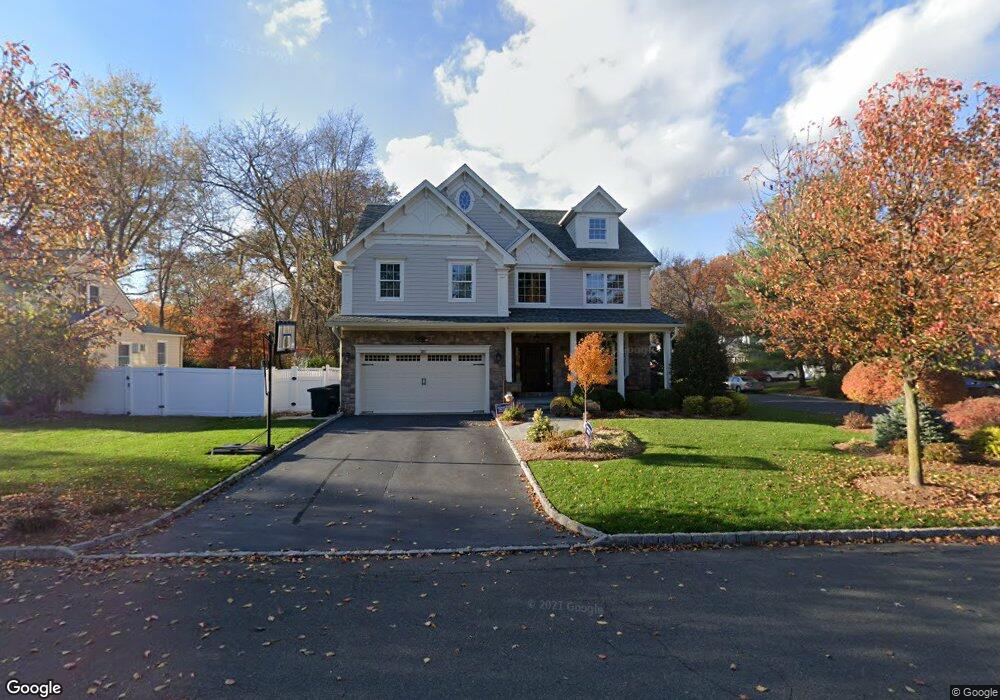
2071 Hill Top Rd Scotch Plains, NJ 07076
Estimated Value: $876,814 - $1,363,000
--
Bed
--
Bath
2,878
Sq Ft
$398/Sq Ft
Est. Value
About This Home
This home is located at 2071 Hill Top Rd, Scotch Plains, NJ 07076 and is currently estimated at $1,144,704, approximately $397 per square foot. 2071 Hill Top Rd is a home located in Union County with nearby schools including William J. McGinn Elementary School, Terrill Middle School, and Scotch Plains-Fanwood High School.
Ownership History
Date
Name
Owned For
Owner Type
Purchase Details
Closed on
Sep 19, 2001
Sold by
Skowronski John
Bought by
Skowronski Lisa Ann
Current Estimated Value
Purchase Details
Closed on
Dec 20, 1996
Sold by
Kelly Shannon
Bought by
Skowronski John and Skowronski Lisa Ann
Home Financials for this Owner
Home Financials are based on the most recent Mortgage that was taken out on this home.
Original Mortgage
$189,000
Outstanding Balance
$19,298
Interest Rate
7.75%
Estimated Equity
$1,125,406
Purchase Details
Closed on
Mar 25, 1994
Sold by
Binkiewicz Gary S
Bought by
Kelly Shannon
Home Financials for this Owner
Home Financials are based on the most recent Mortgage that was taken out on this home.
Original Mortgage
$180,000
Interest Rate
7.6%
Create a Home Valuation Report for This Property
The Home Valuation Report is an in-depth analysis detailing your home's value as well as a comparison with similar homes in the area
Home Values in the Area
Average Home Value in this Area
Purchase History
| Date | Buyer | Sale Price | Title Company |
|---|---|---|---|
| Skowronski Lisa Ann | -- | -- | |
| Skowronski John | $210,000 | -- | |
| Kelly Shannon | $225,000 | -- |
Source: Public Records
Mortgage History
| Date | Status | Borrower | Loan Amount |
|---|---|---|---|
| Open | Skowronski John | $189,000 | |
| Previous Owner | Kelly Shannon | $180,000 |
Source: Public Records
Tax History Compared to Growth
Tax History
| Year | Tax Paid | Tax Assessment Tax Assessment Total Assessment is a certain percentage of the fair market value that is determined by local assessors to be the total taxable value of land and additions on the property. | Land | Improvement |
|---|---|---|---|---|
| 2025 | $21,853 | $185,700 | $31,000 | $154,700 |
| 2024 | $21,209 | $185,700 | $31,000 | $154,700 |
| 2023 | $21,209 | $185,700 | $31,000 | $154,700 |
| 2022 | $20,956 | $185,700 | $31,000 | $154,700 |
| 2021 | $20,921 | $185,700 | $31,000 | $154,700 |
| 2020 | $20,821 | $185,700 | $31,000 | $154,700 |
| 2019 | $20,667 | $185,700 | $31,000 | $154,700 |
| 2018 | $20,319 | $185,700 | $31,000 | $154,700 |
| 2017 | $19,868 | $185,700 | $31,000 | $154,700 |
| 2016 | $19,486 | $185,700 | $31,000 | $154,700 |
| 2015 | $19,166 | $185,700 | $31,000 | $154,700 |
| 2014 | $18,535 | $185,700 | $31,000 | $154,700 |
Source: Public Records
Map
Nearby Homes
- 2116 Newark Ave
- 1933 Mary Ellen Ln
- 1933 W Broad St
- 2154 W Broad St
- 119 Lamberts Mill Rd
- 2212 Shady Ln
- 2 Brookside Ct
- 187 King St
- 2219 North Ave Unit 6
- 2314 Longfellow Ave
- 345 La Grande Ave
- 120 S Martine Ave
- 5 Robin Rd
- 1466 Lamberts Mill Rd
- 314 Highgate Ave
- 21 Old South Ave
- 40 1st St
- 350 W Dudley Ave
- 524 Edgar Rd
- 2286 Stocker Ln
- 2065 Hill Top Rd
- 1202 Woodside Rd
- 2059 Hill Top Rd
- 1211 Woodside Rd
- 1205 Woodside Rd
- 1196 Woodside Rd
- 1199 Woodside Rd
- 2070 Hill Top Rd
- 2066 Hill Top Rd
- 2053 Hill Top Rd
- 2093 Aldene Ave
- 1215 Maple Hill Rd
- 2082 Hill Top Rd
- 1192 Woodside Rd
- 2060 Hill Top Rd
- 1193 Woodside Rd
- 1209 Maple Hill Rd
- 2054 Hill Top Rd
- 2106 Cheyenne Way
- 2097 Aldene Ave