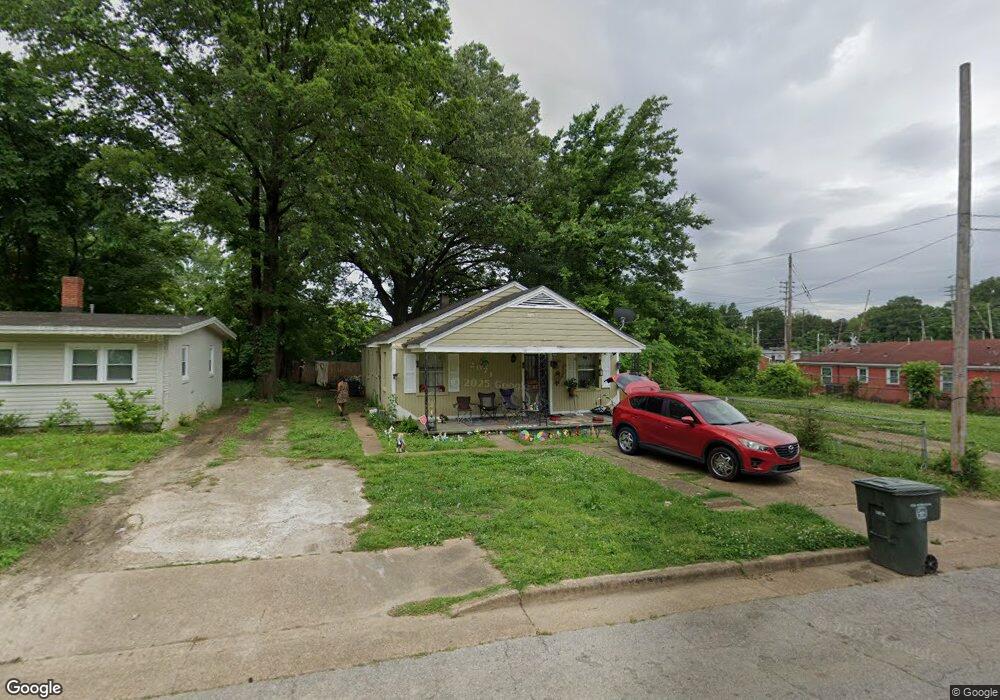
2071 Lowell Ave Memphis, TN 38114
Southeast Memphis NeighborhoodEstimated Value: $46,000 - $187,000
4
Beds
2
Baths
1,484
Sq Ft
$62/Sq Ft
Est. Value
About This Home
This home is located at 2071 Lowell Ave, Memphis, TN 38114 and is currently estimated at $91,483, approximately $61 per square foot. 2071 Lowell Ave is a home located in Shelby County with nearby schools including Melrose High School, Hanley School - Elementary, and Memphis College Preparatory.
Ownership History
Date
Name
Owned For
Owner Type
Purchase Details
Closed on
May 31, 2002
Sold by
Trustees Of Greater Gethsemane Baptist C
Bought by
Greater Gethsemane Missionary Baptist Ch
Current Estimated Value
Purchase Details
Closed on
Oct 30, 1998
Sold by
Moore Elmer and Moore Essie P
Bought by
Trustees Of Greater Gethsemane Baptist C
Home Financials for this Owner
Home Financials are based on the most recent Mortgage that was taken out on this home.
Original Mortgage
$12,400
Interest Rate
6.65%
Purchase Details
Closed on
Aug 14, 1997
Sold by
Newby Malessa and Newby Michael
Bought by
Hud
Create a Home Valuation Report for This Property
The Home Valuation Report is an in-depth analysis detailing your home's value as well as a comparison with similar homes in the area
Home Values in the Area
Average Home Value in this Area
Purchase History
| Date | Buyer | Sale Price | Title Company |
|---|---|---|---|
| Greater Gethsemane Missionary Baptist Ch | -- | -- | |
| Trustees Of Greater Gethsemane Baptist C | $28,000 | -- | |
| Hud | $42,832 | -- |
Source: Public Records
Mortgage History
| Date | Status | Borrower | Loan Amount |
|---|---|---|---|
| Previous Owner | Trustees Of Greater Gethsemane Baptist C | $12,400 |
Source: Public Records
Tax History Compared to Growth
Tax History
| Year | Tax Paid | Tax Assessment Tax Assessment Total Assessment is a certain percentage of the fair market value that is determined by local assessors to be the total taxable value of land and additions on the property. | Land | Improvement |
|---|---|---|---|---|
| 2025 | -- | $9,300 | $1,500 | $7,800 |
| 2024 | -- | $3,875 | $625 | $3,250 |
| 2023 | $236 | $3,875 | $625 | $3,250 |
| 2022 | $236 | $3,875 | $625 | $3,250 |
| 2021 | $239 | $3,875 | $625 | $3,250 |
| 2020 | $293 | $4,050 | $625 | $3,425 |
| 2019 | $293 | $4,050 | $625 | $3,425 |
| 2018 | $293 | $4,050 | $625 | $3,425 |
| 2017 | $166 | $4,050 | $625 | $3,425 |
| 2016 | $247 | $5,650 | $0 | $0 |
| 2014 | $247 | $5,650 | $0 | $0 |
Source: Public Records
Map
Nearby Homes
- 2151 Goff Ave
- 2149 Wabash Ave
- 1971 Boyle Ave
- 0 Dublin Ave Unit LOTS 20 & 21 LAST TW
- 1936 Frisco Ave
- 1998 Cloverdale Dr
- 1720 Airways Blvd
- 2255 Deadrick Ave
- 1059 S Willett St S
- 1817 S Barksdale St
- 1394 Chadwick Cir
- 2383 Lowell Ave
- 1816 Kerr Ave
- 0 Airways Blvd Unit 10199303
- 2421 Arlington Ave
- 1949 Lapaloma St
- 2400 Kimball Ave
- 0 S Barksdale St
- 1481 Oaklawn St
- 1493 Oaklawn St
- 2065 Lowell Ave
- 2077 Lowell Ave
- 2070 E Person Ave
- 2061 Lowell Ave
- 2076 E Person Ave
- 2083 Lowell Ave
- 2080 E Person Ave
- 2064 Lowell Ave
- 2087 Lowell Ave
- 2074 Lowell Ave
- 2066 Lowell Ave
- 2076 Lowell Ave
- 2080 Lowell Ave
- 1644 Castalia St
- 2088 Lowell Ave
- 2090 Lowell Ave
- 1642 Castalia St
- 1659 S Cooper St
- 1655 S Cooper St
- 1669 Cooper St