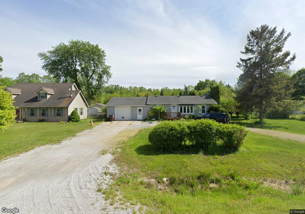
2071 Maplecrest Dr Unit Bldg-Unit Carleton, MI 48117
Estimated Value: $221,000 - $261,000
3
Beds
1
Bath
1,154
Sq Ft
$210/Sq Ft
Est. Value
About This Home
This home is located at 2071 Maplecrest Dr Unit Bldg-Unit, Carleton, MI 48117 and is currently estimated at $241,939, approximately $209 per square foot. 2071 Maplecrest Dr Unit Bldg-Unit is a home located in Monroe County with nearby schools including Airport Senior High School and Carleton Community Baptist.
Ownership History
Date
Name
Owned For
Owner Type
Purchase Details
Closed on
Mar 9, 2018
Sold by
Tsouris Kathryne
Bought by
Black Ryan B and Black Courtney
Current Estimated Value
Home Financials for this Owner
Home Financials are based on the most recent Mortgage that was taken out on this home.
Original Mortgage
$125,681
Outstanding Balance
$108,696
Interest Rate
4.87%
Mortgage Type
FHA
Estimated Equity
$133,243
Purchase Details
Closed on
Oct 10, 2012
Sold by
Jpmorgan Chase Bank Na
Bought by
Secretary Of Hud
Purchase Details
Closed on
Mar 29, 2012
Sold by
Slage Richard D
Bought by
Jpmorgan Chae Bank
Create a Home Valuation Report for This Property
The Home Valuation Report is an in-depth analysis detailing your home's value as well as a comparison with similar homes in the area
Home Values in the Area
Average Home Value in this Area
Purchase History
| Date | Buyer | Sale Price | Title Company |
|---|---|---|---|
| Black Ryan B | $128,000 | Lawyers Title | |
| Secretary Of Hud | -- | None Available | |
| Jpmorgan Chae Bank | -- | None Available |
Source: Public Records
Mortgage History
| Date | Status | Borrower | Loan Amount |
|---|---|---|---|
| Open | Black Ryan B | $125,681 |
Source: Public Records
Tax History
| Year | Tax Paid | Tax Assessment Tax Assessment Total Assessment is a certain percentage of the fair market value that is determined by local assessors to be the total taxable value of land and additions on the property. | Land | Improvement |
|---|---|---|---|---|
| 2025 | $916 | $98,300 | $4,800 | $93,500 |
| 2024 | $888 | $93,300 | $0 | $0 |
| 2023 | $846 | $74,800 | $0 | $0 |
| 2022 | $1,886 | $74,800 | $0 | $0 |
| 2021 | $1,855 | $79,100 | $0 | $0 |
| 2020 | $1,802 | $71,500 | $0 | $0 |
| 2019 | $1,795 | $71,500 | $0 | $0 |
| 2018 | $1,446 | $67,100 | $0 | $0 |
| 2017 | $1,365 | $63,400 | $0 | $0 |
| 2016 | $1,339 | $63,400 | $0 | $0 |
| 2015 | $1,287 | $55,500 | $0 | $0 |
| 2014 | $1,301 | $55,500 | $0 | $0 |
| 2013 | -- | $54,200 | $0 | $0 |
Source: Public Records
Map
Nearby Homes
- 12464 Maxwell Rd
- 12259 Eldora St
- 12361 Spencer Ln
- 1405 Cedarcrest Dr
- 12850 Crane St
- 12751 Jones St
- 13498 Exeter Rd
- 49 James Dr
- 1980 Oakville Waltz Rd
- 0 Oakville Waltz Rd Unit G50038710
- 28503 Margaret Ln Unit 1
- VACANT Oakville Waltz Rd
- 12995 Sweitzer Rd
- 36505 Bismark Rd
- 28264 Waltz Rd
- 27972 Waltz Rd
- 9601 Exeter Rd
- 0000 Carleton Rockwood Rd
- 27750 Bell Rd
- 13680 Martinsville Rd
- 2071 Maplecrest Dr
- 2087 Maplecrest Dr
- 2055 Maplecrest Dr
- 0 Maplecrest Unit 21480981
- 0 Maplecrest Unit 4923739
- 0 Maplecrest Unit 212040086
- 2039 Maplecrest Dr
- 2103 Maplecrest Dr
- 2103 Maplecrest Dr
- 2088 Maplecrest Dr
- 2072 Maplecrest Dr
- 12342 Knox Dr
- 2050 Maplecrest Dr
- 2023 Maplecrest Dr
- 2026 Maplecrest Dr
- 2005 Maplecrest Dr
- 2126 Maplecrest Dr
- 2126 Maplecrest Dr
- 2008 Maplecrest Dr
- 12345 Knox Dr
Your Personal Tour Guide
Ask me questions while you tour the home.