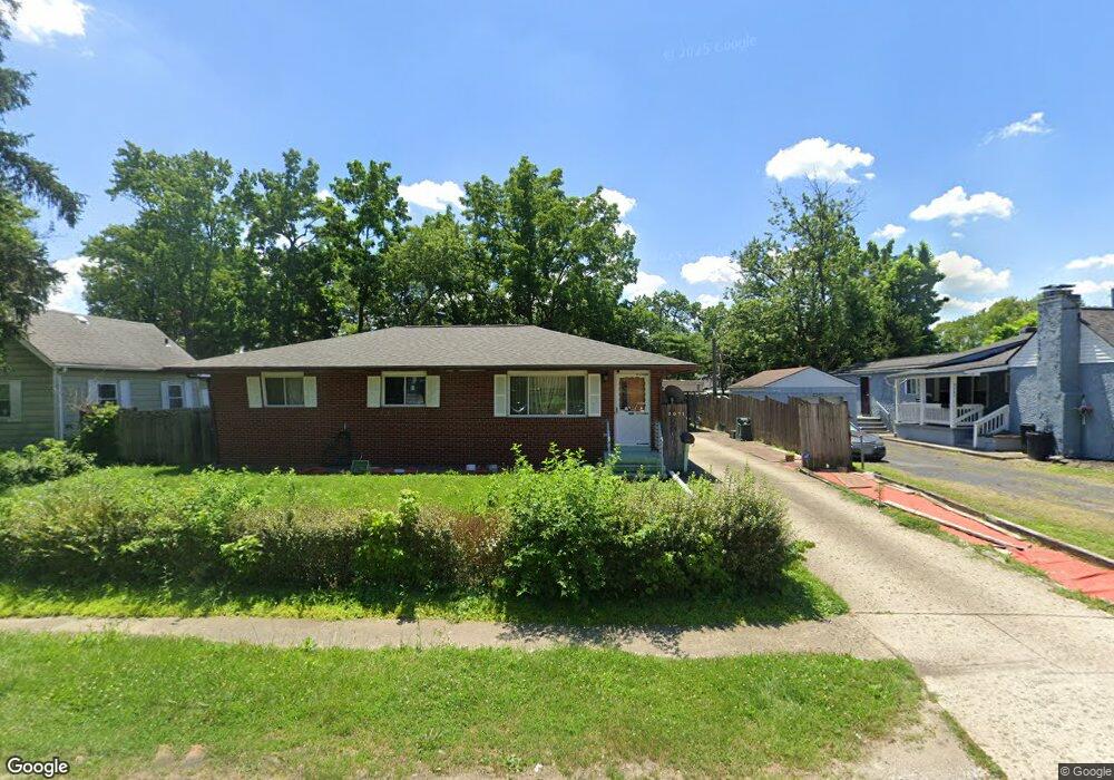
2071 Radnor Ave Columbus, OH 43224
North Linden NeighborhoodEstimated Value: $210,197 - $238,000
3
Beds
2
Baths
1,161
Sq Ft
$194/Sq Ft
Est. Value
About This Home
This home is located at 2071 Radnor Ave, Columbus, OH 43224 and is currently estimated at $225,049, approximately $193 per square foot. 2071 Radnor Ave is a home located in Franklin County with nearby schools including North Linden Elementary School, Medina Middle School, and Mifflin High School.
Ownership History
Date
Name
Owned For
Owner Type
Purchase Details
Closed on
Nov 4, 1996
Sold by
Graley Sharon L
Bought by
Ly An M and Ly Thao P
Current Estimated Value
Home Financials for this Owner
Home Financials are based on the most recent Mortgage that was taken out on this home.
Original Mortgage
$72,086
Outstanding Balance
$5,207
Interest Rate
8.23%
Mortgage Type
FHA
Estimated Equity
$219,842
Purchase Details
Closed on
Oct 1, 1985
Create a Home Valuation Report for This Property
The Home Valuation Report is an in-depth analysis detailing your home's value as well as a comparison with similar homes in the area
Home Values in the Area
Average Home Value in this Area
Purchase History
| Date | Buyer | Sale Price | Title Company |
|---|---|---|---|
| Ly An M | $75,000 | -- | |
| -- | -- | -- |
Source: Public Records
Mortgage History
| Date | Status | Borrower | Loan Amount |
|---|---|---|---|
| Open | Ly An M | $72,086 |
Source: Public Records
Tax History
| Year | Tax Paid | Tax Assessment Tax Assessment Total Assessment is a certain percentage of the fair market value that is determined by local assessors to be the total taxable value of land and additions on the property. | Land | Improvement |
|---|---|---|---|---|
| 2025 | $3,663 | $63,430 | $11,730 | $51,700 |
| 2024 | $3,663 | $63,430 | $11,730 | $51,700 |
| 2023 | $3,624 | $63,430 | $11,730 | $51,700 |
| 2022 | $2,465 | $33,850 | $7,950 | $25,900 |
| 2021 | $2,469 | $33,850 | $7,950 | $25,900 |
| 2020 | $2,472 | $33,850 | $7,950 | $25,900 |
| 2019 | $2,126 | $26,950 | $6,370 | $20,580 |
| 2018 | $2,165 | $26,950 | $6,370 | $20,580 |
| 2017 | $2,325 | $26,950 | $6,370 | $20,580 |
| 2016 | $2,528 | $28,980 | $4,480 | $24,500 |
| 2015 | $2,205 | $28,980 | $4,480 | $24,500 |
| 2014 | $2,209 | $28,980 | $4,480 | $24,500 |
| 2013 | $1,205 | $32,200 | $4,970 | $27,230 |
Source: Public Records
Map
Nearby Homes
- 2081 Ormond Ave
- 2010 Melrose Ave
- 2045 Sale Rd
- 2023 Ferris Rd
- 2196 Ferris Rd
- 2267 Ferris Rd
- 3750 Dresden St
- 1863 Ward Rd
- 3508 Kenlawn St
- 4090 Cleveland Ave
- 3583 Dresden St
- 2299 Belcher Dr
- 3426 Oaklawn St
- 2298 Belcher Dr
- 4123 Arbury Ln
- 1812 Audrey Rd
- 2583 Milverton Way
- 3620 Walmar Dr
- 3585 Gerbert Rd
- 3137 Westerville Rd Unit 4
- 2063 Radnor Ave
- 2053 Radnor Ave
- 2056 E Cooke Rd
- 2066 E Cooke Rd
- 2074 Radnor Ave
- 2045 Radnor Ave
- 2099 Radnor Ave
- 2074 E Cooke Rd
- 2066 Radnor Ave
- 2084 Radnor Ave
- 2048 E Cooke Rd
- 2084 E Cooke Rd
- 2056 Radnor Ave
- 2094 Radnor Ave
- 2094 E Cooke Rd
- 2038 E Cooke Rd
- 2035 Radnor Ave
- 2048 Radnor Ave
- 2102 Radnor Ave
- 2028 E Cooke Rd
Your Personal Tour Guide
Ask me questions while you tour the home.