Estimated Value: $187,406 - $304,000
3
Beds
2
Baths
1,880
Sq Ft
$125/Sq Ft
Est. Value
About This Home
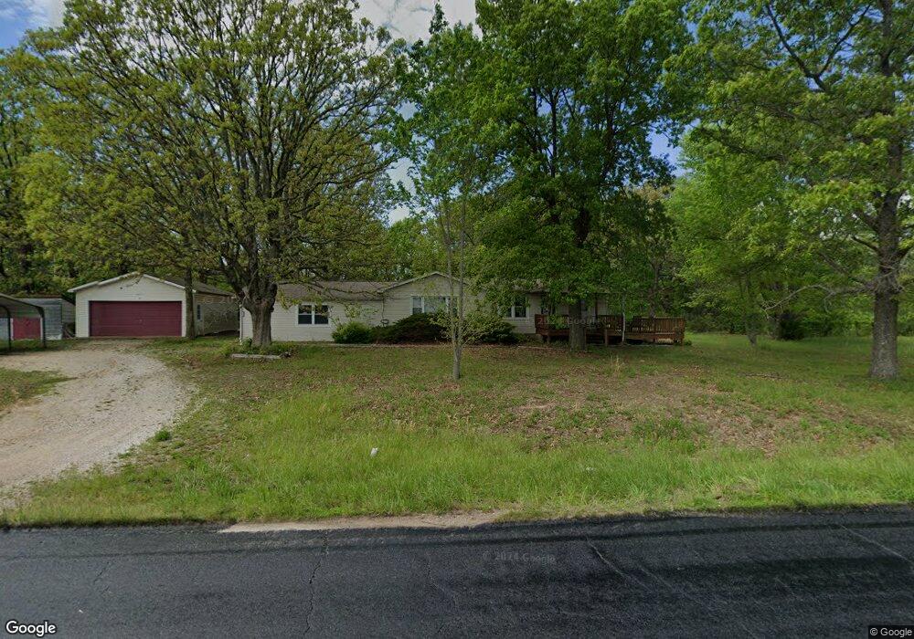
This home is located at 20715 Highway 133, Dixon, MO 65459 and is currently estimated at $234,602, approximately $124 per square foot. 20715 Highway 133 is a home located in Maries County with nearby schools including Dixon Elementary School, Dixon Middle School, and Dixon High School.
Ownership History
Date
Name
Owned For
Owner Type
Purchase Details
Closed on
Nov 15, 2019
Sold by
Bulone Dominic and Bulone Stephanie
Bought by
Robinson Keenan O Dell
Current Estimated Value
Home Financials for this Owner
Home Financials are based on the most recent Mortgage that was taken out on this home.
Original Mortgage
$91,919
Outstanding Balance
$80,771
Interest Rate
3.65%
Mortgage Type
New Conventional
Estimated Equity
$153,831
Create a Home Valuation Report for This Property
The Home Valuation Report is an in-depth analysis detailing your home's value as well as a comparison with similar homes in the area
Home Values in the Area
Average Home Value in this Area
Purchase History
| Date | Buyer | Sale Price | Title Company |
|---|---|---|---|
| Robinson Keenan O Dell | -- | None Available |
Source: Public Records
Mortgage History
| Date | Status | Borrower | Loan Amount |
|---|---|---|---|
| Open | Robinson Keenan O Dell | $91,919 |
Source: Public Records
Tax History Compared to Growth
Tax History
| Year | Tax Paid | Tax Assessment Tax Assessment Total Assessment is a certain percentage of the fair market value that is determined by local assessors to be the total taxable value of land and additions on the property. | Land | Improvement |
|---|---|---|---|---|
| 2025 | $573 | $14,610 | $0 | $0 |
| 2024 | $573 | $13,030 | $0 | $0 |
| 2023 | $571 | $13,030 | $0 | $0 |
| 2022 | $571 | $13,030 | $0 | $0 |
| 2021 | $564 | $13,030 | $0 | $0 |
| 2020 | $564 | $12,830 | $0 | $0 |
| 2019 | $564 | $12,830 | $0 | $0 |
| 2018 | $557 | $12,710 | $0 | $0 |
| 2017 | $559 | $12,710 | $0 | $0 |
| 2016 | $557 | $12,710 | $0 | $0 |
| 2015 | -- | $12,710 | $0 | $0 |
| 2011 | -- | $0 | $0 | $0 |
Source: Public Records
Map
Nearby Homes
- 0 Copperstone Unit MAR25022868
- 13306 Canuck Ln
- 602 W 6th St
- 200 W 6th St
- 207 Sunset Rd
- 100 E 6th St
- 501 W 5th St
- 105 S Oak St
- 615 W 4th St
- 103 S Ellen St
- 204 W 4th St
- 104 W 3rd St
- 16560 Highway 133
- 0 Highway 28 Unit MAR24074301
- 15005 Carthage Rd
- 10771 Crest Rd
- 11880 Cypress Rd
- 0 Maries 638 Rd Unit MIS25067458
- 12280 Chicago Rd
- 18626 28 W
- 20715 Highway 133
- 20661 Highway 133
- 21479 McR 626
- 20384 Highway 133
- 38533 Highway Hh
- 33825 Maries County Road 628
- 33827 Maries County Road 628
- 33826 Maries County Rd 628
- 33826 Maries County Road 628
- 38879 Maries Road 628
- 38672 Maries Road 628
- 38501 Highway Hh
- 20221 Highway 133
- 21301 Maries Road 626
- 38802 Maries Road 628
- 204 S Locust St
- 39031 Maries Road 628
- 21210 Highway 133
- 39024 Maries Road 628
- 38826 Maries Road 628