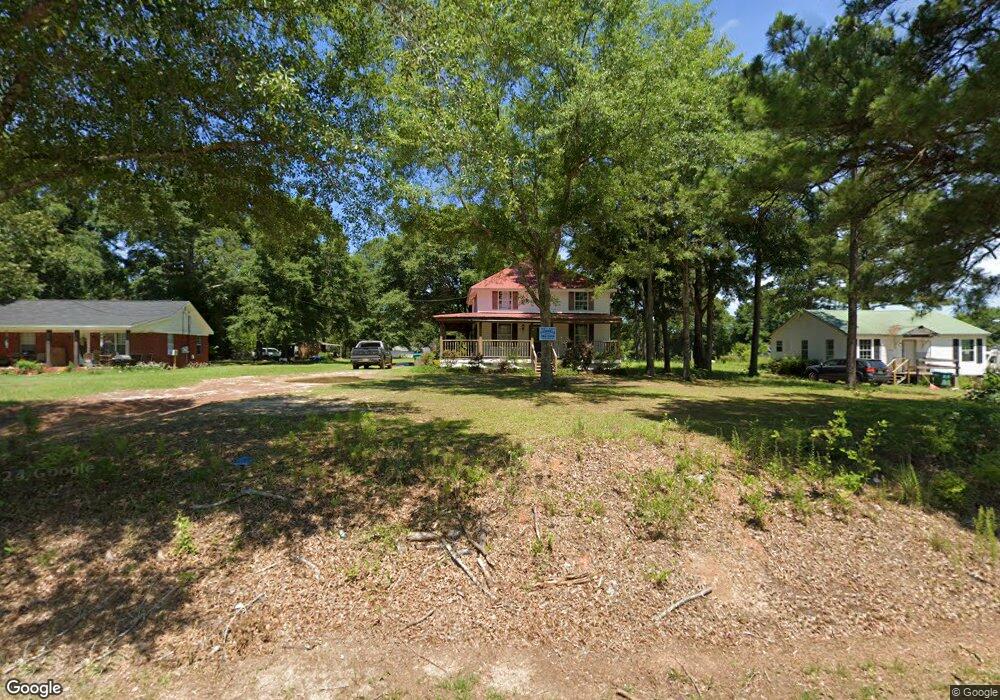
20715 Odom Rd Citronelle, AL 36522
Estimated Value: $190,290 - $242,000
3
Beds
3
Baths
2,000
Sq Ft
$103/Sq Ft
Est. Value
About This Home
This home is located at 20715 Odom Rd, Citronelle, AL 36522 and is currently estimated at $205,073, approximately $102 per square foot. 20715 Odom Rd is a home located in Mobile County with nearby schools including McDavid-Jones Elementary School, Lott Middle School, and Citronelle High School.
Ownership History
Date
Name
Owned For
Owner Type
Purchase Details
Closed on
Jun 28, 2024
Sold by
Reed Robert M and Reed Jerri K
Bought by
Reed Jerri K
Current Estimated Value
Purchase Details
Closed on
May 20, 2004
Sold by
Rivers Warren J
Bought by
Reed Robert Michael and Reed Jerri K
Home Financials for this Owner
Home Financials are based on the most recent Mortgage that was taken out on this home.
Original Mortgage
$48,465
Interest Rate
5.89%
Mortgage Type
Unknown
Create a Home Valuation Report for This Property
The Home Valuation Report is an in-depth analysis detailing your home's value as well as a comparison with similar homes in the area
Home Values in the Area
Average Home Value in this Area
Purchase History
| Date | Buyer | Sale Price | Title Company |
|---|---|---|---|
| Reed Jerri K | $50,150 | None Listed On Document | |
| Reed Robert Michael | $48,465 | -- |
Source: Public Records
Mortgage History
| Date | Status | Borrower | Loan Amount |
|---|---|---|---|
| Previous Owner | Reed Robert Michael | $48,465 |
Source: Public Records
Tax History Compared to Growth
Tax History
| Year | Tax Paid | Tax Assessment Tax Assessment Total Assessment is a certain percentage of the fair market value that is determined by local assessors to be the total taxable value of land and additions on the property. | Land | Improvement |
|---|---|---|---|---|
| 2024 | $1,093 | $10,030 | $1,000 | $9,030 |
| 2023 | $1,093 | $17,600 | $2,400 | $15,200 |
| 2022 | $959 | $17,600 | $2,400 | $15,200 |
| 2021 | $959 | $17,600 | $2,400 | $15,200 |
| 2020 | $984 | $18,060 | $2,400 | $15,660 |
| 2019 | $964 | $17,680 | $2,400 | $15,280 |
| 2018 | $964 | $17,680 | $0 | $0 |
| 2017 | $964 | $17,680 | $0 | $0 |
| 2016 | $990 | $18,160 | $0 | $0 |
| 2013 | $442 | $9,120 | $0 | $0 |
Source: Public Records
Map
Nearby Homes
- 20725 Odom Rd
- 8040 John Clay St
- 0 Road St Unit 7531981
- 20115 N 3rd St
- 20190 Lonnie Walker Rd
- 0 Reed Rd
- 19850 N 5th St
- 19747 N 4th St
- 18280 S 6th St
- 19665 N 4th St
- 8350 Grove Park
- 19630 Road St
- 19645 N 5th St
- 8005 Alabama St
- 8800 W Williams St
- 0 John Johnston Rd
- 19370 Magnolia Ave
- 7940 Lebaron Ave Unit 9
- 7940 Lebaron Ave E
- 19305 1st St
- 20705 Odom Rd
- 20700 Odom Rd
- 20745 Odom Rd
- 20665 Odom Rd
- 20690 Odom Rd
- 8215 Meadowood Dr
- 8195 Meadowood Dr
- 20740 Odom Rd
- 8185 Meadowood Dr
- 20755 Odom Rd
- 8175 Meadowood Dr
- 8075 Meadowood Dr Unit 20
- 8075 Meadowood Dr
- 8200 Meadowood Dr
- 8055 Meadowwood Dr Unit 20
- 8055 Meadowwood Dr Unit 21
- 0 Meadowwood Dr Unit 19 0182980
- 0 Meadowwood Dr Unit 10 0511399
- 0 Meadowwood Dr Unit 6 0243691
- 0 Meadowwood Dr Unit 19