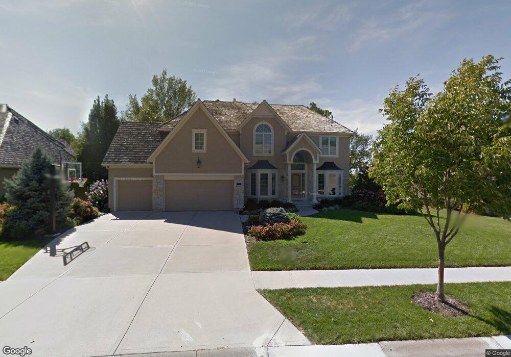
20729 W 92nd St Lenexa, KS 66220
Estimated Value: $681,000 - $793,000
4
Beds
6
Baths
3,654
Sq Ft
$203/Sq Ft
Est. Value
About This Home
This home is located at 20729 W 92nd St, Lenexa, KS 66220 and is currently estimated at $741,146, approximately $202 per square foot. 20729 W 92nd St is a home located in Johnson County with nearby schools including Manchester Park Elementary School, Prairie Trail Middle School, and Olathe Northwest High School.
Ownership History
Date
Name
Owned For
Owner Type
Purchase Details
Closed on
Sep 27, 2013
Sold by
Mckinzie Patrick K and Mckinzie Deborah A
Bought by
Mckinzie Patrick K and Mckinzie Deborah A
Current Estimated Value
Purchase Details
Closed on
Apr 13, 2005
Sold by
Apple Asset Llc
Bought by
Mckinzie Patrick and Mckinzie Deborah
Home Financials for this Owner
Home Financials are based on the most recent Mortgage that was taken out on this home.
Original Mortgage
$50,000
Outstanding Balance
$25,306
Interest Rate
5.89%
Mortgage Type
Credit Line Revolving
Estimated Equity
$715,840
Purchase Details
Closed on
Feb 25, 2005
Sold by
Taylor Kevin and Taylor Lynn
Bought by
Apple Asset L C
Home Financials for this Owner
Home Financials are based on the most recent Mortgage that was taken out on this home.
Original Mortgage
$50,000
Outstanding Balance
$25,306
Interest Rate
5.89%
Mortgage Type
Credit Line Revolving
Estimated Equity
$715,840
Purchase Details
Closed on
Oct 15, 2003
Sold by
Apple Asset Lc
Bought by
Taylor Kevin W and Taylor Lynn M
Home Financials for this Owner
Home Financials are based on the most recent Mortgage that was taken out on this home.
Original Mortgage
$391,200
Interest Rate
10.87%
Mortgage Type
Purchase Money Mortgage
Purchase Details
Closed on
Sep 22, 2003
Sold by
Taylor Kevin W and Taylor Lynn M
Bought by
Apple Asset Lc
Home Financials for this Owner
Home Financials are based on the most recent Mortgage that was taken out on this home.
Original Mortgage
$391,200
Interest Rate
10.87%
Mortgage Type
Purchase Money Mortgage
Purchase Details
Closed on
Jul 31, 2002
Sold by
Lambie Geer Homes Inc
Bought by
Taylor Kevin W and Taylor Lynn M
Home Financials for this Owner
Home Financials are based on the most recent Mortgage that was taken out on this home.
Original Mortgage
$415,300
Interest Rate
6.6%
Purchase Details
Closed on
Mar 12, 2001
Sold by
Royal Heights Inc
Bought by
Lambie Geer Homes Inc
Home Financials for this Owner
Home Financials are based on the most recent Mortgage that was taken out on this home.
Original Mortgage
$343,752
Interest Rate
7.1%
Create a Home Valuation Report for This Property
The Home Valuation Report is an in-depth analysis detailing your home's value as well as a comparison with similar homes in the area
Home Values in the Area
Average Home Value in this Area
Purchase History
| Date | Buyer | Sale Price | Title Company |
|---|---|---|---|
| Mckinzie Patrick K | -- | None Available | |
| Mckinzie Patrick | -- | None Available | |
| Apple Asset L C | -- | None Available | |
| Taylor Kevin W | -- | Heartland Title Company | |
| Apple Asset Lc | -- | Heartland Title Company | |
| Taylor Kevin W | -- | Security Land Title Company | |
| Lambie Geer Homes Inc | -- | Security Land Title Company |
Source: Public Records
Mortgage History
| Date | Status | Borrower | Loan Amount |
|---|---|---|---|
| Open | Mckinzie Patrick | $50,000 | |
| Open | Mckinzie Patrick | $325,000 | |
| Previous Owner | Apple Asset L C | $325,000 | |
| Previous Owner | Taylor Kevin W | $391,200 | |
| Previous Owner | Taylor Kevin W | $415,300 | |
| Previous Owner | Lambie Geer Homes Inc | $343,752 | |
| Closed | Taylor Kevin W | $97,800 |
Source: Public Records
Tax History
| Year | Tax Paid | Tax Assessment Tax Assessment Total Assessment is a certain percentage of the fair market value that is determined by local assessors to be the total taxable value of land and additions on the property. | Land | Improvement |
|---|---|---|---|---|
| 2025 | $9,557 | $82,881 | $12,748 | $70,133 |
| 2024 | $9,557 | $77,602 | $12,748 | $64,854 |
| 2023 | $9,453 | $75,543 | $11,087 | $64,456 |
| 2022 | $8,685 | $67,689 | $10,551 | $57,138 |
| 2021 | $8,097 | $60,133 | $10,551 | $49,582 |
| 2020 | $8,094 | $59,535 | $10,551 | $48,984 |
| 2019 | $7,256 | $52,934 | $8,787 | $44,147 |
| 2018 | $6,912 | $49,852 | $8,787 | $41,065 |
| 2017 | $7,138 | $50,393 | $7,991 | $42,402 |
| 2016 | $6,942 | $50,128 | $7,991 | $42,137 |
| 2015 | $6,860 | $49,554 | $7,993 | $41,561 |
| 2013 | -- | $45,299 | $7,993 | $37,306 |
Source: Public Records
Map
Nearby Homes
- 20810 W 94th St
- 20823 W 94th St
- 22476 W 90th Terrace
- 9002 Pine St
- 8920 Pine St
- 20308 W 92nd St
- 21359 W 93rd Ct
- 8000 Marion St
- 8005 Marion St
- 21396 W 93rd Ct
- 9259 Deer Run St
- 9450 Marion St
- 9410 Deer Run St
- 8823 Sunset Dr
- 22068 W 94th Terrace
- 22105 W 94th Terrace
- 22093 W 94th Terrace
- 22140 W 94th Terrace
- 22092 W 94th Terrace
- 22117 W 94th Terrace
- 20733 W 92nd St
- 9205 Redbud Ln
- 9209 Redbud Ln
- 20730 W 92nd St
- 20734 W 92nd St
- 20726 W 92nd St
- 20721 W 92nd St
- 9213 Redbud Ln
- 20722 W 92nd St
- 9140 Redbud Ln
- 9136 Redbud Ln
- 20806 W 92nd St
- 20809 W 92nd St
- 9133 Redbud Ln
- 9217 Redbud Ln
- 9208 Redbud Ln
- 9132 Redbud Ln
- 20718 W 92nd St
- 9221 Redbud Ln
- 9212 Redbud Ln
Your Personal Tour Guide
Ask me questions while you tour the home.