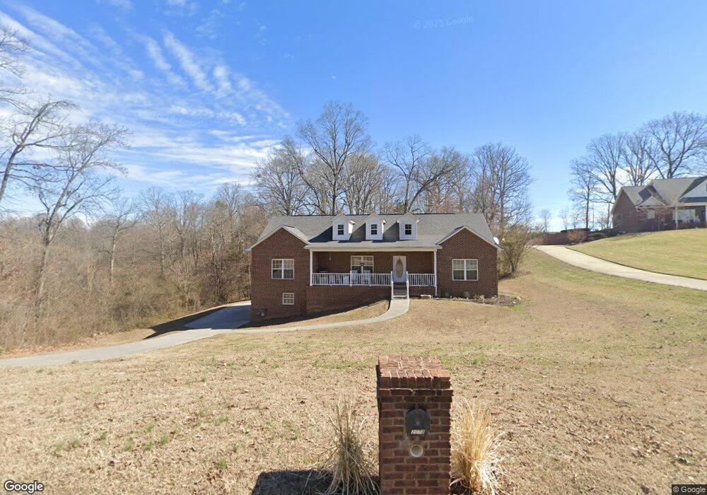
2073 Lindsey Ln Jefferson City, TN 37760
Estimated Value: $275,000 - $400,000
3
Beds
2
Baths
1,800
Sq Ft
$189/Sq Ft
Est. Value
About This Home
This home is located at 2073 Lindsey Ln, Jefferson City, TN 37760 and is currently estimated at $339,778, approximately $188 per square foot. 2073 Lindsey Ln is a home located in Jefferson County.
Ownership History
Date
Name
Owned For
Owner Type
Purchase Details
Closed on
May 14, 2015
Sold by
Keene Darrell
Bought by
Przybelski Mitchell J and Przybelski Angela L
Current Estimated Value
Home Financials for this Owner
Home Financials are based on the most recent Mortgage that was taken out on this home.
Original Mortgage
$167,100
Outstanding Balance
$129,240
Interest Rate
3.79%
Mortgage Type
New Conventional
Estimated Equity
$210,538
Purchase Details
Closed on
Dec 9, 2013
Sold by
Matlock Joseph L
Bought by
Keene Darrell
Purchase Details
Closed on
Oct 10, 2008
Sold by
Matlock Joe L
Bought by
Matlock Joseph L
Purchase Details
Closed on
Sep 15, 1999
Bought by
Clark Martin E and Clark Glenda F
Purchase Details
Closed on
Oct 22, 1988
Bought by
Nelson Carol S and Creech Ynthia S
Purchase Details
Closed on
Mar 4, 1988
Bought by
Creech Cynthia S
Create a Home Valuation Report for This Property
The Home Valuation Report is an in-depth analysis detailing your home's value as well as a comparison with similar homes in the area
Home Values in the Area
Average Home Value in this Area
Purchase History
| Date | Buyer | Sale Price | Title Company |
|---|---|---|---|
| Przybelski Mitchell J | $175,900 | -- | |
| Keene Darrell | $15,000 | -- | |
| Matlock Joseph L | -- | -- | |
| Clark Martin E | $446,000 | -- | |
| Nelson Carol S | $43,000 | -- | |
| Creech Cynthia S | -- | -- |
Source: Public Records
Mortgage History
| Date | Status | Borrower | Loan Amount |
|---|---|---|---|
| Open | Przybelski Mitchell J | $167,100 |
Source: Public Records
Tax History Compared to Growth
Tax History
| Year | Tax Paid | Tax Assessment Tax Assessment Total Assessment is a certain percentage of the fair market value that is determined by local assessors to be the total taxable value of land and additions on the property. | Land | Improvement |
|---|---|---|---|---|
| 2025 | $1,036 | $83,700 | $6,650 | $77,050 |
| 2023 | $1,036 | $45,025 | $0 | $0 |
| 2022 | $986 | $45,025 | $4,550 | $40,475 |
| 2021 | $986 | $45,025 | $4,550 | $40,475 |
| 2020 | $986 | $45,025 | $4,550 | $40,475 |
| 2019 | $986 | $45,025 | $4,550 | $40,475 |
| 2018 | $958 | $40,775 | $4,550 | $36,225 |
| 2017 | $958 | $40,775 | $4,550 | $36,225 |
| 2016 | $958 | $40,775 | $4,550 | $36,225 |
| 2015 | $958 | $40,775 | $4,550 | $36,225 |
| 2014 | $107 | $4,550 | $4,550 | $0 |
Source: Public Records
Map
Nearby Homes
- 1991 Kaylee Dr
- 1961 Kaylee Dr
- 1946 Kaylee Dr
- Lot 18 Kaylee Dr
- 1336 Tom Breeden Rd
- 144 Snowbird Ln Unit 13
- 144 Snowbird Ln
- Lot 0 Talbott-Kansas Rd
- 1601 Mossy Oak Dr
- 183 S Chucky Pike
- 2013 Phagan Rd
- 881 Greene Meadow Dr
- 877 Greene Meadow Dr
- 864 Greene Meadow Dr
- 1116 Janice Ln
- 1001 Dumplin Valley Rd E
- 2540 Lucille Ln
- 805 Greene Meadow Dr
- 1205 Cole
- 914 Flax Ln
- 2077 Lindsey Ln
- 2069 Lindsey Ln
- 2081 Lindsey Ln
- 1998 Kaylee Dr
- 1994 Kaylee Dr
- 2065 Lindsey Ln
- 2065 Lindsey Ln
- 2085 Lindsey Ln
- 2085 Lindsey Ln
- 2074 Lindsey Ln
- 1990 Kaylee Dr
- 2080 Lindsey Ln
- 1986 Kaylee Dr
- 1982 Kaylee Dr
- 1987 Kaylee Dr
- 1978 Kaylee Dr
- 2045 Lindsey Ln
- 2045 Lindsey Ln Unit 41
- 2038 Lindsey Ln
- 1974 Kaylee Dr