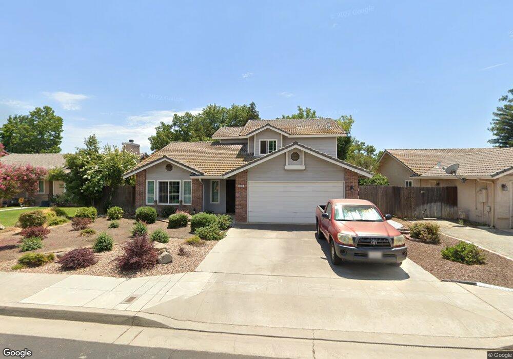
2074 Polson Ave Clovis, CA 93611
Estimated Value: $469,000 - $532,000
4
Beds
3
Baths
2,069
Sq Ft
$240/Sq Ft
Est. Value
About This Home
This home is located at 2074 Polson Ave, Clovis, CA 93611 and is currently estimated at $495,637, approximately $239 per square foot. 2074 Polson Ave is a home located in Fresno County with nearby schools including Cox Elementary School, Clark Intermediate School, and Clovis High School.
Ownership History
Date
Name
Owned For
Owner Type
Purchase Details
Closed on
Dec 8, 2005
Sold by
Yamanaka Gordon and Yamanaka Marilyn
Bought by
Yamanaka Gordon and Yamanaka Marilyn
Current Estimated Value
Home Financials for this Owner
Home Financials are based on the most recent Mortgage that was taken out on this home.
Original Mortgage
$170,000
Interest Rate
1%
Mortgage Type
Negative Amortization
Create a Home Valuation Report for This Property
The Home Valuation Report is an in-depth analysis detailing your home's value as well as a comparison with similar homes in the area
Home Values in the Area
Average Home Value in this Area
Purchase History
| Date | Buyer | Sale Price | Title Company |
|---|---|---|---|
| Yamanaka Gordon | -- | Chicago Title Company |
Source: Public Records
Mortgage History
| Date | Status | Borrower | Loan Amount |
|---|---|---|---|
| Closed | Yamanaka Gordon | $170,000 |
Source: Public Records
Tax History
| Year | Tax Paid | Tax Assessment Tax Assessment Total Assessment is a certain percentage of the fair market value that is determined by local assessors to be the total taxable value of land and additions on the property. | Land | Improvement |
|---|---|---|---|---|
| 2025 | $3,309 | $286,769 | $90,176 | $196,593 |
| 2023 | $3,180 | $275,635 | $86,675 | $188,960 |
| 2022 | $3,137 | $270,231 | $84,976 | $185,255 |
| 2021 | $3,047 | $264,933 | $83,310 | $181,623 |
| 2020 | $3,035 | $262,217 | $82,456 | $179,761 |
| 2019 | $2,974 | $257,077 | $80,840 | $176,237 |
| 2018 | $2,908 | $252,037 | $79,255 | $172,782 |
| 2017 | $2,857 | $247,096 | $77,701 | $169,395 |
| 2016 | $2,759 | $242,252 | $76,178 | $166,074 |
| 2015 | $2,715 | $238,614 | $75,034 | $163,580 |
| 2014 | $2,664 | $233,941 | $73,565 | $160,376 |
Source: Public Records
Map
Nearby Homes
- 2047 Menlo Ave
- 192 N Wathen Ave
- 13351 E Herndon Ave
- 1855 Vartikian Ave
- 2231 Escalon Ave
- 2535 Sierra Ave
- 2578 Warner Ave
- 344 McKelvy Ave
- 332 Magnolia Ave
- 1946 Calimyrna Ave
- 1650 Fir Ave
- 1921 Kelly Ln
- 712 N Bliss Ln
- 1956 Minarets Ln
- 2526 Gibson Ave
- 1490 Fir Ave
- 1498 Escalon Ave
- 24 Sunnyside Ave
- 2562 Mesa Ave
- 2034 Wrenwood Ave
- 2062 Polson Ave
- 2086 Polson Ave
- 2073 Los Altos Ave
- 2061 Los Altos Ave
- 2085 Los Altos Ave
- 2050 Polson Ave
- 2098 Polson Ave
- 2071 Polson Ave
- 2051 Los Altos Ave
- 2061 Polson Ave
- 2097 Los Altos Ave
- 2081 Polson Ave
- 2038 Polson Ave
- 2051 Polson Ave
- 2091 Polson Ave
- 2037 Los Altos Ave
- 2041 Polson Ave
- 2101 Polson Ave
- 2026 Polson Ave
- 2074 Los Altos Ave
