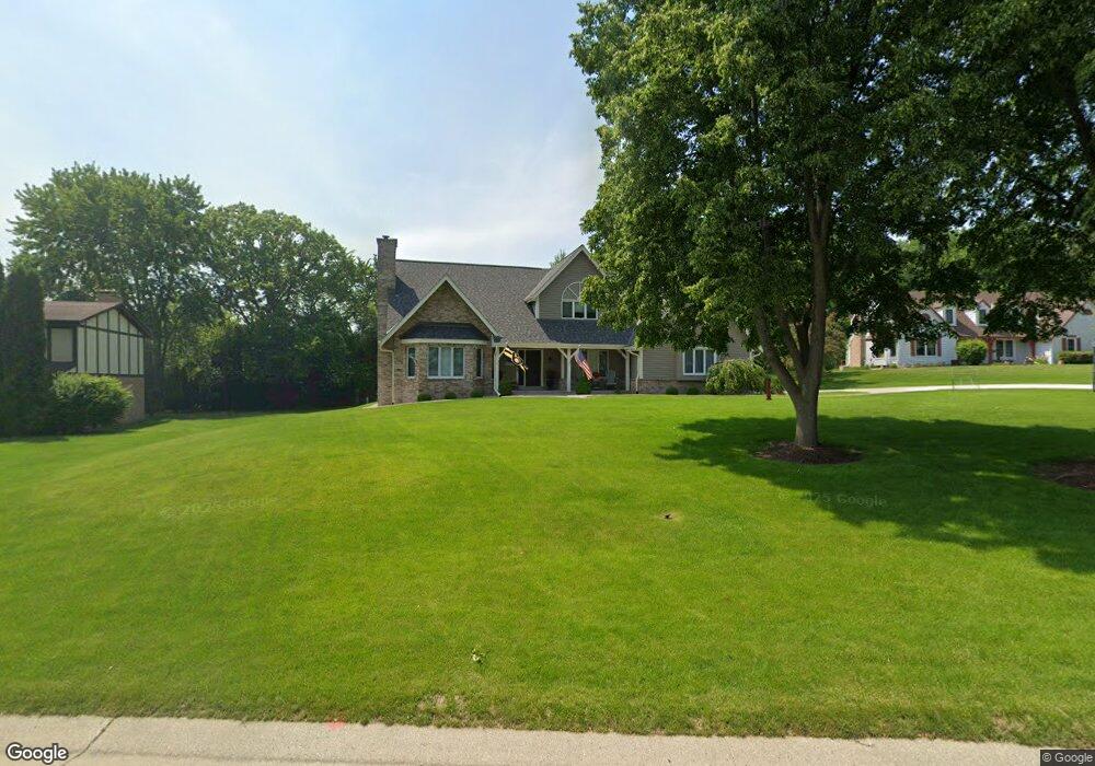
2075 Carrington Dr Brookfield, WI 53045
Estimated Value: $664,623 - $767,000
3
Beds
3
Baths
1,518
Sq Ft
$468/Sq Ft
Est. Value
About This Home
This home is located at 2075 Carrington Dr, Brookfield, WI 53045 and is currently estimated at $710,156, approximately $467 per square foot. 2075 Carrington Dr is a home located in Waukesha County with nearby schools including Brookfield Elementary School, Wisconsin Hills Middle School, and Brookfield Central High School.
Ownership History
Date
Name
Owned For
Owner Type
Purchase Details
Closed on
Dec 17, 2021
Sold by
Keith W Van Vreede Trust
Bought by
Vanvreede Keith W and Vanvreede Van Vreede
Current Estimated Value
Home Financials for this Owner
Home Financials are based on the most recent Mortgage that was taken out on this home.
Original Mortgage
$117,000
Outstanding Balance
$107,421
Interest Rate
2.98%
Mortgage Type
New Conventional
Estimated Equity
$602,735
Purchase Details
Closed on
Jan 31, 2018
Sold by
Vanvreede Keith W and Van Vreede Michelle L
Bought by
Vanvreede Keith W and Van Vreede Michelle L
Purchase Details
Closed on
Jun 4, 2014
Sold by
Gromowsld Michael and Gromowsld Diane L
Bought by
Vanyreede Keith W and Van Yreede Michelle L
Home Financials for this Owner
Home Financials are based on the most recent Mortgage that was taken out on this home.
Original Mortgage
$154,000
Interest Rate
4.34%
Mortgage Type
New Conventional
Create a Home Valuation Report for This Property
The Home Valuation Report is an in-depth analysis detailing your home's value as well as a comparison with similar homes in the area
Home Values in the Area
Average Home Value in this Area
Purchase History
| Date | Buyer | Sale Price | Title Company |
|---|---|---|---|
| Vanvreede Keith W | -- | None Available | |
| Vanvreede Keith W | -- | None Available | |
| Vanyreede Keith W | $424,000 | Knight Barry Title Inc |
Source: Public Records
Mortgage History
| Date | Status | Borrower | Loan Amount |
|---|---|---|---|
| Open | Vanvreede Keith W | $117,000 | |
| Previous Owner | Vanyreede Keith W | $154,000 |
Source: Public Records
Tax History
| Year | Tax Paid | Tax Assessment Tax Assessment Total Assessment is a certain percentage of the fair market value that is determined by local assessors to be the total taxable value of land and additions on the property. | Land | Improvement |
|---|---|---|---|---|
| 2024 | $6,964 | $617,900 | $135,000 | $482,900 |
| 2023 | $6,100 | $543,500 | $135,000 | $408,500 |
| 2022 | $6,332 | $440,900 | $130,000 | $310,900 |
| 2021 | $6,708 | $440,900 | $130,000 | $310,900 |
| 2020 | $6,987 | $440,900 | $130,000 | $310,900 |
| 2019 | $6,716 | $440,900 | $130,000 | $310,900 |
| 2018 | $6,714 | $428,500 | $140,000 | $288,500 |
| 2017 | $6,708 | $428,500 | $140,000 | $288,500 |
| 2016 | $6,805 | $428,500 | $140,000 | $288,500 |
| 2015 | $6,763 | $428,500 | $140,000 | $288,500 |
| 2014 | $7,016 | $428,500 | $140,000 | $288,500 |
| 2013 | $7,016 | $428,500 | $140,000 | $288,500 |
Source: Public Records
Map
Nearby Homes
- 1930 Cotton Tail Ln
- 2465 Lionel Ct
- 21965 W North Ave
- 2550 Harmony Cir
- 2570 Gaywood Ct
- 1365 Poplar Ridge Ct
- 1825 Derrin Ln
- 1775 Derrin Ln
- 20300 Yorktown Ct
- 20335 Yorktown Ct
- 19775 Trilby Ct
- 2000 Kathlynn Ct
- 1040 Lansdowne Ct Unit V6
- 1045 Lansdowne Ct Unit V39
- Lt118 Berwick Ct
- Lt120 Berwick Ct
- Lt116 Berwick Ct
- Lt114 Berwick Ct
- N28W22131 Indianwood Ct
- W224N2507 Ridgewood Ln
- 2055 Carrington Dr
- 2105 Brighton Ct
- 2130 Possum Ct
- 2160 Possum Ct
- 2100 Possum Ct
- 2050 Carrington Dr
- 2125 Brighton Ct
- 2090 Carrington Dr
- 2025 Carrington Dr
- 2135 Carrington Dr
- 2170 Possum Ct
- 21090 Carrington Dr
- 2060 Possum Ct
- 2100 Carrington Dr
- 2065 Hensley Ct
- 21150 Stratford Ct
- 21210 W North Ave
- 2085 Possum Ct
- 2155 Carrington Dr
- 2115 Possum Ct
Your Personal Tour Guide
Ask me questions while you tour the home.