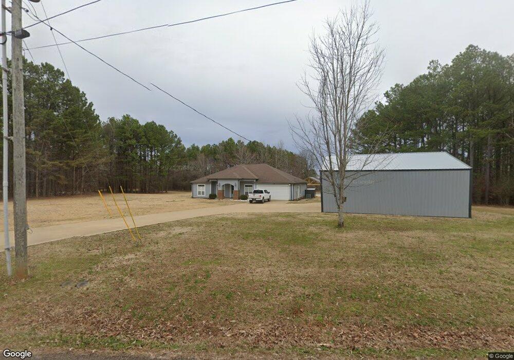
2075 Carroll Rd Michie, TN 38357
Estimated Value: $295,000 - $346,000
--
Bed
3
Baths
2,103
Sq Ft
$151/Sq Ft
Est. Value
About This Home
This home is located at 2075 Carroll Rd, Michie, TN 38357 and is currently estimated at $318,192, approximately $151 per square foot. 2075 Carroll Rd is a home located in Hardin County with nearby schools including Hardin County High School.
Ownership History
Date
Name
Owned For
Owner Type
Purchase Details
Closed on
Sep 23, 2019
Sold by
Picard Michael
Bought by
Atkinson Justin L and Atkinson Heather A
Current Estimated Value
Home Financials for this Owner
Home Financials are based on the most recent Mortgage that was taken out on this home.
Original Mortgage
$175,950
Outstanding Balance
$135,375
Interest Rate
3.5%
Mortgage Type
New Conventional
Estimated Equity
$182,817
Purchase Details
Closed on
Aug 2, 2007
Sold by
Carroll Charles P
Bought by
Michael Picard
Purchase Details
Closed on
Aug 12, 2002
Bought by
Carroll Owen and Carroll Charles P
Purchase Details
Closed on
Mar 8, 1991
Bought by
Roberts Frances C
Purchase Details
Closed on
Nov 27, 1978
Bought by
Roberts Frances C
Purchase Details
Closed on
May 4, 1976
Create a Home Valuation Report for This Property
The Home Valuation Report is an in-depth analysis detailing your home's value as well as a comparison with similar homes in the area
Home Values in the Area
Average Home Value in this Area
Purchase History
| Date | Buyer | Sale Price | Title Company |
|---|---|---|---|
| Atkinson Justin L | $207,000 | -- | |
| Michael Picard | $7,500 | -- | |
| Carroll Owen | $75,000 | -- | |
| Roberts Frances C | $6,600 | -- | |
| Roberts Frances C | -- | -- | |
| -- | -- | -- |
Source: Public Records
Mortgage History
| Date | Status | Borrower | Loan Amount |
|---|---|---|---|
| Open | Atkinson Justin L | $175,950 |
Source: Public Records
Tax History Compared to Growth
Tax History
| Year | Tax Paid | Tax Assessment Tax Assessment Total Assessment is a certain percentage of the fair market value that is determined by local assessors to be the total taxable value of land and additions on the property. | Land | Improvement |
|---|---|---|---|---|
| 2024 | $1,222 | $69,850 | $3,800 | $66,050 |
| 2023 | $1,222 | $69,850 | $3,800 | $66,050 |
| 2022 | $895 | $43,450 | $3,125 | $40,325 |
| 2021 | $895 | $43,450 | $3,125 | $40,325 |
| 2020 | $895 | $43,450 | $3,125 | $40,325 |
| 2019 | $895 | $43,450 | $3,125 | $40,325 |
| 2018 | $865 | $43,450 | $3,125 | $40,325 |
| 2017 | $869 | $41,800 | $3,125 | $38,675 |
| 2016 | $869 | $41,800 | $3,125 | $38,675 |
| 2015 | $761 | $41,800 | $3,125 | $38,675 |
| 2014 | $761 | $41,800 | $3,125 | $38,675 |
Source: Public Records
Map
Nearby Homes
- LOT 1 Carroll Rd
- LOT 6 Carroll Rd
- LOT 7 Carroll Rd
- 1010 Kendrick Rd
- 5205 Hamburg Rd
- 330 Lick Creek Rd
- 504 Rushing Rd
- 0 Rushing Rd
- 305 Damron Loop
- 02 Mount Olive Rd
- 01 Mount Olive Rd
- 0 Track 2 Kendrick Gin Rd Unit 10204662
- 1 Track 1 Kendrick Rd
- 109 Grand Dr
- 359 Cemetery Rd
- 1017 Post Office Rd
- 3400 Tennessee 57
- 996 Matrose Carrolls Rd
- 705 Post Office Rd
- 501 Post Office Rd
- 1955 Carroll Rd
- 1986 Carroll Rd
- 1990 Carroll Rd
- 1960 Carroll Rd
- 1930 Carroll Rd Unit house and 2 lots
- 1930 Carroll Rd
- 1996 Carroll Rd
- 1900 Carroll Rd
- 1850 Carroll Rd
- 2255 Carroll Rd
- 2320 Carroll Rd
- 2325 Carroll Rd
- 1790 Carroll Rd
- 2259 Carroll Rd
- 1700 Carroll Rd
- 1695 Carroll Rd
- 1655 Carroll Rd
- 1680 Carroll Rd
- 1450 Carroll Rd
- 900 Kendrick Rd