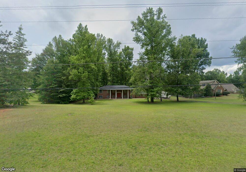
2075 Graham Rd Macon, GA 31211
Estimated Value: $162,000 - $284,626
4
Beds
3
Baths
3,420
Sq Ft
$64/Sq Ft
Est. Value
About This Home
This home is located at 2075 Graham Rd, Macon, GA 31211 and is currently estimated at $218,907, approximately $64 per square foot. 2075 Graham Rd is a home located in Jones County with nearby schools including Dames Ferry Elementary School, Clifton Ridge Middle School, and Jones County High School.
Ownership History
Date
Name
Owned For
Owner Type
Purchase Details
Closed on
Jan 13, 2021
Sold by
Mizell Corbitt
Bought by
Baron James J
Current Estimated Value
Purchase Details
Closed on
Feb 7, 2017
Sold by
Lorettas Wrath
Bought by
Davis Carlton Adonis
Purchase Details
Closed on
Feb 26, 2016
Sold by
Macon Moves Llc
Bought by
Lorettas Wrath Llc
Purchase Details
Closed on
Oct 18, 2013
Sold by
Thompson Leola P
Bought by
Macon Moves Llc
Purchase Details
Closed on
Oct 16, 2013
Sold by
Thompson William D
Bought by
Macon Moves Llc
Create a Home Valuation Report for This Property
The Home Valuation Report is an in-depth analysis detailing your home's value as well as a comparison with similar homes in the area
Home Values in the Area
Average Home Value in this Area
Purchase History
| Date | Buyer | Sale Price | Title Company |
|---|---|---|---|
| Baron James J | -- | -- | |
| Mizell Corbitt | $40,000 | -- | |
| Davis Carlton Adonis | -- | -- | |
| Lorettas Wrath Llc | -- | -- | |
| Macon Moves Llc | -- | -- | |
| Macon Moves Llc | -- | -- | |
| Macon Moves Llc | -- | -- | |
| Macon Moves Llc | $35,000 | -- |
Source: Public Records
Tax History Compared to Growth
Tax History
| Year | Tax Paid | Tax Assessment Tax Assessment Total Assessment is a certain percentage of the fair market value that is determined by local assessors to be the total taxable value of land and additions on the property. | Land | Improvement |
|---|---|---|---|---|
| 2023 | $1,406 | $39,150 | $12,180 | $26,970 |
| 2022 | $575 | $38,663 | $11,693 | $26,970 |
| 2021 | $1,390 | $38,663 | $11,692 | $26,971 |
| 2020 | $1,391 | $38,663 | $11,693 | $26,970 |
| 2019 | $1,426 | $39,637 | $11,693 | $27,944 |
| 2018 | $1,426 | $39,637 | $11,693 | $27,944 |
| 2017 | $433 | $12,027 | $11,693 | $334 |
| 2016 | $433 | $12,027 | $11,693 | $334 |
| 2015 | $1,344 | $39,501 | $11,693 | $27,808 |
| 2014 | $439 | $39,501 | $11,693 | $27,808 |
Source: Public Records
Map
Nearby Homes
- 2331 Gray Hwy
- 3086 Gray Hwy
- 2771 Old Gray Hwy
- 194 Welker Cir
- 0 Silver Lake Ct Unit 10558444
- V L Silver Lake Ct Unit LotWP001
- 1965 Deerwood Place
- 1957 Deerwood Place
- 1949 Deerwood Place
- 1898 Wood Valley Rd
- Birch Plan at Clifton Ridge
- Lane Plan at Clifton Ridge
- Benton Plan at Clifton Ridge
- Duke Plan at Clifton Ridge
- Brooke Plan at Clifton Ridge
- Delilah Plan at Clifton Ridge
- 1916 Flintwood Dr
- 699 Jasmine Dr
- 2071 Graham Rd
- 2083 Graham Rd
- 2061 Graham Rd
- 2087 Graham Rd
- 2076 Graham Rd
- 2070 Graham Rd
- 2058 Graham Rd
- 2084 Graham Rd
- 2053 Graham Rd
- 2090 Graham Rd
- 2052 Graham Rd
- 2047 Graham Rd
- 129 Crestwood Dr
- 2098 Graham Rd
- 2046 Graham Rd
- 114 Crestwood Dr
- 399 E Colonial Dr
- 2043 Graham Rd
- 118 Crestwood Dr
- 2040 Graham Rd