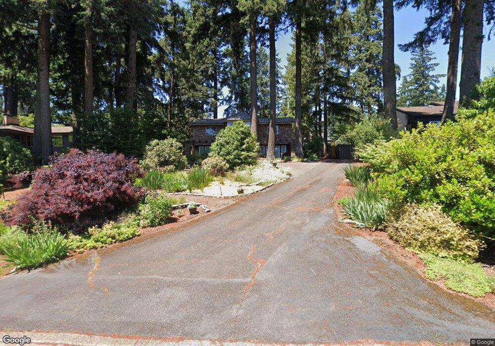
2075 Marylwood Ct West Linn, OR 97068
Marylhurst NeighborhoodEstimated Value: $822,000 - $915,973
4
Beds
3
Baths
2,318
Sq Ft
$372/Sq Ft
Est. Value
About This Home
This home is located at 2075 Marylwood Ct, West Linn, OR 97068 and is currently estimated at $861,243, approximately $371 per square foot. 2075 Marylwood Ct is a home located in Clackamas County with nearby schools including Stafford Primary School, West Linn High School, and Harmony Academy.
Ownership History
Date
Name
Owned For
Owner Type
Purchase Details
Closed on
Jun 6, 2005
Sold by
Oien Michael and Oien Margaret Mary
Bought by
Harju David L and Harju Diane C
Current Estimated Value
Home Financials for this Owner
Home Financials are based on the most recent Mortgage that was taken out on this home.
Original Mortgage
$292,000
Outstanding Balance
$151,075
Interest Rate
5.72%
Mortgage Type
Fannie Mae Freddie Mac
Estimated Equity
$710,168
Create a Home Valuation Report for This Property
The Home Valuation Report is an in-depth analysis detailing your home's value as well as a comparison with similar homes in the area
Home Values in the Area
Average Home Value in this Area
Purchase History
| Date | Buyer | Sale Price | Title Company |
|---|---|---|---|
| Harju David L | $365,000 | Chicago Title Insurance Comp |
Source: Public Records
Mortgage History
| Date | Status | Borrower | Loan Amount |
|---|---|---|---|
| Open | Harju David L | $292,000 |
Source: Public Records
Tax History Compared to Growth
Tax History
| Year | Tax Paid | Tax Assessment Tax Assessment Total Assessment is a certain percentage of the fair market value that is determined by local assessors to be the total taxable value of land and additions on the property. | Land | Improvement |
|---|---|---|---|---|
| 2025 | $10,099 | $524,059 | -- | -- |
| 2024 | $9,721 | $508,796 | -- | -- |
| 2023 | $9,721 | $493,977 | $0 | $0 |
| 2022 | $9,176 | $479,590 | $0 | $0 |
| 2021 | $8,579 | $465,622 | $0 | $0 |
| 2020 | $8,494 | $452,061 | $0 | $0 |
| 2019 | $8,145 | $438,895 | $0 | $0 |
| 2018 | $7,750 | $426,112 | $0 | $0 |
| 2017 | $7,541 | $413,701 | $0 | $0 |
| 2016 | $7,236 | $401,651 | $0 | $0 |
| 2015 | $6,929 | $389,952 | $0 | $0 |
| 2014 | $6,554 | $378,594 | $0 | $0 |
Source: Public Records
Map
Nearby Homes
- 2167 Marylwood Ct
- 1397 Skye Pkwy
- 2041 Marylhurst Dr
- 1611 Arran Ct
- 1384 Celtic Ct
- 1354 Skye Pkwy
- 2455 College Hill Place
- 17833 Marylcreek Dr
- 1321 Troon Dr
- 1777 Skyland Dr
- 19661 Sun Cir
- 2636 Maria Ct
- 18194 Shady Hollow Way
- 17634 Brookhurst Dr
- 17623 Brookhurst Dr
- 17514 Brookhurst Dr
- 19640 Kapteyns St
- 18711 Willamette Dr
- 3340 Arbor Dr
- 2005 Carriage Way
- 2100 Mountain View Ct
- 0 Mountain View Ct
- 2050 Marylwood Ct
- 1653 Skye Pkwy
- 2102 Marylwood Ct
- 2043 Mountain View Ct
- 2051 Mountain View Ct
- 2137 Marylwood Ct
- 2083 Mountain View Ct
- 2001 Mountain View Ct
- 2122 Marylwood Ct
- 1617 Marylhurst Dr
- 2013 Mountain View Ct
- 1675 Marylhurst Dr
- 1597 Skye (Relisted)
- 2039 Mountain View Ct
- 2039 Mountain View Ct Unit 7
- 2067 Mountain View Ct Unit 6
- 1597 Skye Pkwy
- 2027 Mountain View Ct Unit 8