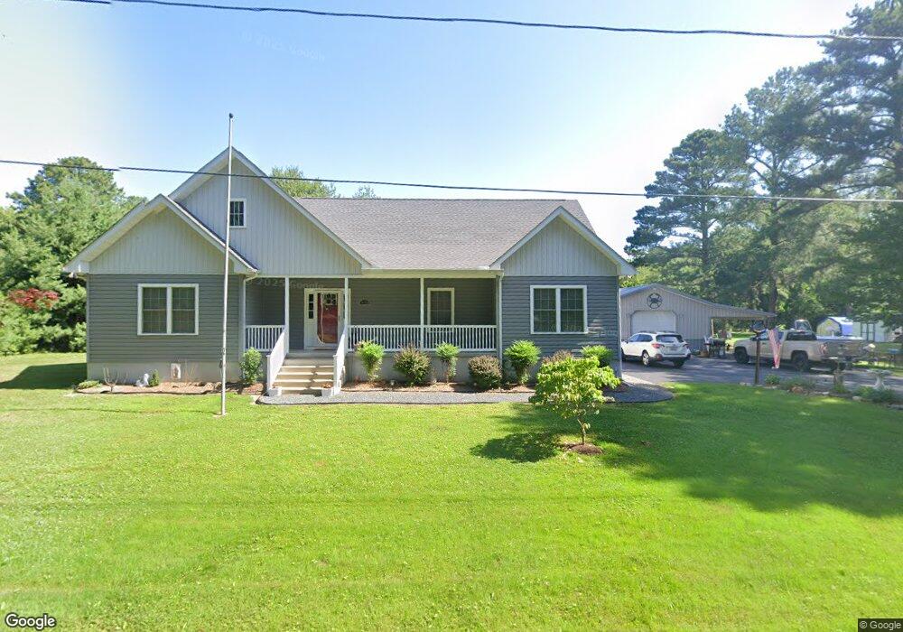
20750 Mercer Ave Rock Hall, MD 21661
Estimated Value: $425,000 - $528,000
--
Bed
--
Bath
1,858
Sq Ft
$251/Sq Ft
Est. Value
About This Home
This home is located at 20750 Mercer Ave, Rock Hall, MD 21661 and is currently estimated at $466,507, approximately $251 per square foot. 20750 Mercer Ave is a home located in Kent County with nearby schools including Center for Innovation, Kent County Middle School, and Kent County High School.
Ownership History
Date
Name
Owned For
Owner Type
Purchase Details
Closed on
Oct 31, 2016
Sold by
Grauer Mark Joseph
Bought by
Grauer Mark Joseph and Grauer Renee L
Current Estimated Value
Home Financials for this Owner
Home Financials are based on the most recent Mortgage that was taken out on this home.
Original Mortgage
$216,000
Outstanding Balance
$173,738
Interest Rate
3.48%
Mortgage Type
Purchase Money Mortgage
Estimated Equity
$292,769
Purchase Details
Closed on
Aug 10, 2004
Sold by
Grauer John J and Grauer Arlene M
Bought by
Joseph Grauer John J and Joseph Mark
Create a Home Valuation Report for This Property
The Home Valuation Report is an in-depth analysis detailing your home's value as well as a comparison with similar homes in the area
Home Values in the Area
Average Home Value in this Area
Purchase History
| Date | Buyer | Sale Price | Title Company |
|---|---|---|---|
| Grauer Mark Joseph | -- | None Available | |
| Joseph Grauer John J | -- | -- |
Source: Public Records
Mortgage History
| Date | Status | Borrower | Loan Amount |
|---|---|---|---|
| Open | Grauer Mark Joseph | $216,000 |
Source: Public Records
Tax History Compared to Growth
Tax History
| Year | Tax Paid | Tax Assessment Tax Assessment Total Assessment is a certain percentage of the fair market value that is determined by local assessors to be the total taxable value of land and additions on the property. | Land | Improvement |
|---|---|---|---|---|
| 2025 | $5,128 | $338,733 | $0 | $0 |
| 2024 | $4,761 | $312,400 | $85,300 | $227,100 |
| 2023 | $4,551 | $298,600 | $0 | $0 |
| 2022 | $4,283 | $284,800 | $0 | $0 |
| 2021 | $3,974 | $271,000 | $85,300 | $185,700 |
| 2020 | $3,974 | $269,600 | $0 | $0 |
| 2019 | $3,953 | $268,200 | $0 | $0 |
| 2018 | $3,879 | $266,800 | $84,300 | $182,500 |
| 2017 | $3,879 | $266,800 | $0 | $0 |
| 2016 | -- | $145,900 | $0 | $0 |
| 2015 | $2,449 | $152,500 | $0 | $0 |
| 2014 | $2,449 | $152,500 | $0 | $0 |
Source: Public Records
Map
Nearby Homes
- 5750 Walnut St
- 5697 Walnut St
- 5980 Lawton Ave
- 6119 New St Unit 2
- #2 Lawton Ave
- 5791 S Hawthorne Ave
- 21090 W Sharp St Unit 133
- 21090 W Sharp St Unit 112
- 21119 Striper Run
- 21131 Striper Run
- 21133 Striper Run
- 21163 Chesapeake Ave
- 21139 Striper Run
- 21141 Striper Run
- 5829 N Main St
- 21305 Haven Rd
- 5686 S Main St
- 5898 Williams St
- 21332 E Sharp St
- 21336 Haven Rd
- 20742 Mercer Ave
- 20753 Mercer Ave
- 5825 Locust St
- 20764 Mercer Ave
- 0 Mercer Ave
- 5835 Locust St
- 20772 Mercer Ave
- 20747 Mercer Ave
- 5839 Locust St
- 20780 Mercer Ave
- 20726 Mercer Ave
- 5830 Locust St
- 20775 Mercer Ave
- 20759 Mercer Ave
- 20723 Mercer Ave
- 20725 Wilkins Ave
- 20714 Mercer Ave
- 20718 Bayside Ave
- 20783 Mercer Ave
- 20722 Bayside Ave