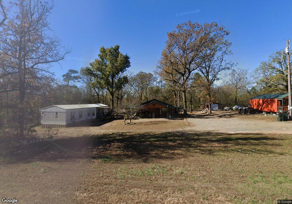
20757 N Us Highway 259 Broken Bow, OK 74728
Estimated Value: $85,274 - $439,000
2
Beds
1
Bath
1,008
Sq Ft
$319/Sq Ft
Est. Value
About This Home
This home is located at 20757 N Us Highway 259, Broken Bow, OK 74728 and is currently estimated at $321,819, approximately $319 per square foot. 20757 N Us Highway 259 is a home located in McCurtain County with nearby schools including Battiest Elementary School and Battiest High School.
Ownership History
Date
Name
Owned For
Owner Type
Purchase Details
Closed on
Apr 24, 2017
Sold by
Anderson Stevie
Bought by
Barrick Tacha
Current Estimated Value
Purchase Details
Closed on
Dec 7, 2016
Sold by
Anderson Steve
Bought by
Barrick Tacha
Purchase Details
Closed on
Mar 9, 2007
Sold by
Barrick Fred O
Bought by
Barrick Jeramie
Purchase Details
Closed on
Apr 14, 2004
Sold by
Troy Sheriff and Troy Billy
Bought by
Barrick Fred and Barrick Lora
Purchase Details
Closed on
Feb 19, 2002
Sold by
Billy Debra A
Bought by
Billy Troy E
Create a Home Valuation Report for This Property
The Home Valuation Report is an in-depth analysis detailing your home's value as well as a comparison with similar homes in the area
Home Values in the Area
Average Home Value in this Area
Purchase History
| Date | Buyer | Sale Price | Title Company |
|---|---|---|---|
| Barrick Tacha | -- | None Available | |
| Barrick Tacha | $4,000 | None Available | |
| Barrick Jeramie | -- | None Available | |
| Barrick Fred | -- | -- | |
| Billy Troy E | -- | -- |
Source: Public Records
Tax History Compared to Growth
Tax History
| Year | Tax Paid | Tax Assessment Tax Assessment Total Assessment is a certain percentage of the fair market value that is determined by local assessors to be the total taxable value of land and additions on the property. | Land | Improvement |
|---|---|---|---|---|
| 2024 | $16 | $1,202 | $110 | $1,092 |
| 2023 | $13 | $1,167 | $110 | $1,057 |
| 2022 | $14 | $1,167 | $110 | $1,057 |
| 2021 | $14 | $1,167 | $110 | $1,057 |
| 2020 | $14 | $1,167 | $110 | $1,057 |
| 2019 | $15 | $1,167 | $110 | $1,057 |
| 2018 | $15 | $1,167 | $110 | $1,057 |
| 2017 | $13 | $1,160 | $110 | $1,050 |
| 2016 | $10 | $1,126 | $110 | $1,016 |
| 2015 | $13 | $1,159 | $110 | $1,049 |
| 2014 | $12 | $1,159 | $110 | $1,049 |
Source: Public Records
Map
Nearby Homes
- 0 Tbd Fly Rod Rd
- 27 Shade Tree Trail
- 176 Shade Tree Trail
- 142 Shade Tree Trail
- 25 Mission Fig Trail
- 199 Aged Acacia Trail
- 204 Aged Acacia Trail
- 51 Aged Acacia Trail
- 66 Aged Acacia Trail
- 160 Red Fern Trail
- 53 Weathered Timber Trail
- 118 Gopher Wood Trail
- 25 Cabins North Carter Creek
- 252 Bass Cat Trail
- 1231 Catfish Bay Rd
- 1411 Catfish Bay Rd
- 160 Bombardier Ln
- 154 Double Oak Dr
- 153 Double Oak Dr
- 1214 Bass Cat Trail
- 20 Almond Ln
- 2805 Catfish Bay Rd
- 2805 Catfish Bay Rd
- 0 N 259 Hwy Unit 1020674
- 259 N Hwy
- 20556 N Us Highway 259
- 0 Lot 8 Unit 1018043
- 3000 Catfish Bay Rd
- 393 Spanish Oak Ln
- 16 N the Cabins of North Carter Creek
- 21121 N Us Highway 259
- 204 Shade Tree Trail
- 92 Bachelor Blvd Trail
- 102 Shade Tree Trail
- 95 Shade Tree Trail
- 9 Cabins of North Carter Creek
- 93 Bachelor Blvd Trail
- 20 Mission Fig Trail
- 94 Bachelor Blvd Trail
- 95 Bachelor Blvd Trail