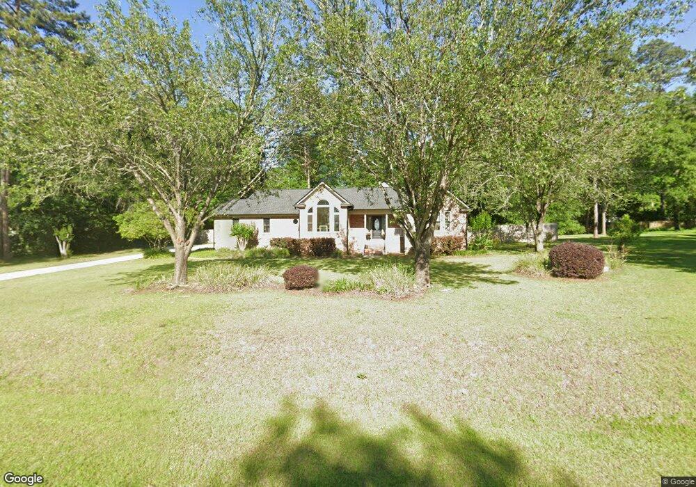
2076 Angus St Tallahassee, FL 32317
Buck Lake NeighborhoodEstimated Value: $397,000 - $508,000
3
Beds
2
Baths
1,978
Sq Ft
$229/Sq Ft
Est. Value
About This Home
This home is located at 2076 Angus St, Tallahassee, FL 32317 and is currently estimated at $452,868, approximately $228 per square foot. 2076 Angus St is a home located in Leon County with nearby schools including Buck Lake Elementary School, Swift Creek Middle School, and Lincoln High School.
Ownership History
Date
Name
Owned For
Owner Type
Purchase Details
Closed on
Jul 30, 2020
Sold by
Hirst Christopher T and Hirst Bonnie K
Bought by
Hirst Christopher T and Hirst Bonnie K
Current Estimated Value
Purchase Details
Closed on
Dec 15, 2014
Sold by
Mattuski Charles E and Mattuski Lia R
Bought by
Hirst Christopher
Home Financials for this Owner
Home Financials are based on the most recent Mortgage that was taken out on this home.
Original Mortgage
$257,400
Outstanding Balance
$198,396
Interest Rate
4.09%
Mortgage Type
New Conventional
Estimated Equity
$254,472
Purchase Details
Closed on
Aug 15, 2000
Sold by
Lilly David L and Lilly Lidia
Bought by
Mattuski Charles E and Mattuski Lia R
Home Financials for this Owner
Home Financials are based on the most recent Mortgage that was taken out on this home.
Original Mortgage
$125,000
Interest Rate
8.17%
Create a Home Valuation Report for This Property
The Home Valuation Report is an in-depth analysis detailing your home's value as well as a comparison with similar homes in the area
Home Values in the Area
Average Home Value in this Area
Purchase History
| Date | Buyer | Sale Price | Title Company |
|---|---|---|---|
| Hirst Christopher T | -- | None Available | |
| Hirst Christopher | $286,000 | Attorney | |
| Mattuski Charles E | -- | -- |
Source: Public Records
Mortgage History
| Date | Status | Borrower | Loan Amount |
|---|---|---|---|
| Open | Hirst Christopher | $257,400 | |
| Previous Owner | Mattuski Charles E | $125,000 |
Source: Public Records
Tax History Compared to Growth
Tax History
| Year | Tax Paid | Tax Assessment Tax Assessment Total Assessment is a certain percentage of the fair market value that is determined by local assessors to be the total taxable value of land and additions on the property. | Land | Improvement |
|---|---|---|---|---|
| 2024 | $3,335 | $257,560 | -- | -- |
| 2023 | $3,242 | $250,058 | $0 | $0 |
| 2022 | $3,092 | $242,775 | $0 | $0 |
| 2021 | $3,075 | $235,704 | $0 | $0 |
| 2020 | $2,976 | $232,450 | $0 | $0 |
| 2019 | $2,932 | $226,706 | $0 | $0 |
| 2018 | $2,904 | $222,479 | $0 | $0 |
| 2017 | $2,879 | $217,903 | $0 | $0 |
| 2016 | $2,862 | $213,421 | $0 | $0 |
| 2015 | $2,785 | $211,937 | $0 | $0 |
| 2014 | $2,785 | $202,451 | $0 | $0 |
Source: Public Records
Map
Nearby Homes
- 469 Olivia Rose Ave
- 1181 Lovers Ln S
- 1107 Lovers Ln
- 249 Camellia Oaks Ave
- 4318 Terebinth Trail
- 5152 Royal Fern Cir
- 1285 Sumerlin Dr
- 5003 Vernon Rd
- 5264 Old Retreat Way
- xxx Southern Oaks Dr
- 5303 Buck Lake Rd
- 4905 Vernon Rd
- 0 Maylor Ln
- 4297 Maylor Ln
- 4110 E Bugle View
- 487 Grand Oaks Rd
- 5664 Native Oak Dr
- 5680 Native Oak Dr
- 5640 Jacksons Gap Rd
- 5631 Fletcher Oaks Dr
- 2068 Angus St
- 2084 Angus St
- 1960 Charlais St
- 2077 Angus St
- 1956 Charlais St
- 1964 Charlais St
- 2067 Angus St
- 2060 Angus St
- 1952 Charlais St
- 2059 Angus St
- 2052 Angus St
- 1961 Charlais St
- 1972 Charlais St
- 1948 Charlais St
- 1957 Charlais St Unit 1
- 1957 Charlais St
- 1965 Charlais St
- 2051 Angus St
- 1953 Charlais St
- 1969 Charlais St