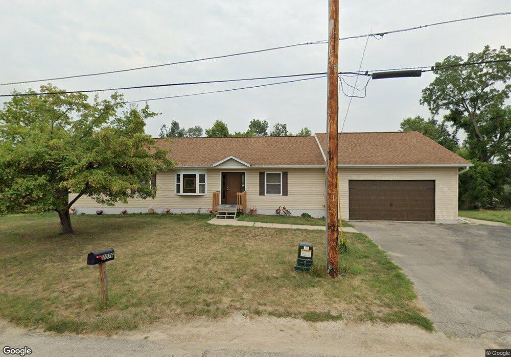
2076 High Dr SE Cedar Rapids, IA 52403
Cedar Valley NeighborhoodEstimated Value: $239,000 - $300,000
3
Beds
4
Baths
1,770
Sq Ft
$152/Sq Ft
Est. Value
About This Home
This home is located at 2076 High Dr SE, Cedar Rapids, IA 52403 and is currently estimated at $269,584, approximately $152 per square foot. 2076 High Dr SE is a home located in Linn County with nearby schools including Erskine Elementary School, McKinley STEAM Academy, and George Washington High School.
Ownership History
Date
Name
Owned For
Owner Type
Purchase Details
Closed on
Aug 3, 2020
Sold by
Lange Terrence R and Lange Pamela J
Bought by
Harger Yvonne
Current Estimated Value
Purchase Details
Closed on
May 18, 2004
Sold by
Seaton Tracy A
Bought by
Brecht James P and Brecht Pamela R
Home Financials for this Owner
Home Financials are based on the most recent Mortgage that was taken out on this home.
Original Mortgage
$120,772
Interest Rate
5.85%
Mortgage Type
Unknown
Create a Home Valuation Report for This Property
The Home Valuation Report is an in-depth analysis detailing your home's value as well as a comparison with similar homes in the area
Home Values in the Area
Average Home Value in this Area
Purchase History
| Date | Buyer | Sale Price | Title Company |
|---|---|---|---|
| Harger Yvonne | $140,000 | None Available | |
| Brecht James P | $24,500 | -- |
Source: Public Records
Mortgage History
| Date | Status | Borrower | Loan Amount |
|---|---|---|---|
| Previous Owner | Brecht James P | $120,772 |
Source: Public Records
Tax History Compared to Growth
Tax History
| Year | Tax Paid | Tax Assessment Tax Assessment Total Assessment is a certain percentage of the fair market value that is determined by local assessors to be the total taxable value of land and additions on the property. | Land | Improvement |
|---|---|---|---|---|
| 2025 | $3,926 | $284,800 | $52,700 | $232,100 |
| 2024 | $4,792 | $255,000 | $46,900 | $208,100 |
| 2023 | $4,792 | $232,300 | $41,000 | $191,300 |
| 2022 | $4,346 | $236,100 | $41,000 | $195,100 |
| 2021 | $4,182 | $218,800 | $41,000 | $177,800 |
| 2020 | $4,182 | $198,100 | $23,400 | $174,700 |
| 2019 | $3,684 | $179,400 | $23,400 | $156,000 |
| 2018 | $3,578 | $179,400 | $23,400 | $156,000 |
| 2017 | $4,265 | $178,000 | $23,400 | $154,600 |
| 2016 | $4,265 | $200,700 | $23,400 | $177,300 |
| 2015 | $4,137 | $194,407 | $23,426 | $170,981 |
| 2014 | $3,952 | $194,407 | $23,426 | $170,981 |
| 2013 | $3,862 | $194,407 | $23,426 | $170,981 |
Source: Public Records
Map
Nearby Homes
- 0 Rompot St SE
- 1649 Memorial Dr SE
- 1507 26th St SE
- 1524 Memorial Dr SE
- 1635 31st St SE
- 2940 Otis Ave SE
- 1325 Hertz Dr SE
- Lot 53 Kestrel Dr SE
- Lot 52 Kestrel Dr SE
- Lot 49 Kestrel Dr SE
- Lot 48 Kestrel Dr SE
- Lot 51 Kestrel Dr SE
- Lot 46 Kestrel Dr SE
- Lot 50 Kestrel Dr SE
- Lot 45 Kestrel Dr SE
- Lot 44 Kestrel Dr SE
- Lot 43 Kestrel Dr SE
- 2082 High Dr SE
- LOT101 High Dr SE
- 0 Lot 101 High Dr SE Unit 2903158
- LOT 101 High Dr SE
- 2036 High Dr SE
- 2086 High Dr SE
- 2075 High Dr SE
- 2065 High Dr SE
- 2087 High Dr SE
- 2095 High Dr SE
- 2020 High Dr SE
- 2045 High Dr SE
- 2106 High Dr SE
- 2111 High Dr SE
- 2015 High Dr SE
- 2232 Pine Ave SE
- 2010 High Dr SE
- LOT 96* Pine Ave SE
- 2112 High Dr SE
- 2209 Pine Ave SE