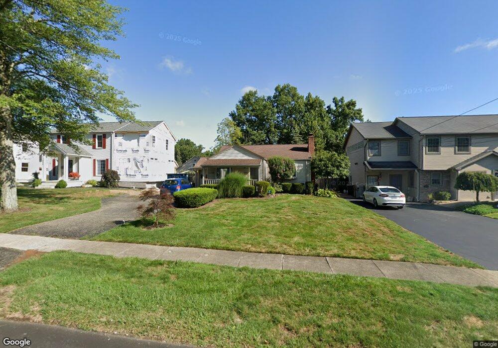
2076 Renwick Dr Youngstown, OH 44514
Estimated Value: $125,000 - $155,000
2
Beds
1
Bath
800
Sq Ft
$171/Sq Ft
Est. Value
About This Home
This home is located at 2076 Renwick Dr, Youngstown, OH 44514 and is currently estimated at $137,050, approximately $171 per square foot. 2076 Renwick Dr is a home located in Mahoning County with nearby schools including Struthers Elementary School, Struthers Middle School, and Struthers High School.
Ownership History
Date
Name
Owned For
Owner Type
Purchase Details
Closed on
May 24, 2018
Sold by
Scott Lois R
Bought by
Volosin Pamela E and Holisky Dennis J
Current Estimated Value
Purchase Details
Closed on
Apr 3, 2016
Sold by
Scott Lois R
Bought by
Volosin Pamela E and Holisky Dennis J
Purchase Details
Closed on
Dec 3, 2002
Sold by
Scott George B and Scott Lois R
Bought by
Scott George B and Scott Lois R
Purchase Details
Closed on
Jan 25, 1996
Sold by
Jeffrey L Bodine
Bought by
Scott George B and Scott Lois R
Home Financials for this Owner
Home Financials are based on the most recent Mortgage that was taken out on this home.
Original Mortgage
$63,000
Interest Rate
7.19%
Mortgage Type
New Conventional
Purchase Details
Closed on
Aug 31, 1993
Bought by
Bodine and Bodine Traficant
Create a Home Valuation Report for This Property
The Home Valuation Report is an in-depth analysis detailing your home's value as well as a comparison with similar homes in the area
Purchase History
| Date | Buyer | Sale Price | Title Company |
|---|---|---|---|
| Volosin Pamela E | $65,000 | None Available | |
| Volosin Pamela E | $65,000 | Attorney | |
| Scott George B | -- | -- | |
| Scott George B | $66,500 | -- | |
| Bodine | $58,900 | -- |
Source: Public Records
Mortgage History
| Date | Status | Borrower | Loan Amount |
|---|---|---|---|
| Previous Owner | Scott George B | $63,000 | |
| Closed | Volosin Pamela E | $0 |
Source: Public Records
Tax History
| Year | Tax Paid | Tax Assessment Tax Assessment Total Assessment is a certain percentage of the fair market value that is determined by local assessors to be the total taxable value of land and additions on the property. | Land | Improvement |
|---|---|---|---|---|
| 2025 | $1,794 | $36,780 | $6,800 | $29,980 |
| 2024 | $1,847 | $36,780 | $6,800 | $29,980 |
| 2023 | $1,805 | $36,780 | $6,800 | $29,980 |
| 2022 | $1,386 | $23,610 | $6,240 | $17,370 |
| 2021 | $1,324 | $23,610 | $6,240 | $17,370 |
| 2020 | $1,330 | $23,610 | $6,240 | $17,370 |
| 2019 | $1,281 | $21,150 | $6,240 | $14,910 |
| 2018 | $689 | $21,150 | $6,240 | $14,910 |
| 2017 | $687 | $21,150 | $6,240 | $14,910 |
| 2016 | $917 | $24,510 | $6,240 | $18,270 |
| 2015 | $898 | $24,510 | $6,240 | $18,270 |
| 2014 | $901 | $24,510 | $6,240 | $18,270 |
| 2013 | $889 | $24,510 | $6,240 | $18,270 |
Source: Public Records
Map
Nearby Homes
- 97 Renwick Dr
- 2035 Woodward Ave
- 2301 Lyon Blvd
- 5710 Youngstown Poland Rd
- 2215 Knollwood Ave
- 2350 Hamilton Ave
- 2370 Lyon Blvd
- 5425 Sheridan Rd
- 0 Oles Ave
- 2451 W Manor Ave
- 0 Woodlawn Ave
- 172 Lakeshore Dr
- 453 W Omar St
- 101 Delaware Ave
- 148 Island Dr
- 1933 Brandon Ave
- 118 N Main St
- 563 Geneva Ave
- 0 Mathews Rd Unit 5149232
- 0 Mathews Rd Unit 5143059
Your Personal Tour Guide
Ask me questions while you tour the home.