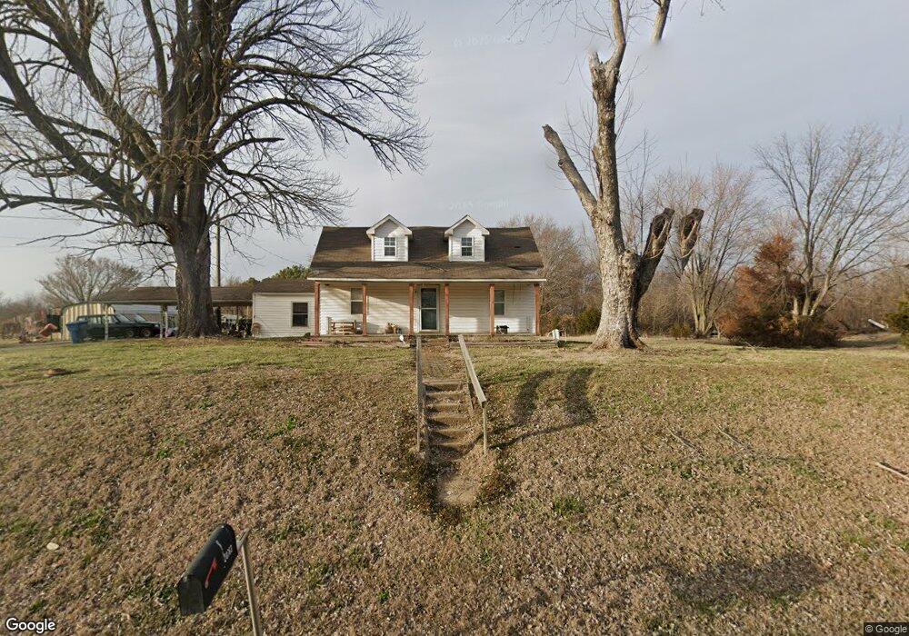
20763 State Highway Ab Bloomfield, MO 63825
Estimated Value: $156,000 - $186,000
3
Beds
1
Bath
1,312
Sq Ft
$130/Sq Ft
Est. Value
About This Home
This home is located at 20763 State Highway Ab, Bloomfield, MO 63825 and is currently estimated at $170,586, approximately $130 per square foot. 20763 State Highway Ab is a home located in Stoddard County with nearby schools including Bloomfield Elementary School, Bloomfield Middle School, and Bloomfield High School.
Ownership History
Date
Name
Owned For
Owner Type
Purchase Details
Closed on
Jul 31, 2024
Sold by
Murphy Shawn and Murphy Tonya
Bought by
Williams Malik S
Current Estimated Value
Home Financials for this Owner
Home Financials are based on the most recent Mortgage that was taken out on this home.
Original Mortgage
$146,500
Outstanding Balance
$123,960
Interest Rate
0.61%
Mortgage Type
Construction
Estimated Equity
$46,626
Purchase Details
Closed on
Oct 15, 2018
Sold by
Doyle Burgess and Doyle Tina
Bought by
Murphy Shawn and Murphy Tonya
Create a Home Valuation Report for This Property
The Home Valuation Report is an in-depth analysis detailing your home's value as well as a comparison with similar homes in the area
Home Values in the Area
Average Home Value in this Area
Purchase History
| Date | Buyer | Sale Price | Title Company |
|---|---|---|---|
| Williams Malik S | $183,125 | Stoddard Cnty Title & Escrow | |
| Murphy Shawn | -- | -- |
Source: Public Records
Mortgage History
| Date | Status | Borrower | Loan Amount |
|---|---|---|---|
| Open | Williams Malik S | $146,500 |
Source: Public Records
Tax History Compared to Growth
Tax History
| Year | Tax Paid | Tax Assessment Tax Assessment Total Assessment is a certain percentage of the fair market value that is determined by local assessors to be the total taxable value of land and additions on the property. | Land | Improvement |
|---|---|---|---|---|
| 2025 | $1,191 | $27,740 | $0 | $0 |
| 2024 | $1,191 | $25,403 | $0 | $0 |
| 2023 | $1,191 | $25,403 | $0 | $0 |
| 2022 | $1,101 | $23,484 | $0 | $0 |
| 2021 | $1,101 | $23,484 | $0 | $0 |
| 2020 | $994 | $1,615 | $0 | $0 |
| 2019 | $104 | $2,204 | $0 | $0 |
| 2018 | $76 | $1,615 | $0 | $0 |
| 2016 | $399 | $8,492 | $0 | $0 |
| 2015 | -- | $8,492 | $0 | $0 |
| 2014 | -- | $8,513 | $0 | $0 |
| 2013 | -- | $1,008 | $0 | $0 |
Source: Public Records
Map
Nearby Homes
- 123 Link Rd
- 25097 State Highway 25
- 23847 Friar Tuck Ct
- 709 N Prairie St
- 610 N Spring St
- 503 S Viola St
- 100 E Shawnee St
- 301 W Shawnee St
- 17800 County Road 527
- 0 Tract 5 County Road 260 262
- 0 Tract 3 County Road 260 262
- 0 Tract 2 County Road 260 262
- 0 Tract 4 County Road 260 262
- 24898 State Highway Ab
- 15877 Highway M
- 21895 County Road 550
- 0 County Road 237
- 000 State Highway K
- 16313 State Highway K
- 27859 State Highway K
- 20887 State Highway Ab
- 20878 State Highway Ab
- 22243 County Road 503
- 20251 State Highway Ab
- 20251 State Highway Ab
- 20993 State Highway Ab
- 22348 County Road 503
- 22476 County Road 503
- 22593 County Road 503
- 22083 County Road 525
- 21213 State Highway Ab
- 21256 State Highway Ab
- 20510 State Highway Ab
- 21257 State Highway Ab
- 21997 County Road 525
- 21289 State Highway Ab
- 22288 County Road 525
- 21298 State Highway Ab
- 22412 County Road 525
- 20256 State Highway Ab