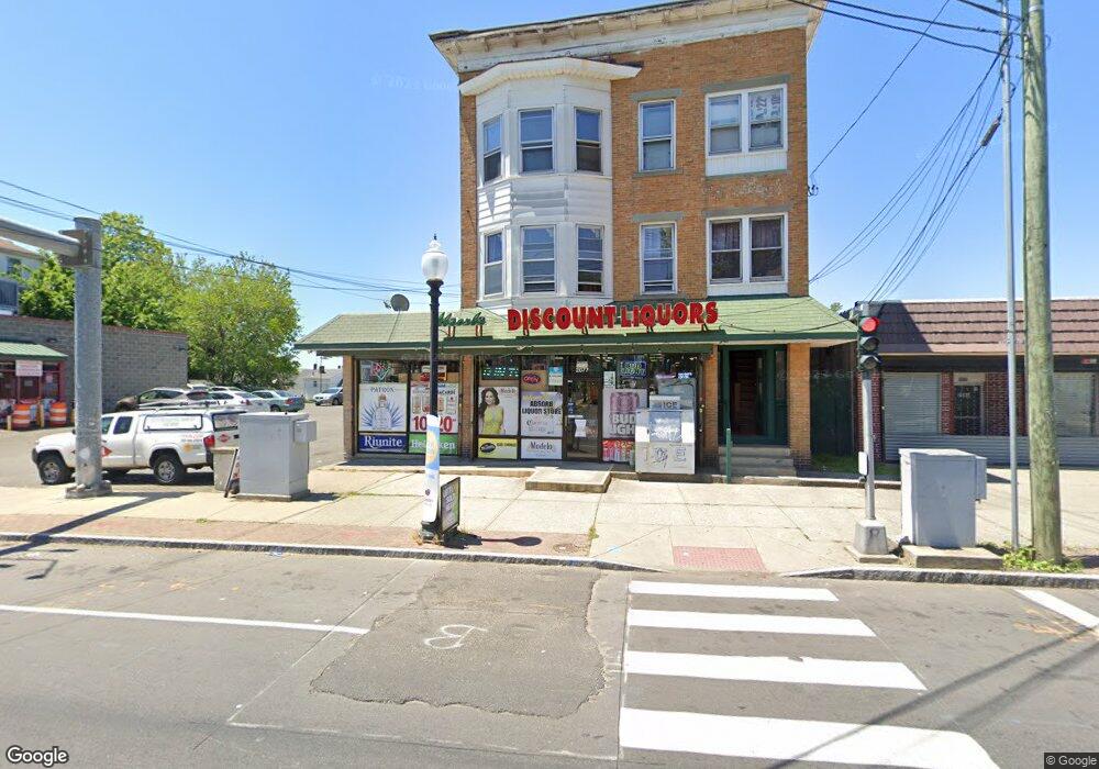
2077 E Main St Bridge Port, CT 06610
North Bridgeport NeighborhoodEstimated Value: $391,178
Studio
--
Bath
5,396
Sq Ft
$72/Sq Ft
Est. Value
About This Home
This home is located at 2077 E Main St, Bridge Port, CT 06610 and is currently estimated at $391,178, approximately $72 per square foot. 2077 E Main St is a home located in Fairfield County with nearby schools including Beardsley School, Harding High School, and Achievement First Bridgeport Academy Elementary School.
Ownership History
Date
Name
Owned For
Owner Type
Purchase Details
Closed on
Jan 19, 2007
Sold by
Marrero Juan
Bought by
Teenmurti Llc
Current Estimated Value
Home Financials for this Owner
Home Financials are based on the most recent Mortgage that was taken out on this home.
Original Mortgage
$220,000
Outstanding Balance
$89,404
Interest Rate
6.14%
Mortgage Type
Commercial
Estimated Equity
$301,774
Purchase Details
Closed on
Feb 4, 2004
Sold by
Marrero Juan
Bought by
Marrero 2Nd Juan
Home Financials for this Owner
Home Financials are based on the most recent Mortgage that was taken out on this home.
Original Mortgage
$145,000
Interest Rate
5.8%
Mortgage Type
Commercial
Purchase Details
Closed on
Mar 13, 1996
Sold by
Figmic Robert J
Bought by
Marrero Juan O and Marrero Carmen L
Create a Home Valuation Report for This Property
The Home Valuation Report is an in-depth analysis detailing your home's value as well as a comparison with similar homes in the area
Home Values in the Area
Average Home Value in this Area
Purchase History
| Date | Buyer | Sale Price | Title Company |
|---|---|---|---|
| Teenmurti Llc | $275,000 | -- | |
| Teenmurti Llc | $275,000 | -- | |
| Marrero 2Nd Juan | $58,000 | -- | |
| Marrero 2Nd Juan | $58,000 | -- | |
| Marrero Juan O | $28,000 | -- | |
| Marrero Juan O | $28,000 | -- | |
| Marrero Juan O | $28,000 | -- | |
| Marrero Juan O | $28,000 | -- |
Source: Public Records
Mortgage History
| Date | Status | Borrower | Loan Amount |
|---|---|---|---|
| Open | Marrero Juan O | $220,000 | |
| Closed | Marrero Juan O | $220,000 | |
| Previous Owner | Marrero Juan O | $145,000 |
Source: Public Records
Tax History
| Year | Tax Paid | Tax Assessment Tax Assessment Total Assessment is a certain percentage of the fair market value that is determined by local assessors to be the total taxable value of land and additions on the property. | Land | Improvement |
|---|---|---|---|---|
| 2025 | $11,436 | $263,210 | $77,300 | $185,910 |
| 2024 | $11,436 | $263,210 | $77,300 | $185,910 |
| 2023 | $11,436 | $263,210 | $77,300 | $185,910 |
| 2022 | $11,436 | $263,210 | $77,300 | $185,910 |
| 2021 | $11,436 | $263,210 | $77,300 | $185,910 |
| 2020 | $13,595 | $251,800 | $63,310 | $188,490 |
| 2019 | $13,595 | $251,800 | $63,310 | $188,490 |
| 2018 | $13,690 | $251,800 | $63,310 | $188,490 |
| 2017 | $13,690 | $251,800 | $63,310 | $188,490 |
| 2016 | $13,690 | $251,800 | $63,310 | $188,490 |
| 2015 | $11,697 | $277,180 | $77,370 | $199,810 |
| 2014 | $11,697 | $277,180 | $77,370 | $199,810 |
Source: Public Records
Map
Nearby Homes
- 2031 E Main St
- 2034 E Main St
- 2092 E Main St
- 2100 E Main St
- 46 York St
- 142 Palm St
- 282 Horace St
- 386 Huntington Rd Unit 388
- 107 Colony St Unit 109
- 33 Louisiana Ave Unit 35
- 154 Virginia Ave Unit B
- 186 Louisiana Ave Unit D
- 1218 Kossuth St
- 11 Nob Hill Cir
- 211 Louisiana Ave Unit D
- 619 Brooks St Unit 621
- 132 Virginia Ave Unit 132
- 750 William St
- 502 Berkshire Ave
- 1365 E Main St
- 2085 E Main St
- 2065 E Main St
- 780 Huntington Rd
- 782 Huntington Rd
- 764 Huntington Rd
- 772 Huntington Rd Unit 774
- 796 Huntington Rd
- 2049 E Main St
- 31 York St
- 806 Huntington Rd Unit 808
- 2084 E Main St
- 2068 E Main St
- 2048 E Main St
- 750 Huntington Rd Unit 752
- 2127 E Main St Unit 2
- 2127 E Main St
- 742 Huntington Rd
- 2115 E Main St
- 38 York St
- 2060 E Main St
Your Personal Tour Guide
Ask me questions while you tour the home.