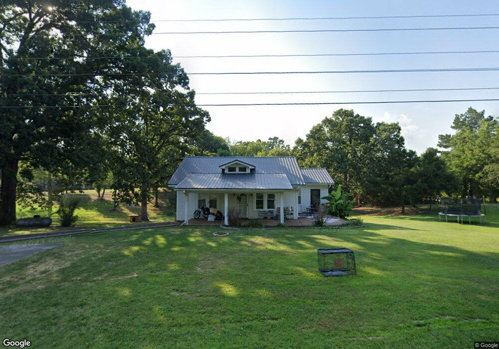
20777 Highway 79 Gadsden, TN 38337
Estimated Value: $134,000 - $155,000
--
Bed
1
Bath
1,460
Sq Ft
$98/Sq Ft
Est. Value
About This Home
This home is located at 20777 Highway 79, Gadsden, TN 38337 and is currently estimated at $143,152, approximately $98 per square foot. 20777 Highway 79 is a home located in Crockett County with nearby schools including Crockett County High School.
Ownership History
Date
Name
Owned For
Owner Type
Purchase Details
Closed on
Feb 10, 2022
Sold by
Hutchison Jr Harry W
Bought by
Sidney F Chapman Revocable Living Trust
Current Estimated Value
Purchase Details
Closed on
Mar 29, 2019
Sold by
Middleton Holly Reasons
Bought by
Hutchison Harry W
Home Financials for this Owner
Home Financials are based on the most recent Mortgage that was taken out on this home.
Original Mortgage
$99,900
Interest Rate
4.3%
Create a Home Valuation Report for This Property
The Home Valuation Report is an in-depth analysis detailing your home's value as well as a comparison with similar homes in the area
Home Values in the Area
Average Home Value in this Area
Purchase History
| Date | Buyer | Sale Price | Title Company |
|---|---|---|---|
| Sidney F Chapman Revocable Living Trust | -- | -- | |
| Hutchison Harry W | $99,900 | -- |
Source: Public Records
Mortgage History
| Date | Status | Borrower | Loan Amount |
|---|---|---|---|
| Previous Owner | Hutchison Harry W | $99,900 |
Source: Public Records
Tax History Compared to Growth
Tax History
| Year | Tax Paid | Tax Assessment Tax Assessment Total Assessment is a certain percentage of the fair market value that is determined by local assessors to be the total taxable value of land and additions on the property. | Land | Improvement |
|---|---|---|---|---|
| 2025 | $467 | $30,150 | $0 | $0 |
| 2024 | $467 | $20,575 | $1,825 | $18,750 |
| 2023 | $467 | $20,575 | $1,825 | $18,750 |
| 2022 | $467 | $20,575 | $1,825 | $18,750 |
| 2021 | $321 | $12,175 | $1,300 | $10,875 |
| 2020 | $315 | $12,175 | $1,300 | $10,875 |
| 2019 | $315 | $11,950 | $1,300 | $10,650 |
| 2018 | $315 | $11,950 | $1,300 | $10,650 |
| 2017 | $315 | $11,950 | $1,300 | $10,650 |
| 2016 | $315 | $11,950 | $1,300 | $10,650 |
| 2015 | $331 | $11,950 | $1,300 | $10,650 |
| 2014 | $331 | $12,520 | $0 | $0 |
Source: Public Records
Map
Nearby Homes
- 00 Lot#1 Humboldt Lake Rd
- 00 Lot#4 Humboldt Lake Rd
- 127 Franklin St
- 133 Mason St
- 21679 U S 79
- 136 Mason Grove Rd
- 397 Aubrey Fergerson Rd
- 0 Aubrey Fergerson Rd
- 00 Plomar Williams Rd
- 0 Plomar Williams Rd
- 159 Lipford Ln
- 00 Highway 45 W
- 297 Marlow Cemetery Rd
- 0 Clarence Norfleet Rd
- 120 Westwood Cove
- 580 Westside Dr
- 0 MacLin St Unit 224868
- 76 Etheridge St Unit R
- 73 Etheridge St
- 0 W Main St
- 20777 Highway 79
- 20738 U S 79
- 20753 Highway 79
- 20684 Highway 79
- 20876 Highway 79
- 00 U S 79
- 20823 Highway 79
- 20586 Highway 79
- 168 Humboldt Lake Rd
- 21025 Highway 79
- 152 Humboldt Lake Rd
- Tract #4 Humboldt Lake Rd
- Tract #5 Humboldt Lake Rd
- Tract #1 Humboldt Lake Rd
- Tract #2 Humboldt Lake Rd
- B/C Humboldt Lake Rd
- 00C Humboldt Lake Rd
- 00B Humboldt Lake Rd
- 00A Humboldt Lake Rd
- 0 Humboldt Lake Rd