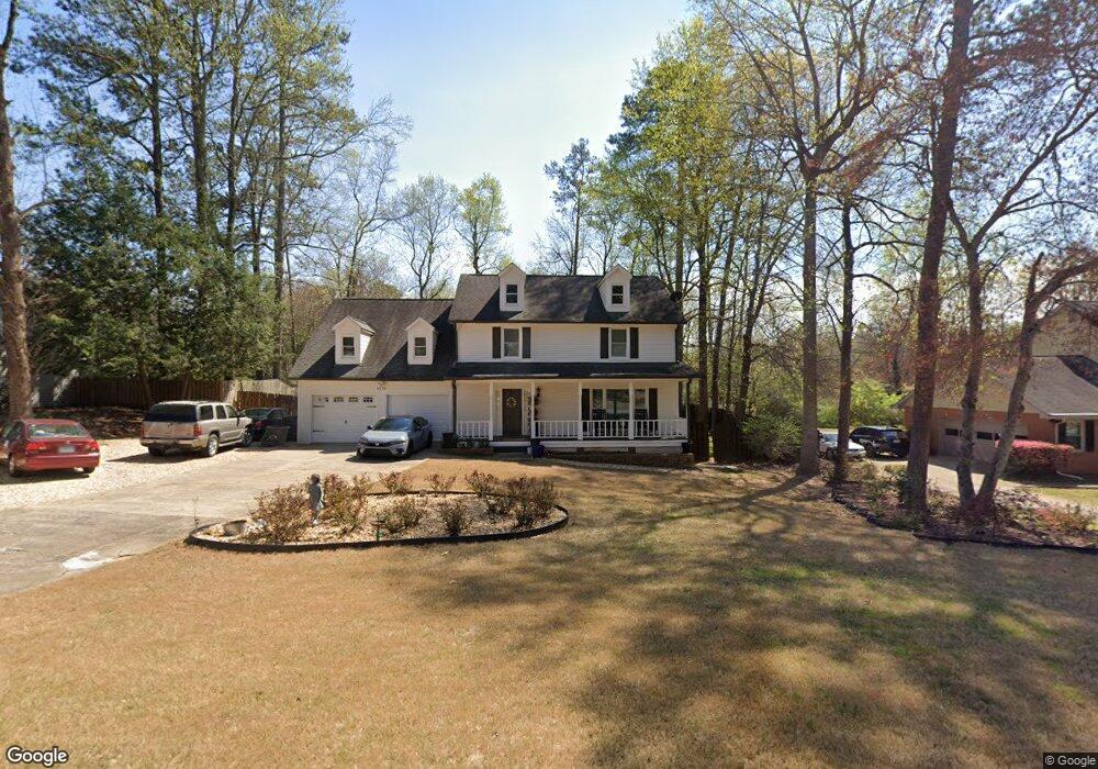
2079 Moccasin Way SW Marietta, GA 30064
West Cobb NeighborhoodEstimated Value: $411,000 - $484,000
5
Beds
3
Baths
2,384
Sq Ft
$188/Sq Ft
Est. Value
About This Home
This home is located at 2079 Moccasin Way SW, Marietta, GA 30064 and is currently estimated at $448,071, approximately $187 per square foot. 2079 Moccasin Way SW is a home located in Cobb County with nearby schools including Dowell Elementary School, Lovinggood Middle School, and Hillgrove High School.
Ownership History
Date
Name
Owned For
Owner Type
Purchase Details
Closed on
Jun 1, 2010
Sold by
Wilmington Trust Co
Bought by
Angel Jose M
Current Estimated Value
Home Financials for this Owner
Home Financials are based on the most recent Mortgage that was taken out on this home.
Original Mortgage
$96,000
Outstanding Balance
$64,282
Interest Rate
5.03%
Mortgage Type
New Conventional
Estimated Equity
$383,789
Purchase Details
Closed on
Mar 2, 2010
Sold by
Rubio Adan L
Bought by
Us Bk National Assn
Purchase Details
Closed on
May 30, 2001
Sold by
Anderson Robert J and Anderson Peggy D
Bought by
Nolan David K and Nolan Tonie H
Home Financials for this Owner
Home Financials are based on the most recent Mortgage that was taken out on this home.
Original Mortgage
$136,400
Interest Rate
7.23%
Mortgage Type
FHA
Create a Home Valuation Report for This Property
The Home Valuation Report is an in-depth analysis detailing your home's value as well as a comparison with similar homes in the area
Home Values in the Area
Average Home Value in this Area
Purchase History
| Date | Buyer | Sale Price | Title Company |
|---|---|---|---|
| Angel Jose M | $120,000 | -- | |
| Us Bk National Assn | $133,631 | -- | |
| Nolan David K | $168,000 | -- |
Source: Public Records
Mortgage History
| Date | Status | Borrower | Loan Amount |
|---|---|---|---|
| Open | Angel Jose M | $96,000 | |
| Previous Owner | Nolan David K | $136,400 |
Source: Public Records
Tax History Compared to Growth
Tax History
| Year | Tax Paid | Tax Assessment Tax Assessment Total Assessment is a certain percentage of the fair market value that is determined by local assessors to be the total taxable value of land and additions on the property. | Land | Improvement |
|---|---|---|---|---|
| 2025 | $4,040 | $170,844 | $36,000 | $134,844 |
| 2024 | $3,667 | $153,524 | $12,800 | $140,724 |
| 2023 | $3,125 | $153,524 | $12,800 | $140,724 |
| 2022 | $3,562 | $147,380 | $12,800 | $134,580 |
| 2021 | $2,718 | $108,824 | $12,800 | $96,024 |
| 2020 | $2,718 | $108,824 | $12,800 | $96,024 |
| 2019 | $2,489 | $98,372 | $12,800 | $85,572 |
| 2018 | $2,357 | $92,352 | $12,800 | $79,552 |
| 2017 | $2,021 | $81,436 | $14,000 | $67,436 |
| 2016 | $1,809 | $71,824 | $14,000 | $57,824 |
| 2015 | $1,856 | $71,824 | $14,000 | $57,824 |
| 2014 | $1,164 | $48,000 | $0 | $0 |
Source: Public Records
Map
Nearby Homes
- 1946 MacLand Rd SW
- 1952 Freestone Way
- 2040 Hardwood Cir SW Unit 3
- Monteluce Plan at Freestone Station
- Hillside Plan at Freestone Station
- Oakshire Plan at Freestone Station
- Hendricks Plan at Freestone Station
- Hedgerow Plan at Freestone Station
- Antioch Plan at Freestone Station
- 1985 Freestone Way
- 1830 MacLand Rd SW
- 2002 MacLand Square Dr Unit 1
- 2009 Freestone Way
- 2028 MacLand Square Dr Unit 4
- 2409 Caneridge Point SW
- 1976 Grove Field Ln
- 1976 Grove Field Ln Unit BLDG 33
- 2040 Freestone Way
- 2117 Caneridge Dr SW
- 2268 Grove Valley Way Unit 9
- 2081 Moccasin Way SW
- 2075 Moccasin Way SW
- 2090 Moccasin Way SW
- 2080 Moccasin Way SW
- 2083 Moccasin Way SW
- 2071 Moccasin Way SW
- 1941 Rollingwoods Way SW
- 2085 Moccasin Way SW
- 1950 Rollingwoods Way SW
- 1940 McEachern Manor Dr SW
- 2080 MacLand Rd SW
- 1930 McEachern Manor Dr SW
- 2090 MacLand Rd SW
- 2094 MacLand Rd
- 1920 McEachern Manor Dr SW
- 1948 Rollingwoods Way SW Unit 1
- 1948 McEachern Manor Dr SW
- 1910 McEachern Manor Dr SW
- 1942 Rollingwoods Way SW
- 2078 MacLand Rd SW