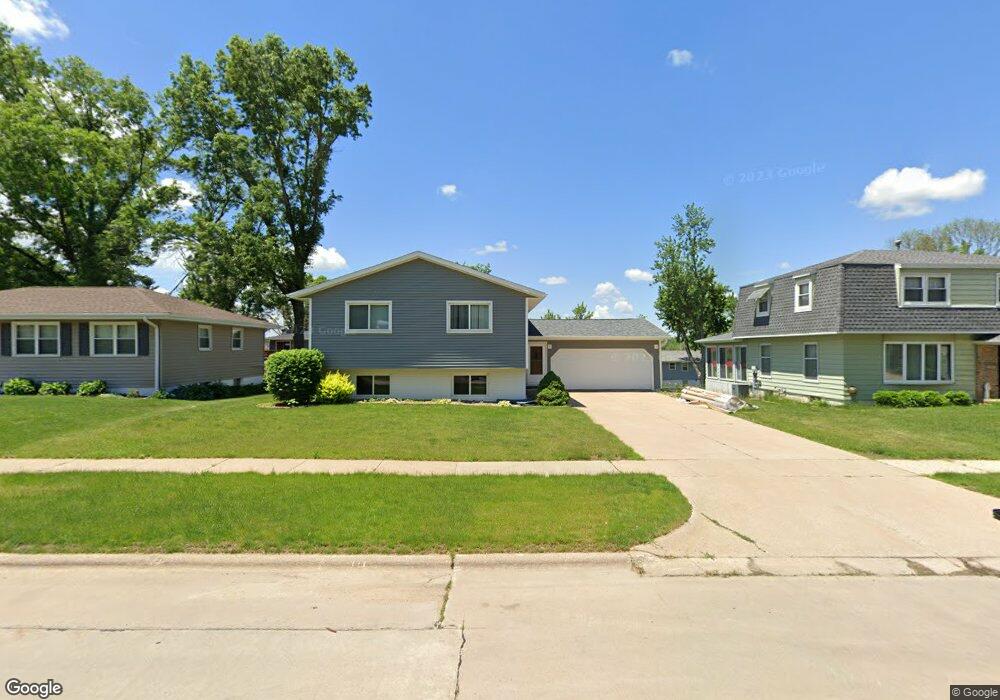
208 31st St NW Cedar Rapids, IA 52405
Estimated Value: $217,000 - $253,694
3
Beds
3
Baths
1,189
Sq Ft
$203/Sq Ft
Est. Value
About This Home
This home is located at 208 31st St NW, Cedar Rapids, IA 52405 and is currently estimated at $241,924, approximately $203 per square foot. 208 31st St NW is a home located in Linn County with nearby schools including Junction City Elementary School, Cleveland Elementary School, and Kentucky Tech - Ashland Reg Tech Center.
Ownership History
Date
Name
Owned For
Owner Type
Purchase Details
Closed on
Mar 11, 2024
Sold by
Pyzick Brittney and Pyzick Samuel
Bought by
Pyzick Brittney
Current Estimated Value
Home Financials for this Owner
Home Financials are based on the most recent Mortgage that was taken out on this home.
Original Mortgage
$175,925
Outstanding Balance
$173,134
Interest Rate
6.88%
Mortgage Type
FHA
Estimated Equity
$68,790
Purchase Details
Closed on
Aug 23, 2020
Sold by
Goldsberry Brittney and Pyzick Samuel
Bought by
Pyzick Brittney and Pyzick Samuel
Home Financials for this Owner
Home Financials are based on the most recent Mortgage that was taken out on this home.
Original Mortgage
$176,067
Interest Rate
2.7%
Mortgage Type
FHA
Purchase Details
Closed on
Dec 21, 2018
Sold by
Graeve Michael J
Bought by
Goldsberry Brittney and Pyzick Samuel
Home Financials for this Owner
Home Financials are based on the most recent Mortgage that was taken out on this home.
Original Mortgage
$177,230
Interest Rate
4.9%
Mortgage Type
FHA
Purchase Details
Closed on
Jun 7, 2002
Sold by
Thomas Amy J and Thomas Chad W
Bought by
Graeve Michael J and Graeve Tracy R
Home Financials for this Owner
Home Financials are based on the most recent Mortgage that was taken out on this home.
Original Mortgage
$119,225
Interest Rate
8.85%
Purchase Details
Closed on
Nov 30, 2001
Sold by
Denard Michael A
Bought by
Thomas Amy J
Home Financials for this Owner
Home Financials are based on the most recent Mortgage that was taken out on this home.
Original Mortgage
$112,113
Interest Rate
6.68%
Mortgage Type
FHA
Purchase Details
Closed on
Feb 24, 1998
Sold by
David George A and David Sandra K
Bought by
Denard Bobby A and Denard Barbara M
Home Financials for this Owner
Home Financials are based on the most recent Mortgage that was taken out on this home.
Original Mortgage
$99,000
Interest Rate
8%
Create a Home Valuation Report for This Property
The Home Valuation Report is an in-depth analysis detailing your home's value as well as a comparison with similar homes in the area
Home Values in the Area
Average Home Value in this Area
Purchase History
| Date | Buyer | Sale Price | Title Company |
|---|---|---|---|
| Pyzick Brittney | -- | None Listed On Document | |
| Pyzick Brittney | -- | None Listed On Document | |
| Pyzick Brittney | -- | Amrock Inc | |
| Goldsberry Brittney | $180,500 | Security First Title Co | |
| Graeve Michael J | $125,000 | -- | |
| Thomas Amy J | $112,500 | -- | |
| Denard Michael A | $109,500 | -- | |
| Denard Bobby A | $107,000 | -- | |
| Denard Michael A | $110,000 | -- |
Source: Public Records
Mortgage History
| Date | Status | Borrower | Loan Amount |
|---|---|---|---|
| Open | Pyzick Brittney | $175,925 | |
| Closed | Pyzick Brittney | $175,925 | |
| Previous Owner | Pyzick Brittney | $176,067 | |
| Previous Owner | Goldsberry Brittney | $177,230 | |
| Previous Owner | Graeve Michael J | $119,225 | |
| Previous Owner | Thomas Amy J | $112,113 | |
| Previous Owner | Denard Bobby A | $99,000 | |
| Closed | Denard Michael A | -- |
Source: Public Records
Tax History Compared to Growth
Tax History
| Year | Tax Paid | Tax Assessment Tax Assessment Total Assessment is a certain percentage of the fair market value that is determined by local assessors to be the total taxable value of land and additions on the property. | Land | Improvement |
|---|---|---|---|---|
| 2025 | $3,744 | $244,100 | $42,700 | $201,400 |
| 2024 | $3,938 | $222,000 | $37,100 | $184,900 |
| 2023 | $3,938 | $222,000 | $37,100 | $184,900 |
| 2022 | $3,654 | $195,600 | $37,100 | $158,500 |
| 2021 | $3,722 | $185,300 | $33,400 | $151,900 |
| 2020 | $3,722 | $177,300 | $29,700 | $147,600 |
| 2019 | $3,366 | $167,900 | $29,700 | $138,200 |
| 2018 | $3,266 | $167,900 | $29,700 | $138,200 |
| 2017 | $3,236 | $160,400 | $29,700 | $130,700 |
| 2016 | $3,173 | $152,600 | $29,700 | $122,900 |
| 2015 | $3,089 | $148,469 | $29,680 | $118,789 |
| 2014 | $2,904 | $148,469 | $29,680 | $118,789 |
| 2013 | $2,834 | $148,469 | $29,680 | $118,789 |
Source: Public Records
Map
Nearby Homes
- 225 31st St NW
- 3107 Johnson Ave NW Unit 4
- 201 Edgewood Rd NW
- 211 Edgewood Rd NW
- 3013 Sue Ln NW
- 327 NW Edgewood Rd Unit 324, 330, 336, 342 C
- 3416 Sue Ln NW
- 159 26th St NW
- 3600 Midway Dr NW
- 425 28th St NW
- 1410 Adair Ct SW Unit Lot 2
- 312 24th Ave NW
- 3509 E Ave NW Unit D
- 3507 E Ave NW Unit F
- 3403 1st Ave SW
- 56 Julia Ann Dr NW
- 615 27th St NW
- 2433 8th Ave SW
- 623 27th St NW
- 2437 9th Ave SW
- 208 31st St NW
- 216 31st St NW
- 200 31st St NW
- 209 32nd St NW
- 201 32nd St NW
- 217 32nd St NW
- 224 31st St NW
- 158 31st St NW
- 225 32nd St NW
- 159 32nd St NW
- 223 31st St NW
- 209 31st St NW
- 232 31st St NW
- 150 31st St NW
- 201 31st St NW
- 217 31st St NW
- 151 32nd St NW
- 3121 Hogan Ave NW
- 159 31st St NW
- 142 31st St NW