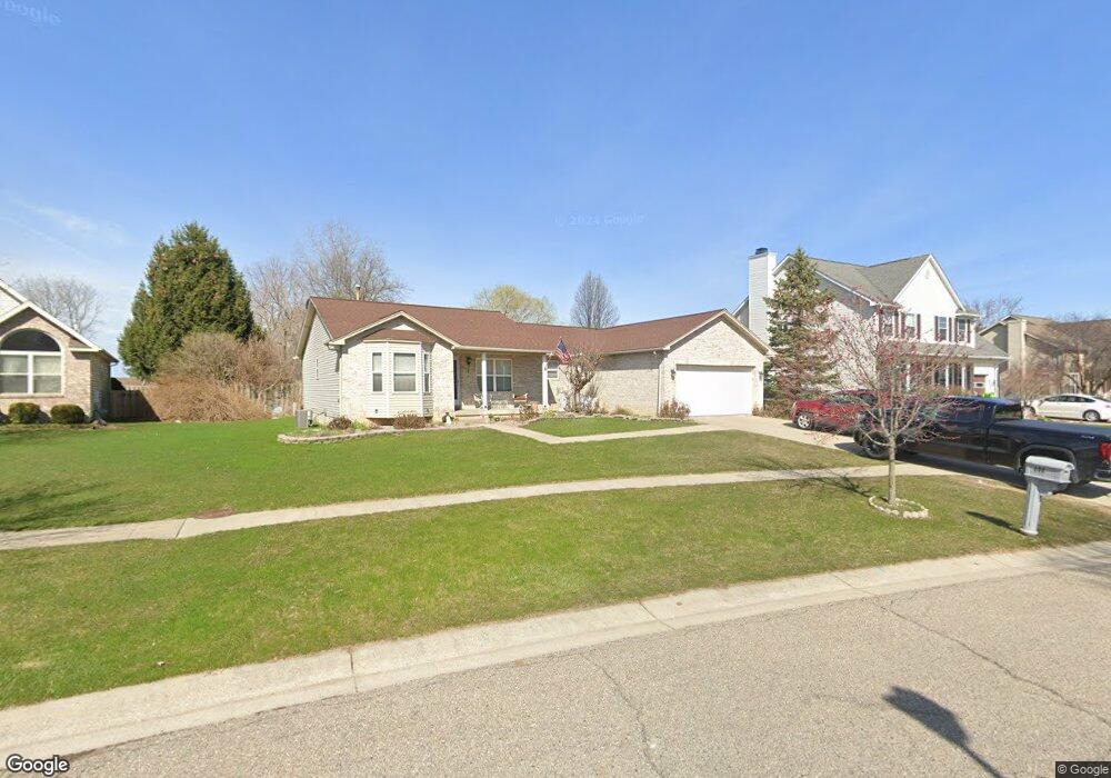
208 Brookside Dr Flushing, MI 48433
Estimated Value: $228,563 - $327,000
Studio
--
Bath
1,590
Sq Ft
$171/Sq Ft
Est. Value
About This Home
This home is located at 208 Brookside Dr, Flushing, MI 48433 and is currently estimated at $272,141, approximately $171 per square foot. 208 Brookside Dr is a home located in Genesee County with nearby schools including Central Elementary School, Flushing Middle School, and Flushing High School.
Ownership History
Date
Name
Owned For
Owner Type
Purchase Details
Closed on
Mar 1, 2002
Sold by
Woodside Builders Inc
Bought by
Kalo Gino K and Kalo Sawsan Z
Current Estimated Value
Purchase Details
Closed on
Sep 7, 2001
Sold by
Kalo Gino K and Kalo Sawsan Z
Bought by
Woodside Builders Inc
Create a Home Valuation Report for This Property
The Home Valuation Report is an in-depth analysis detailing your home's value as well as a comparison with similar homes in the area
Home Values in the Area
Average Home Value in this Area
Purchase History
| Date | Buyer | Sale Price | Title Company |
|---|---|---|---|
| Kalo Gino K | -- | Sargents Abstract & Title Co | |
| Woodside Builders Inc | -- | Sargents Abstract & Title Co | |
| Kalo Gino K | $34,000 | Sargents Title Company |
Source: Public Records
Tax History
| Year | Tax Paid | Tax Assessment Tax Assessment Total Assessment is a certain percentage of the fair market value that is determined by local assessors to be the total taxable value of land and additions on the property. | Land | Improvement |
|---|---|---|---|---|
| 2025 | $4,172 | $118,900 | $0 | $0 |
| 2024 | $3,339 | $115,400 | $0 | $0 |
| 2023 | $3,209 | $99,100 | $0 | $0 |
| 2022 | $3,555 | $94,700 | $0 | $0 |
| 2021 | $3,555 | $89,900 | $0 | $0 |
| 2020 | $2,820 | $82,400 | $0 | $0 |
| 2019 | $2,785 | $77,100 | $0 | $0 |
| 2018 | $3,338 | $78,200 | $0 | $0 |
| 2017 | $3,106 | $77,100 | $0 | $0 |
| 2016 | $3,080 | $70,506 | $0 | $0 |
| 2015 | $3,069 | $0 | $0 | $0 |
| 2012 | -- | $67,900 | $67,900 | $0 |
Source: Public Records
Map
Nearby Homes
- 219 Primrose Ln
- 3500 Woodridge Ct
- 0 W Pierson Rd Unit 50141989
- 315 N Maple St
- 100 Aberdeen Dr Unit 36
- 321 Terrace Dr
- 468 Windy Bluff
- 229 Aberdeen Ct
- 6289 W River Rd
- 241 Aberdeen Ct Unit 11 bldg 6
- 113 N Mckinley Rd
- 501 Spring Ln
- 10101 Carpenter Rd
- 314 Myrtle St
- 0 E River Rd Unit 50180952
- 0 Winters Eave Dr Unit 50117986
- 608 Autumn Dr
- 527 Oakbrook Cir Unit 14
- 588 Oakbrook Cir
- 530 Coutant St
- 204 Brookside Dr Unit Bldg-Unit
- 204 Brookside Dr
- 212 Brookside Dr
- 200 Brookside Dr
- 216 Brookside Dr
- 196 Brookside Dr
- 221 Brookside Dr
- 220 Brookside Dr
- 192 Brookside Dr
- 217 Brookside Dr
- 205 Brookside Dr
- 225 Brookside Dr
- 222 Brookside Dr
- 213 Brookside Dr
- 199 Brookside Dr Unit Bldg-Unit
- 188 Brookside Dr
- 226 Brookside Dr
- 227 Brookside Dr
- 197 Brookside Dr
- 190 Primrose Ln
Your Personal Tour Guide
Ask me questions while you tour the home.