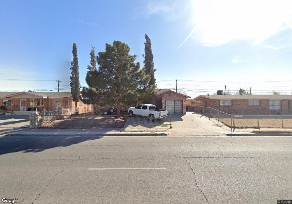
208 Mccarthy Ave El Paso, TX 79915
Thomas Manor NeighborhoodEstimated Value: $158,000 - $191,000
4
Beds
2
Baths
1,394
Sq Ft
$128/Sq Ft
Est. Value
About This Home
This home is located at 208 Mccarthy Ave, El Paso, TX 79915 and is currently estimated at $177,777, approximately $127 per square foot. 208 Mccarthy Ave is a home located in El Paso County with nearby schools including Thomas Manor, Riverside Middle School, and Riverside High School.
Ownership History
Date
Name
Owned For
Owner Type
Purchase Details
Closed on
Aug 23, 2003
Sold by
Saucedo Daisy
Bought by
Quintanilla Alejandro and Saucedo Daisy
Current Estimated Value
Home Financials for this Owner
Home Financials are based on the most recent Mortgage that was taken out on this home.
Original Mortgage
$52,800
Interest Rate
5.71%
Mortgage Type
Credit Line Revolving
Purchase Details
Closed on
Dec 30, 1996
Sold by
Juarez Michael M
Bought by
Juarez Daisy
Home Financials for this Owner
Home Financials are based on the most recent Mortgage that was taken out on this home.
Original Mortgage
$44,775
Interest Rate
7.57%
Create a Home Valuation Report for This Property
The Home Valuation Report is an in-depth analysis detailing your home's value as well as a comparison with similar homes in the area
Home Values in the Area
Average Home Value in this Area
Purchase History
| Date | Buyer | Sale Price | Title Company |
|---|---|---|---|
| Quintanilla Alejandro | -- | -- | |
| Saucedo Daisy | -- | -- | |
| Juarez Daisy | -- | -- |
Source: Public Records
Mortgage History
| Date | Status | Borrower | Loan Amount |
|---|---|---|---|
| Closed | Quintanilla Alejandro | $52,800 | |
| Previous Owner | Juarez Daisy | $44,775 |
Source: Public Records
Tax History
| Year | Tax Paid | Tax Assessment Tax Assessment Total Assessment is a certain percentage of the fair market value that is determined by local assessors to be the total taxable value of land and additions on the property. | Land | Improvement |
|---|---|---|---|---|
| 2025 | $1,374 | $104,081 | -- | -- |
| 2024 | $1,374 | $94,619 | -- | -- |
| 2023 | $1,337 | $86,017 | $0 | $0 |
| 2022 | $2,428 | $78,197 | $0 | $0 |
| 2021 | $2,311 | $98,523 | $13,098 | $85,425 |
| 2020 | $2,041 | $64,625 | $13,098 | $51,527 |
| 2018 | $2,044 | $65,717 | $13,098 | $52,619 |
| 2017 | $2,094 | $68,505 | $13,098 | $55,407 |
| 2016 | $2,094 | $68,505 | $13,098 | $55,407 |
| 2015 | $1,564 | $68,505 | $13,098 | $55,407 |
| 2014 | $1,564 | $70,497 | $13,098 | $57,399 |
Source: Public Records
Map
Nearby Homes
- 261 Gladys Ave
- 222 Kelvin Ave
- 310 Kelvin Ave
- 7798 Rosedale St
- 7860 Porche St
- 7869 Jersey St
- 104 Chip Way
- 7632 Franklin Dr Unit 1-2
- 7907 Alameda Ave
- 7925 Broadway Dr
- 7859 Rosemary St Unit A
- 140 Teakwood Rd
- 423 N Carolina Dr
- 368 Milton Rd
- 404 Lesa Ln
- 436 Emerson St Unit 1-7
- 411 San Pablo Place
- 412 Lesa Ln
- 537 Emerson St
- 3 Atkinson Way
- 212 Mccarthy Ave
- 204 Mccarthy Ave
- 209 Jensen Ave
- 213 Jensen Ave
- 216 Mccarthy Ave
- 205 Jensen Ave
- 200 Mccarthy Ave
- 217 Jensen Ave
- 201 Jensen Ave
- 205 Mccarthy Ave
- 220 Mccarthy Ave
- 201 Mccarthy Ave
- 221 Jensen Ave
- 209 Mccarthy Ave
- 224 Mccarthy Ave
- 212 Gladys Ave
- 213 Mccarthy Ave
- 208 Jensen Ave
- 7701 Broadway Dr
- 225 Jensen Ave
Your Personal Tour Guide
Ask me questions while you tour the home.