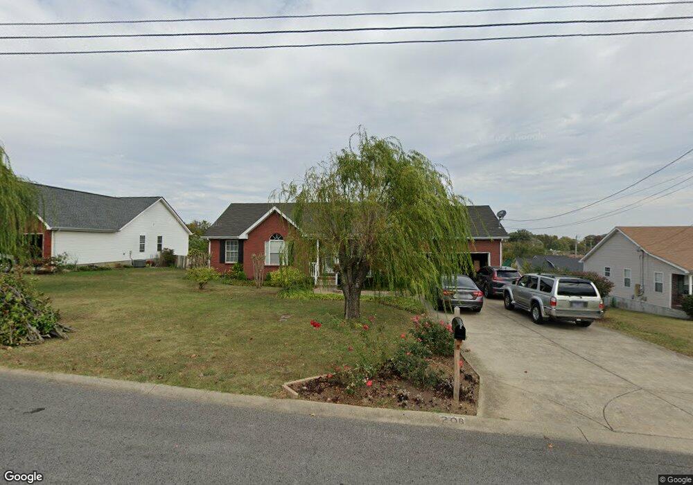
208 Poulan Ct La Vergne, TN 37086
Estimated Value: $312,353 - $362,000
--
Bed
2
Baths
1,241
Sq Ft
$279/Sq Ft
Est. Value
About This Home
This home is located at 208 Poulan Ct, La Vergne, TN 37086 and is currently estimated at $346,338, approximately $279 per square foot. 208 Poulan Ct is a home located in Rutherford County with nearby schools including Cedar Grove Elementary School, Rock Springs Middle School, and Lavergne High School.
Ownership History
Date
Name
Owned For
Owner Type
Purchase Details
Closed on
Sep 23, 2022
Sold by
Soboun Larry
Bought by
Ninthala Laem
Current Estimated Value
Purchase Details
Closed on
May 8, 2006
Sold by
Waldron Merilyn D Llc
Bought by
Larry Soboun
Home Financials for this Owner
Home Financials are based on the most recent Mortgage that was taken out on this home.
Original Mortgage
$103,920
Interest Rate
6.39%
Create a Home Valuation Report for This Property
The Home Valuation Report is an in-depth analysis detailing your home's value as well as a comparison with similar homes in the area
Home Values in the Area
Average Home Value in this Area
Purchase History
| Date | Buyer | Sale Price | Title Company |
|---|---|---|---|
| Ninthala Laem | -- | -- | |
| Ninthala Laem | -- | None Listed On Document | |
| Larry Soboun | $129,900 | -- |
Source: Public Records
Mortgage History
| Date | Status | Borrower | Loan Amount |
|---|---|---|---|
| Previous Owner | Larry Soboun | $103,920 |
Source: Public Records
Tax History Compared to Growth
Tax History
| Year | Tax Paid | Tax Assessment Tax Assessment Total Assessment is a certain percentage of the fair market value that is determined by local assessors to be the total taxable value of land and additions on the property. | Land | Improvement |
|---|---|---|---|---|
| 2025 | $1,596 | $66,125 | $13,750 | $52,375 |
| 2024 | $1,596 | $66,125 | $13,750 | $52,375 |
| 2023 | $1,241 | $66,125 | $13,750 | $52,375 |
| 2022 | $1,069 | $66,125 | $13,750 | $52,375 |
| 2021 | $970 | $43,725 | $9,375 | $34,350 |
| 2020 | $970 | $43,725 | $9,375 | $34,350 |
| 2019 | $970 | $43,725 | $9,375 | $34,350 |
| 2018 | $1,228 | $43,725 | $0 | $0 |
| 2017 | $1,193 | $32,875 | $0 | $0 |
| 2016 | $1,193 | $32,875 | $0 | $0 |
| 2015 | $1,202 | $32,875 | $0 | $0 |
| 2014 | $818 | $32,875 | $0 | $0 |
| 2013 | -- | $33,725 | $0 | $0 |
Source: Public Records
Map
Nearby Homes
- 330 Akin St
- 1726 Elevation JKL Plan at Finch Branch
- 2073 Elevation JKL Plan at Finch Branch
- 1567 Elevation JKL Plan at Finch Branch
- 1824 Elevation JKL Plan at Finch Branch
- 2433 Elevation JKL Plan at Finch Branch
- 2540 Elevation JKL Plan at Finch Branch
- 1489 Elevation JKL Plan at Finch Branch
- 1989 Elevation JKL Plan at Finch Branch
- 2249 Elevation JKL Plan at Finch Branch
- 109 Vincent Ln
- 110 Chatham Ct
- 104 Forest Ln
- 813 Chaney Woods Dr
- 145 Woody Thomas Dr
- 0 Old Nashville Hwy Unit RTC2671318
- 121 Highland St
- 303 Nasturtium Way
- 831 Briargrove Dr
- 127 Brookridge Dr