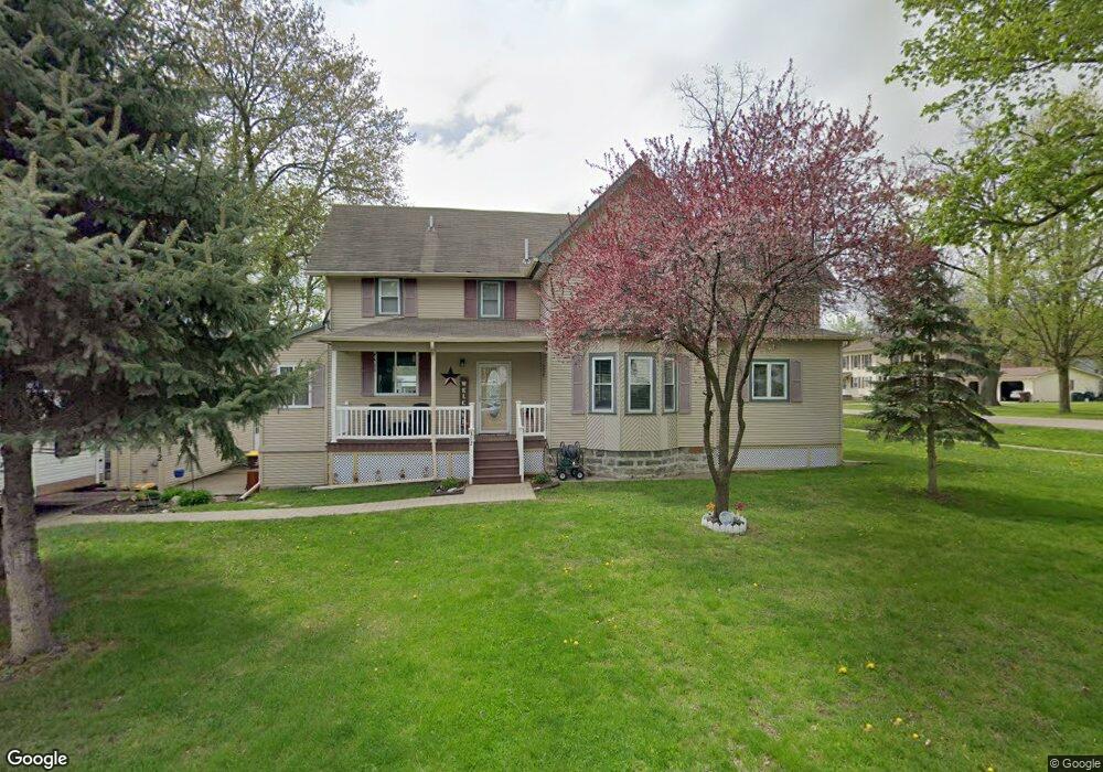
208 S Maple St Durand, MI 48429
Estimated Value: $90,000 - $151,000
2
Beds
2
Baths
865
Sq Ft
$139/Sq Ft
Est. Value
About This Home
This home is located at 208 S Maple St, Durand, MI 48429 and is currently estimated at $120,428, approximately $139 per square foot. 208 S Maple St is a home located in Shiawassee County with nearby schools including Bertha Neal Elementary School, Robert Kerr School, and Durand Middle School.
Ownership History
Date
Name
Owned For
Owner Type
Purchase Details
Closed on
Sep 27, 2011
Sold by
Ross Harris Investments Llc
Bought by
Holley Christopher
Current Estimated Value
Purchase Details
Closed on
Dec 9, 2009
Sold by
Blue Spruce Entities Llc
Bought by
Stonecrest Income And Opportunity Fund
Purchase Details
Closed on
Dec 8, 2009
Sold by
Nationstar Mortgage Llc
Bought by
Blue Spruce Entities Llc
Purchase Details
Closed on
Jun 17, 2009
Sold by
Bredow Kenneth S
Bought by
Nationstar Mortgage Llc
Purchase Details
Closed on
Oct 23, 2003
Sold by
Dusenbury Brian C and Dusenbury Charles E
Bought by
Bredow Kenneth S and Bredow Kenneth
Home Financials for this Owner
Home Financials are based on the most recent Mortgage that was taken out on this home.
Original Mortgage
$61,125
Interest Rate
10.3%
Mortgage Type
Purchase Money Mortgage
Create a Home Valuation Report for This Property
The Home Valuation Report is an in-depth analysis detailing your home's value as well as a comparison with similar homes in the area
Home Values in the Area
Average Home Value in this Area
Purchase History
| Date | Buyer | Sale Price | Title Company |
|---|---|---|---|
| Holley Christopher | $3,924 | -- | |
| Stonecrest Income And Opportunity Fund | $3,750 | -- | |
| Blue Spruce Entities Llc | $1,750 | -- | |
| Nationstar Mortgage Llc | $58,279 | -- | |
| Bredow Kenneth S | $82,500 | Chicago Title | |
| Dusenbury Brian C | -- | Chicago Title |
Source: Public Records
Mortgage History
| Date | Status | Borrower | Loan Amount |
|---|---|---|---|
| Previous Owner | Bredow Kenneth S | $61,125 |
Source: Public Records
Tax History
| Year | Tax Paid | Tax Assessment Tax Assessment Total Assessment is a certain percentage of the fair market value that is determined by local assessors to be the total taxable value of land and additions on the property. | Land | Improvement |
|---|---|---|---|---|
| 2025 | $1,663 | $34,110 | $0 | $0 |
| 2024 | $1,663 | $32,700 | $0 | $0 |
| 2023 | $1,565 | $29,800 | $0 | $0 |
| 2022 | $1,506 | $26,930 | $0 | $0 |
| 2021 | $1,506 | $25,120 | $0 | $0 |
| 2020 | $1,613 | $21,650 | $0 | $0 |
| 2019 | $1,082 | $24,130 | $0 | $0 |
| 2018 | $1,167 | $24,340 | $0 | $0 |
| 2017 | $1,104 | $22,580 | $0 | $0 |
| 2016 | -- | $22,580 | $0 | $0 |
| 2015 | -- | $21,300 | $0 | $0 |
| 2014 | -- | $21,350 | $0 | $0 |
Source: Public Records
Map
Nearby Homes
- 104 W John St
- 105 W John St
- 609 S Kingswood St
- 106 Marquette St
- 209 N Marquette St
- 409 N Lincoln St
- 310 N Mercer St
- 102 W Elm St
- 509 E Genesee St
- 300 N Lenawee St
- 106 E Summit St
- 8390 E Pittsburg Rd
- 1128 N Saginaw St
- 00 M-71
- 0 E Lansing Rd Unit 50159391
- 0 S New Lothrop Rd Unit 20251050266
- 10520 Garrison Rd
- 8875 E Miller Rd
- 310 E Main St
- 211 N Maple St
Your Personal Tour Guide
Ask me questions while you tour the home.