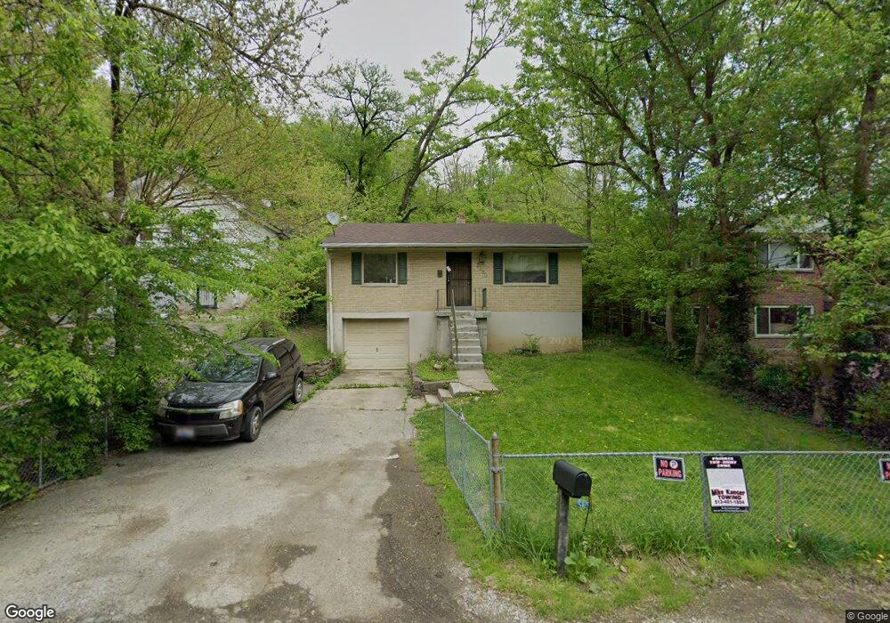
2080 Harkness St Cincinnati, OH 45225
East Westwood NeighborhoodEstimated Value: $77,000 - $134,000
2
Beds
1
Bath
750
Sq Ft
$130/Sq Ft
Est. Value
About This Home
This home is located at 2080 Harkness St, Cincinnati, OH 45225 and is currently estimated at $97,759, approximately $130 per square foot. 2080 Harkness St is a home located in Hamilton County with nearby schools including Western Hills High School, Gilbert A. Dater High School, and Robert A. Taft Information Technology High School.
Ownership History
Date
Name
Owned For
Owner Type
Purchase Details
Closed on
Dec 27, 2000
Sold by
Slageter Lucia
Bought by
Brooks Bobbee
Current Estimated Value
Home Financials for this Owner
Home Financials are based on the most recent Mortgage that was taken out on this home.
Original Mortgage
$72,688
Outstanding Balance
$27,266
Interest Rate
7.77%
Estimated Equity
$70,493
Purchase Details
Closed on
Aug 23, 2000
Sold by
Aames Capital Corp
Bought by
Slageter Lucia
Purchase Details
Closed on
Aug 7, 2000
Sold by
Ada Barnes and Ada John
Bought by
Aames Capital Corp
Purchase Details
Closed on
Jun 14, 1996
Sold by
Pepples Roger L and Pepples Robin J
Bought by
Barnes Ada
Home Financials for this Owner
Home Financials are based on the most recent Mortgage that was taken out on this home.
Original Mortgage
$40,800
Interest Rate
8.29%
Create a Home Valuation Report for This Property
The Home Valuation Report is an in-depth analysis detailing your home's value as well as a comparison with similar homes in the area
Home Values in the Area
Average Home Value in this Area
Purchase History
| Date | Buyer | Sale Price | Title Company |
|---|---|---|---|
| Brooks Bobbee | $72,800 | -- | |
| Slageter Lucia | $25,000 | -- | |
| Aames Capital Corp | $26,000 | -- | |
| Barnes Ada | $50,000 | -- |
Source: Public Records
Mortgage History
| Date | Status | Borrower | Loan Amount |
|---|---|---|---|
| Open | Brooks Bobbee | $72,688 | |
| Previous Owner | Barnes Ada | $40,800 |
Source: Public Records
Tax History Compared to Growth
Tax History
| Year | Tax Paid | Tax Assessment Tax Assessment Total Assessment is a certain percentage of the fair market value that is determined by local assessors to be the total taxable value of land and additions on the property. | Land | Improvement |
|---|---|---|---|---|
| 2024 | $908 | $14,693 | $1,288 | $13,405 |
| 2023 | $927 | $14,693 | $1,288 | $13,405 |
| 2022 | $427 | $5,821 | $903 | $4,918 |
| 2021 | $402 | $5,821 | $903 | $4,918 |
| 2020 | $413 | $5,821 | $903 | $4,918 |
| 2019 | $672 | $8,831 | $875 | $7,956 |
| 2018 | $673 | $8,831 | $875 | $7,956 |
| 2017 | $639 | $8,831 | $875 | $7,956 |
| 2016 | $809 | $11,120 | $1,603 | $9,517 |
| 2015 | $731 | $11,120 | $1,603 | $9,517 |
| 2014 | $737 | $11,120 | $1,603 | $9,517 |
| 2013 | $1,107 | $16,594 | $2,391 | $14,203 |
Source: Public Records
Map
Nearby Homes
- 3407 Ninann Ct
- 3384 Ninann Ct
- 3372 Ninann Ct
- 1965 Baltimore Ave
- 3295 Fyffe Ave
- 2085 N Teralta Cir
- 2315 Iroll Ave
- 3353 Saffer St
- 1928 Neyer Ave
- 2355 Baltimore Ave
- 2352 Iroll Ave
- 2114 Saint Leo Place
- 1854 Carll St
- 2828 Ruberg Ave
- 1859 Baltimore Ave
- 3413 Fyffe Ave
- 3069 Moosewood Ave
- 2117 Saint Leo Place
- 3065 Moosewood Ave
- 1808 Carll St
- 2079 Baltimore Ave
- 2081 Baltimore Ave
- 2082 Harkness St
- 2079 Harkness St
- 2077 Harkness St
- 2081 Harkness St
- 2078 Baltimore Ave
- 2082 Baltimore Ave
- 2032 Yoast Ave
- 2087 Baltimore Ave
- 2085 Harkness St
- 2036 Yoast Ave
- 2087 Harkness St
- 2090 Harkness St
- 2088 Baltimore Ave
- 2040 Yoast Ave
- 2092 Baltimore Ave
- 2044 Baltimore Ave
- 2095 Yoast Ave
- 2083 Harkness St