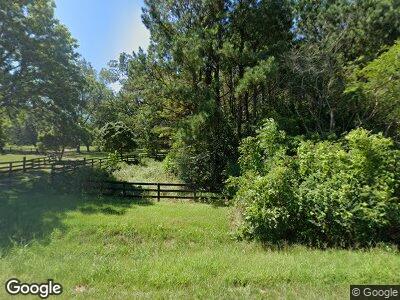
2080 Macon Hwy Talbotton, GA 31827
Estimated Value: $590,000 - $1,642,000
4
Beds
4
Baths
2,673
Sq Ft
$467/Sq Ft
Est. Value
About This Home
This home is located at 2080 Macon Hwy, Talbotton, GA 31827 and is currently estimated at $1,249,464, approximately $467 per square foot. 2080 Macon Hwy is a home located in Talbot County with nearby schools including Central School.
Ownership History
Date
Name
Owned For
Owner Type
Purchase Details
Closed on
Mar 12, 2021
Sold by
Shaw Ray A
Bought by
Pritchard John and Pritchard Sarah
Current Estimated Value
Purchase Details
Closed on
Dec 31, 1998
Sold by
Reynolds Jack J
Bought by
Shaw Ray A
Purchase Details
Closed on
Dec 21, 1998
Sold by
Southern Investments
Bought by
Reynolds Jack J
Purchase Details
Closed on
Aug 8, 1997
Sold by
Duncan Virgil E
Bought by
Southern Investments
Purchase Details
Closed on
Jan 1, 1990
Sold by
Previous Owner
Bought by
Duncan Virgil E
Purchase Details
Closed on
Jan 1, 1984
Sold by
Previous Owner
Bought by
Previous Owner
Create a Home Valuation Report for This Property
The Home Valuation Report is an in-depth analysis detailing your home's value as well as a comparison with similar homes in the area
Home Values in the Area
Average Home Value in this Area
Purchase History
| Date | Buyer | Sale Price | Title Company |
|---|---|---|---|
| Pritchard John | $1,100,000 | -- | |
| Shaw Ray A | $375,000 | -- | |
| Reynolds Jack J | $375,000 | -- | |
| Southern Investments | $250,000 | -- | |
| Duncan Virgil E | $220,000 | -- | |
| Previous Owner | -- | -- |
Source: Public Records
Mortgage History
| Date | Status | Borrower | Loan Amount |
|---|---|---|---|
| Previous Owner | Shaw Ray A | $747,233 |
Source: Public Records
Tax History Compared to Growth
Tax History
| Year | Tax Paid | Tax Assessment Tax Assessment Total Assessment is a certain percentage of the fair market value that is determined by local assessors to be the total taxable value of land and additions on the property. | Land | Improvement |
|---|---|---|---|---|
| 2024 | $8,217 | $381,051 | $202,447 | $178,604 |
| 2023 | $7,167 | $331,653 | $184,066 | $147,587 |
| 2022 | $11,830 | $384,147 | $175,299 | $208,848 |
| 2021 | $5,696 | $268,669 | $152,434 | $116,235 |
| 2020 | $5,238 | $249,593 | $152,434 | $97,159 |
| 2019 | $5,165 | $245,842 | $148,215 | $97,627 |
| 2018 | $7,514 | $249,517 | $148,215 | $101,302 |
| 2017 | $5,337 | $251,367 | $148,215 | $103,152 |
| 2016 | $5,644 | $262,764 | $148,215 | $114,549 |
| 2015 | -- | $437,087 | $325,359 | $111,728 |
| 2013 | -- | $463,260 | $364,786 | $98,474 |
Source: Public Records
Map
Nearby Homes
- 0 None Unit 10431111
- 1181 Kelly Rd
- 346 Kelly Rd
- 809 George W Towns Rd
- 434 George W Towns Rd
- 281 Madison St
- 87 College Ave
- 171 N Jefferson Ave
- 11.68 ACRES Georgia 208
- 0 W Tyler St Unit 10403864
- 0 Adam Ferry Rd Unit 10444398
- 0 Dennis Creek Rd Unit 158993
- 0 Dennis Creek Rd Unit 158992
- 0 Dennis Creek Rd Unit 158990
- 0 Dennis Creek Rd Unit 10436697
- TRACT 3 Dennis Creek Rd
- TRACT 2 Dennis Creek Rd
- 1533 Tuck Persons Hwy
- 86 Carl Mathis Rd Unit 164 ACRES
- Tract 3 Dennis Creek Rd
