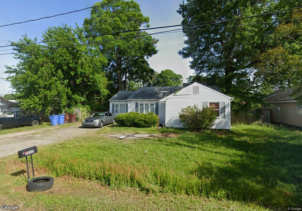
2080 Maywood St Chesapeake, VA 23323
Deep Creek NeighborhoodEstimated Value: $303,000 - $332,000
3
Beds
2
Baths
1,596
Sq Ft
$198/Sq Ft
Est. Value
About This Home
This home is located at 2080 Maywood St, Chesapeake, VA 23323 and is currently estimated at $316,706, approximately $198 per square foot. 2080 Maywood St is a home located in Chesapeake City with nearby schools including G.A. Treakle Elementary School, Deep Creek Middle School, and Deep Creek High.
Ownership History
Date
Name
Owned For
Owner Type
Purchase Details
Closed on
Mar 26, 2018
Sold by
Rae Joseph M and Rae Jessica A
Bought by
Harris Kayla M
Current Estimated Value
Home Financials for this Owner
Home Financials are based on the most recent Mortgage that was taken out on this home.
Original Mortgage
$162,011
Outstanding Balance
$140,315
Interest Rate
4.75%
Mortgage Type
FHA
Estimated Equity
$176,391
Purchase Details
Closed on
Sep 15, 2003
Sold by
Mark A Northern
Bought by
Rae Joseph M
Home Financials for this Owner
Home Financials are based on the most recent Mortgage that was taken out on this home.
Original Mortgage
$117,198
Interest Rate
5.82%
Mortgage Type
VA
Purchase Details
Closed on
Jan 18, 2000
Sold by
William S Mall
Bought by
Northern Mark A
Home Financials for this Owner
Home Financials are based on the most recent Mortgage that was taken out on this home.
Original Mortgage
$69,300
Interest Rate
7.84%
Create a Home Valuation Report for This Property
The Home Valuation Report is an in-depth analysis detailing your home's value as well as a comparison with similar homes in the area
Home Values in the Area
Average Home Value in this Area
Purchase History
| Date | Buyer | Sale Price | Title Company |
|---|---|---|---|
| Harris Kayla M | $165,000 | Attorney | |
| Rae Joseph M | $115,000 | -- | |
| Northern Mark A | $70,500 | -- |
Source: Public Records
Mortgage History
| Date | Status | Borrower | Loan Amount |
|---|---|---|---|
| Open | Harris Kayla M | $162,011 | |
| Previous Owner | Rae Joseph M | $117,198 | |
| Previous Owner | Northern Mark A | $69,300 |
Source: Public Records
Tax History Compared to Growth
Tax History
| Year | Tax Paid | Tax Assessment Tax Assessment Total Assessment is a certain percentage of the fair market value that is determined by local assessors to be the total taxable value of land and additions on the property. | Land | Improvement |
|---|---|---|---|---|
| 2025 | $2,721 | $287,800 | $120,000 | $167,800 |
| 2024 | $2,721 | $269,400 | $110,000 | $159,400 |
| 2023 | $2,282 | $252,500 | $100,000 | $152,500 |
| 2022 | $2,275 | $225,200 | $85,000 | $140,200 |
| 2021 | $2,029 | $193,200 | $70,000 | $123,200 |
| 2020 | $1,943 | $185,000 | $65,000 | $120,000 |
| 2019 | $1,785 | $170,000 | $65,000 | $105,000 |
| 2018 | $1,716 | $158,600 | $65,000 | $93,600 |
| 2017 | $1,715 | $163,300 | $65,000 | $98,300 |
| 2016 | $1,665 | $158,600 | $65,000 | $93,600 |
| 2015 | $1,665 | $158,600 | $65,000 | $93,600 |
| 2014 | $1,665 | $158,600 | $65,000 | $93,600 |
Source: Public Records
Map
Nearby Homes
- 2036 Maywood St
- 928 Michael Dr
- 2404 Livesay Rd
- 2249 Tennessee Dr
- 1241 N River Dr
- 1220 Boxwood Dr
- 1308 Boxwood Dr
- 2817 Camelot Blvd
- 1525 Shell Rd
- 1435 Winslow Ave
- 1400 Winslow Ave
- 1444 Culpepper Ave
- 2009 Battery Park Rd
- 1228 Deep Creek Blvd
- 917 Page Ct
- 1463 Rivers Edge Trace
- 2813 Squire Ct
- 1317 Richwood Ave
- 309 Paperbark Trail
- 604 Treemont Ct
- 2076 Maywood St
- 1001 Canal Dr
- 2072 Maywood St
- 1005 Canal Dr
- 2071 Maywood St
- 1103 Deaton Dr
- 2068 Maywood St
- 1105 Deaton Dr
- 960 Canal Dr
- 960 Poplar Ave
- 1009 Canal Dr
- 2064 Maywood St
- 1104 Deaton Dr
- 958 Poplar Ave
- 1109 Deaton Dr
- 2104 Gilmerton Rd
- 941 Oklahoma Dr
- 1004 Deaton Ct
- 957 Poplar Ave
- 954 Poplar Ave