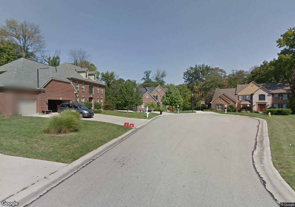
2081 Anderson Cove Ln Cincinnati, OH 45244
Dry Run NeighborhoodEstimated Value: $679,251 - $763,000
4
Beds
4
Baths
3,290
Sq Ft
$219/Sq Ft
Est. Value
About This Home
This home is located at 2081 Anderson Cove Ln, Cincinnati, OH 45244 and is currently estimated at $721,813, approximately $219 per square foot. 2081 Anderson Cove Ln is a home located in Hamilton County with nearby schools including Summit Elementary School, Nagel Middle School, and Anderson High School.
Ownership History
Date
Name
Owned For
Owner Type
Purchase Details
Closed on
Oct 15, 2002
Sold by
Gittinger Steven C
Bought by
Runnels Richard L and Runnels Marta L
Current Estimated Value
Home Financials for this Owner
Home Financials are based on the most recent Mortgage that was taken out on this home.
Original Mortgage
$299,000
Outstanding Balance
$126,086
Interest Rate
6.24%
Estimated Equity
$595,727
Purchase Details
Closed on
Apr 19, 2002
Sold by
Chanticleer Properties Ltd Partnership
Bought by
Zicka Walker Homes Ltd
Create a Home Valuation Report for This Property
The Home Valuation Report is an in-depth analysis detailing your home's value as well as a comparison with similar homes in the area
Home Values in the Area
Average Home Value in this Area
Purchase History
| Date | Buyer | Sale Price | Title Company |
|---|---|---|---|
| Runnels Richard L | -- | -- | |
| Gittinger Steven C | $477,500 | -- | |
| Zicka Walker Homes Ltd | $977,000 | -- |
Source: Public Records
Mortgage History
| Date | Status | Borrower | Loan Amount |
|---|---|---|---|
| Open | Runnels Richard L | $299,000 |
Source: Public Records
Tax History Compared to Growth
Tax History
| Year | Tax Paid | Tax Assessment Tax Assessment Total Assessment is a certain percentage of the fair market value that is determined by local assessors to be the total taxable value of land and additions on the property. | Land | Improvement |
|---|---|---|---|---|
| 2024 | $11,016 | $181,325 | $29,190 | $152,135 |
| 2023 | $10,479 | $181,325 | $29,190 | $152,135 |
| 2022 | $10,442 | $160,924 | $28,676 | $132,248 |
| 2021 | $10,043 | $158,523 | $28,676 | $129,847 |
| 2020 | $10,159 | $158,523 | $28,676 | $129,847 |
| 2019 | $9,902 | $140,284 | $25,375 | $114,909 |
| 2018 | $9,275 | $140,284 | $25,375 | $114,909 |
| 2017 | $8,748 | $140,284 | $25,375 | $114,909 |
| 2016 | $8,776 | $137,512 | $25,883 | $111,629 |
| 2015 | $8,523 | $137,512 | $25,883 | $111,629 |
| 2014 | $8,529 | $137,512 | $25,883 | $111,629 |
| 2013 | $7,908 | $134,817 | $25,375 | $109,442 |
Source: Public Records
Map
Nearby Homes
- 2051 Tall Pines Ln
- 8410 Kilkenny Dr
- 2161 Knightsbridge Dr
- 2197 8 Mile Rd
- 1797 Muskegon Dr
- 463 Auxier Dr
- 4383 Wiborg Dr
- 1728 Rockhurst Ln
- 8486 Bethany Ln
- 2109 Berrypatch Dr
- 4417 Wiborg Dr
- 2547 Teuton Ct
- 1624 Pinebluff Ln
- 8069 Ashgrove Dr
- 471 Sanctuary Way
- 473 Sanctuary Way
- 4172 Brandonmore Dr
- 475 Sanctuary Way
- 4310 Mount Carmel Tobasco Rd
- 477 Sanctuary Way
- 2080 Anderson Cove Ln
- 2077 Anderson Cove Ln
- 2008 Knightsbridge Dr
- 2069 Anderson Cove Ln
- 2069 Anderson Cove Ln Unit 4
- 2070 Anderson Cove Ln
- 2004 Knightsbridge Dr
- 2051 Anderson Cove Ln
- 2051 Anderson Cove Ln Unit 3
- 2012 Knightsbridge Dr
- 2075 Harcourt Estates Dr
- 2085 Harcourt Estates Dr
- 2060 Anderson Cove Ln
- 2060 Anderson Cove Ln Unit 9
- 2103 Harcourt Estates Dr
- 2115 Harcourt Dr
- 2115 Harcourt Estates Dr
- 2131 Harcourt Estates Dr
- 2067 Harcourt Estates Dr
- 2067 Harcourt Dr